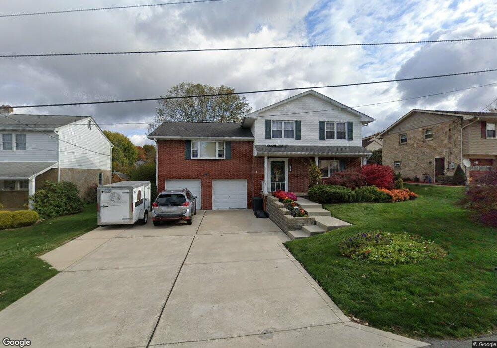
122 Cortland Dr New Stanton, PA 15672
Estimated Value: $238,726 - $375,000
3
Beds
3
Baths
1,667
Sq Ft
$184/Sq Ft
Est. Value
About This Home
This home is located at 122 Cortland Dr, New Stanton, PA 15672 and is currently estimated at $307,182, approximately $184 per square foot. 122 Cortland Dr is a home located in Westmoreland County with nearby schools including Stanwood Elementary School, West Hempfield Middle School, and Hempfield Area Senior High School.
Ownership History
Date
Name
Owned For
Owner Type
Purchase Details
Closed on
Jun 8, 2021
Sold by
Copenhaver Jay M and Copenhaver Clare Marie
Bought by
Copenhaver Jay M and Copenhaver Clare Marie
Current Estimated Value
Home Financials for this Owner
Home Financials are based on the most recent Mortgage that was taken out on this home.
Original Mortgage
$100,000
Outstanding Balance
$61,008
Interest Rate
2.9%
Mortgage Type
New Conventional
Estimated Equity
$246,174
Purchase Details
Closed on
Jun 15, 2011
Sold by
Dudash Gerald G and Dudash Margery R
Bought by
Copenhaver Jay M
Home Financials for this Owner
Home Financials are based on the most recent Mortgage that was taken out on this home.
Original Mortgage
$137,200
Interest Rate
4.74%
Mortgage Type
New Conventional
Create a Home Valuation Report for This Property
The Home Valuation Report is an in-depth analysis detailing your home's value as well as a comparison with similar homes in the area
Home Values in the Area
Average Home Value in this Area
Purchase History
| Date | Buyer | Sale Price | Title Company |
|---|---|---|---|
| Copenhaver Jay M | -- | Accommodation | |
| Copenhaver Jay M | $171,500 | None Available |
Source: Public Records
Mortgage History
| Date | Status | Borrower | Loan Amount |
|---|---|---|---|
| Open | Copenhaver Jay M | $100,000 | |
| Closed | Copenhaver Jay M | $137,200 |
Source: Public Records
Tax History Compared to Growth
Tax History
| Year | Tax Paid | Tax Assessment Tax Assessment Total Assessment is a certain percentage of the fair market value that is determined by local assessors to be the total taxable value of land and additions on the property. | Land | Improvement |
|---|---|---|---|---|
| 2025 | $3,891 | $31,570 | $4,370 | $27,200 |
| 2024 | $3,733 | $31,570 | $4,370 | $27,200 |
| 2023 | $3,440 | $31,570 | $4,370 | $27,200 |
| 2022 | $3,440 | $31,570 | $4,370 | $27,200 |
| 2021 | $3,440 | $31,570 | $4,370 | $27,200 |
| 2020 | $3,440 | $31,570 | $4,370 | $27,200 |
| 2019 | $3,424 | $31,570 | $4,370 | $27,200 |
| 2018 | $3,384 | $31,570 | $4,370 | $27,200 |
| 2017 | $3,306 | $31,570 | $4,370 | $27,200 |
| 2016 | $3,145 | $31,570 | $4,370 | $27,200 |
| 2015 | $3,145 | $31,570 | $4,370 | $27,200 |
| 2014 | $3,097 | $31,570 | $4,370 | $27,200 |
Source: Public Records
Map
Nearby Homes
- 301 S Center Ave
- 101 Stanton Dr
- 237 Melrose Dr
- 440 N Center Ave
- 0 Thermo Village Rd
- 112 Bair Blvd
- 105 Pagano Dr
- 104 Pagano Dr
- 234 Swartz Rd
- 0 Broadview Rd
- 816 S 10th St
- 814 S 10th St
- 812 S 10th St
- Penwell Plan at Broadview Estates
- Deerfield Plan at Broadview Estates
- Galen Plan at Broadview Estates
- Hamilton Plan at Broadview Estates
- 205 Joseph Dr
- 808 S 10th St
- 416 Curtis Ct
- 124 Cortland Dr
- 207 Florence Dr
- 205 Florence Dr
- 207 York Shire Heights Place
- 124 Woodmere Dr
- 205 Shelton Dr
- 201 Florence Dr
- 203 Shelton Dr
- 113 Cortland Dr
- 117 Woodmere Dr
- 103 Melrose Dr
- 115 Woodmere Dr
- 111 Yorkshire Heights P Dr
- 111 Cortland Dr
- 112 Cortland Dr
- 113 Woodmere Dr
- 105 Melrose Dr
- 102 Woodmere Dr
- 109 Cortland Dr
- 109 York Shire Heights Place