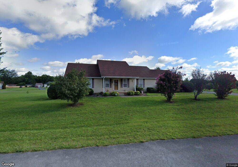
122 Croslin Dr Bowling Green, KY 42104
Greenwood NeighborhoodEstimated Value: $201,000 - $309,000
3
Beds
2
Baths
1,625
Sq Ft
$164/Sq Ft
Est. Value
About This Home
This home is located at 122 Croslin Dr, Bowling Green, KY 42104 and is currently estimated at $266,816, approximately $164 per square foot. 122 Croslin Dr is a home located in Warren County with nearby schools including Plano Elementary School, South Warren Middle School, and South Warren High School.
Ownership History
Date
Name
Owned For
Owner Type
Purchase Details
Closed on
Sep 21, 2023
Sold by
Vici Wanda and White Evona
Bought by
Agnew Corey A and Agnew Taylor Beals
Current Estimated Value
Create a Home Valuation Report for This Property
The Home Valuation Report is an in-depth analysis detailing your home's value as well as a comparison with similar homes in the area
Home Values in the Area
Average Home Value in this Area
Purchase History
| Date | Buyer | Sale Price | Title Company |
|---|---|---|---|
| Agnew Corey A | $155,000 | None Listed On Document |
Source: Public Records
Tax History Compared to Growth
Tax History
| Year | Tax Paid | Tax Assessment Tax Assessment Total Assessment is a certain percentage of the fair market value that is determined by local assessors to be the total taxable value of land and additions on the property. | Land | Improvement |
|---|---|---|---|---|
| 2024 | $1,017 | $160,000 | $0 | $0 |
| 2023 | $1,025 | $160,000 | $0 | $0 |
| 2022 | $1,331 | $160,000 | $0 | $0 |
| 2021 | $1,326 | $160,000 | $0 | $0 |
| 2020 | $1,331 | $160,000 | $0 | $0 |
| 2019 | $1,328 | $160,000 | $0 | $0 |
| 2018 | $1,147 | $138,000 | $0 | $0 |
| 2017 | $1,138 | $138,000 | $0 | $0 |
| 2015 | $1,117 | $138,000 | $0 | $0 |
| 2014 | $1,100 | $138,000 | $0 | $0 |
Source: Public Records
Map
Nearby Homes
- 131 Dude Howard Rd
- 3292 Plano Rd
- 400 Lamplighter Dr
- 4439 Plano Rd
- Lot 1 Plano Rd
- Lot 2 Plano Rd
- 4596 Fairvue Farm Blvd
- 4626 Fairvue Farm Blvd
- 0 Dye Ford Rd Unit RA20255641
- 0 Dye Ford Rd Unit RA20255283
- 285 Huckleberry Way
- 2647 Royal Ct
- 2121 Dye Ford Rd
- 762 Heritage Preserve Ln
- 797 Olde Gap St
- 713 Heritage Preserve Ln
- 386 Pleasant Place Way
- 208 Old Union Church Rd
- 1309 Dye Ford Rd
- 1039 Dye Ford Rd