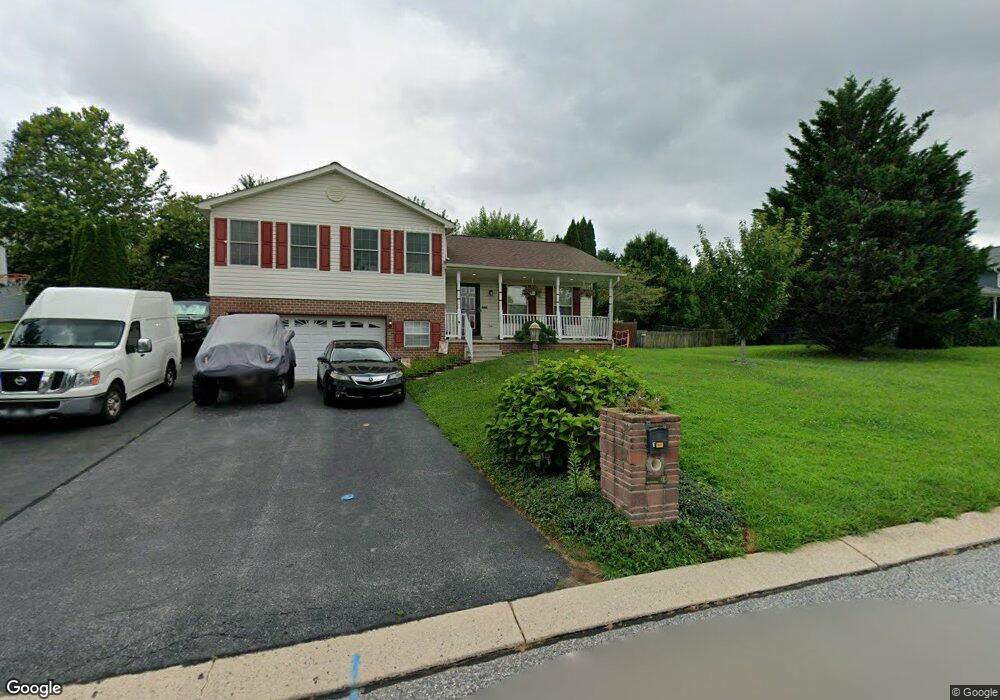
122 Crosstie Dr Stewartstown, PA 17363
Estimated Value: $347,490 - $391,000
3
Beds
2
Baths
1,432
Sq Ft
$255/Sq Ft
Est. Value
About This Home
This home is located at 122 Crosstie Dr, Stewartstown, PA 17363 and is currently estimated at $365,373, approximately $255 per square foot. 122 Crosstie Dr is a home located in York County with nearby schools including South Eastern Intermediate School, South Eastern Middle School, and Kennard-Dale High School.
Ownership History
Date
Name
Owned For
Owner Type
Purchase Details
Closed on
Jul 28, 2004
Sold by
Sharar Andrea L and Sharar Bentley C
Bought by
Sharar Andrea L and Sharar Bentley C
Current Estimated Value
Home Financials for this Owner
Home Financials are based on the most recent Mortgage that was taken out on this home.
Original Mortgage
$164,000
Outstanding Balance
$82,403
Interest Rate
6.2%
Mortgage Type
Purchase Money Mortgage
Estimated Equity
$282,970
Purchase Details
Closed on
Oct 22, 1999
Sold by
Myers Joseph A
Bought by
Marechal Vincent R and Cole Tasey L
Home Financials for this Owner
Home Financials are based on the most recent Mortgage that was taken out on this home.
Original Mortgage
$145,700
Interest Rate
7.83%
Create a Home Valuation Report for This Property
The Home Valuation Report is an in-depth analysis detailing your home's value as well as a comparison with similar homes in the area
Home Values in the Area
Average Home Value in this Area
Purchase History
| Date | Buyer | Sale Price | Title Company |
|---|---|---|---|
| Sharar Andrea L | -- | -- | |
| Eader Andrea L | $205,000 | The Sentinel Title Corp | |
| Marechal Vincent R | $153,418 | -- |
Source: Public Records
Mortgage History
| Date | Status | Borrower | Loan Amount |
|---|---|---|---|
| Open | Eader Andrea L | $164,000 | |
| Previous Owner | Marechal Vincent R | $145,700 | |
| Closed | Eader Andrea L | $30,500 |
Source: Public Records
Tax History Compared to Growth
Tax History
| Year | Tax Paid | Tax Assessment Tax Assessment Total Assessment is a certain percentage of the fair market value that is determined by local assessors to be the total taxable value of land and additions on the property. | Land | Improvement |
|---|---|---|---|---|
| 2025 | $5,633 | $191,860 | $54,520 | $137,340 |
| 2024 | $5,633 | $191,860 | $54,520 | $137,340 |
| 2023 | $5,633 | $191,860 | $54,520 | $137,340 |
| 2022 | $5,633 | $191,860 | $54,520 | $137,340 |
| 2021 | $5,441 | $191,860 | $54,520 | $137,340 |
| 2020 | $5,441 | $191,860 | $54,520 | $137,340 |
| 2019 | $5,422 | $191,860 | $54,520 | $137,340 |
| 2018 | $5,422 | $191,860 | $54,520 | $137,340 |
| 2017 | $5,422 | $191,860 | $54,520 | $137,340 |
| 2016 | $0 | $191,860 | $54,520 | $137,340 |
| 2015 | -- | $191,860 | $54,520 | $137,340 |
| 2014 | -- | $191,860 | $54,520 | $137,340 |
Source: Public Records
Map
Nearby Homes
- 140 Lantern Ln
- 210 Runningboard Rd
- 17756 Barrens Rd N
- 18010 Dave Anne Cir
- 24 Scarborough Fare
- 10 Black Oak Ct
- 150 Patterson Dr Unit 47
- 2 S Main St
- 160 Patterson Dr Unit 48
- 170 Patterson Dr Unit 49
- 13 Baneberry St
- 180 Patterson Dr Unit 50
- 200 Patterson Dr Unit 52
- 119 Edie Cir
- 120 Charles Ave
- 515 Log House Rd Unit 119
- 525 Log House Rd Unit 118
- 545 Log House Rd Unit 116
- 231 Cool Spring Ln
- 18183 Piedmont Rd
- 105 Yellowstone Ln
- 126 Crosstie Dr
- 109 Yellowstone Ln
- 121 Crosstie Dr
- 103 Lantern Ln
- 130 Crosstie Dr
- 117 Crosstie Dr
- 104 Yellowstone Ln
- 113 Yellowstone Ln
- 113 Crosstie Dr
- 136 Crosstie Dr
- 129 Crosstie Dr
- 106 Yellowstone Ln
- 119 Yellowstone Ln
- 125 Yellowstone Ln
- 109 Crosstie Dr
- 105 Lantern Ln
- 110 Yellowstone Ln
- 142 Crosstie Dr
- 108 Lantern Ln