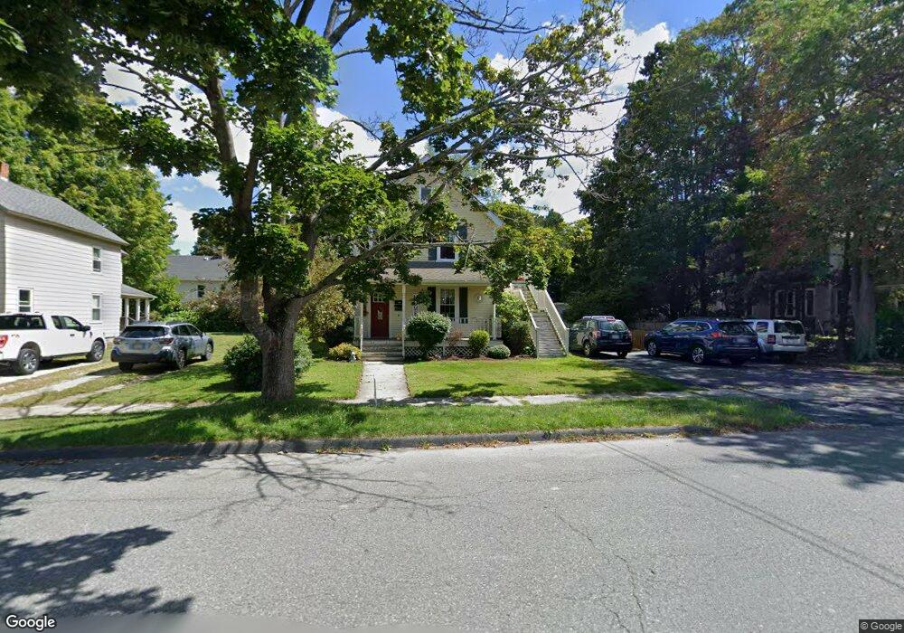
122 Curtis Ave Dalton, MA 01226
Estimated Value: $240,000 - $326,953
5
Beds
3
Baths
2,098
Sq Ft
$143/Sq Ft
Est. Value
About This Home
This home is located at 122 Curtis Ave, Dalton, MA 01226 and is currently estimated at $299,738, approximately $142 per square foot. 122 Curtis Ave is a home located in Berkshire County with nearby schools including Wahconah Regional High School, St. Agnes Academy, and Sacred Heart School.
Ownership History
Date
Name
Owned For
Owner Type
Purchase Details
Closed on
Dec 13, 2007
Sold by
Swegel Carolyn J and Swegel Nicole M
Bought by
Swegel Nicole M
Current Estimated Value
Purchase Details
Closed on
Jul 17, 2000
Sold by
Scapin Kathleen E
Bought by
Swegel Carolyn J and Swegel Nicole M
Home Financials for this Owner
Home Financials are based on the most recent Mortgage that was taken out on this home.
Original Mortgage
$90,000
Interest Rate
8.5%
Mortgage Type
Purchase Money Mortgage
Purchase Details
Closed on
Jun 14, 1994
Sold by
Girard Michael L and Girard Sandra A
Bought by
Scapin Kahleen E
Create a Home Valuation Report for This Property
The Home Valuation Report is an in-depth analysis detailing your home's value as well as a comparison with similar homes in the area
Home Values in the Area
Average Home Value in this Area
Purchase History
| Date | Buyer | Sale Price | Title Company |
|---|---|---|---|
| Swegel Nicole M | -- | -- | |
| Swegel Nicole M | -- | -- | |
| Swegel Carolyn J | $118,400 | -- | |
| Swegel Carolyn J | $118,400 | -- | |
| Scapin Kahleen E | $95,000 | -- | |
| Scapin Kahleen E | $95,000 | -- |
Source: Public Records
Mortgage History
| Date | Status | Borrower | Loan Amount |
|---|---|---|---|
| Open | Scapin Kahleen E | $184,000 | |
| Previous Owner | Scapin Kahleen E | $87,000 | |
| Previous Owner | Scapin Kahleen E | $90,000 |
Source: Public Records
Tax History Compared to Growth
Tax History
| Year | Tax Paid | Tax Assessment Tax Assessment Total Assessment is a certain percentage of the fair market value that is determined by local assessors to be the total taxable value of land and additions on the property. | Land | Improvement |
|---|---|---|---|---|
| 2025 | $5,120 | $282,400 | $57,100 | $225,300 |
| 2024 | $4,490 | $246,700 | $52,200 | $194,500 |
| 2023 | $3,725 | $204,600 | $46,200 | $158,400 |
| 2022 | $3,725 | $179,600 | $46,200 | $133,400 |
| 2021 | $3,633 | $168,900 | $44,000 | $124,900 |
| 2020 | $3,425 | $168,800 | $44,000 | $124,800 |
| 2019 | $3,154 | $161,900 | $42,500 | $119,400 |
| 2018 | $3,263 | $163,900 | $44,300 | $119,600 |
| 2017 | $3,257 | $163,900 | $44,300 | $119,600 |
| 2016 | $3,280 | $167,100 | $44,300 | $122,800 |
| 2015 | $3,236 | $166,200 | $44,300 | $121,900 |
Source: Public Records
Map
Nearby Homes
- 321 High St
- 66 Oak Street Extension
- 18 Chestnut St
- 750 Main St
- 774 Main St
- 60 Franklin St
- 188 North St
- 9 Crane Ave
- 56 Tower Rd
- 0 Crane Ave
- 39 Barton Hill Rd
- 17 Sunnyside Dr
- 48 Mountain View Terrace
- 0 Crane Ave Suite 2 -- Unit 248430
- 0 Crane Ave Suite 1 -- Unit 248429
- 249 Orchard Rd
- 144 Kittredge Rd
- 63 Asci Dr
- 68 Howe Rd
- 0 Cheshire Rd
- 112 Curtis Ave Unit 114
- 130 Curtis Ave
- 17 2nd St Unit 19
- 17 2nd St
- 17-19 2nd St
- 14 3rd St
- 24 3rd St
- 121 Central Ave
- 111 Central Ave
- 12 2nd St
- 96 Curtis Ave Unit 98
- 127 Central Ave
- 107 Curtis Ave
- 99 Central Ave
- 99 Curtis Ave
- 93 Central Ave
- 118 Central Ave
- 110 Central Ave
- 9 John St Unit 11
- 130 Central Ave