122 Dr Dr Brockport, PA 15823
Estimated Value: $386,885 - $472,000
3
Beds
3
Baths
--
Sq Ft
16.26
Acres
About This Home
This home is located at 122 Dr Dr, Brockport, PA 15823 and is currently estimated at $440,628. 122 Dr Dr is a home located in Elk County with nearby schools including Brockway Area Elementary School and Brockway Area Junior/Senior High School.
Ownership History
Date
Name
Owned For
Owner Type
Purchase Details
Closed on
Dec 20, 2023
Sold by
Thompson Dale
Bought by
Kerr Scott K and Kerr Katie E
Current Estimated Value
Home Financials for this Owner
Home Financials are based on the most recent Mortgage that was taken out on this home.
Original Mortgage
$308,000
Outstanding Balance
$302,409
Interest Rate
7.03%
Mortgage Type
Purchase Money Mortgage
Estimated Equity
$138,219
Purchase Details
Closed on
Nov 17, 2017
Sold by
Thompson Dale and Thompson Sheila
Bought by
Thompson Dale
Purchase Details
Closed on
May 6, 2010
Sold by
Thompson Dale and Thompson Sheila
Bought by
Thompson Dale and Thompson Sheila
Create a Home Valuation Report for This Property
The Home Valuation Report is an in-depth analysis detailing your home's value as well as a comparison with similar homes in the area
Home Values in the Area
Average Home Value in this Area
Purchase History
| Date | Buyer | Sale Price | Title Company |
|---|---|---|---|
| Kerr Scott K | $385,000 | -- | |
| Thompson Dale | -- | -- | |
| Thompson Dale | -- | None Available |
Source: Public Records
Mortgage History
| Date | Status | Borrower | Loan Amount |
|---|---|---|---|
| Open | Kerr Scott K | $308,000 |
Source: Public Records
Tax History Compared to Growth
Tax History
| Year | Tax Paid | Tax Assessment Tax Assessment Total Assessment is a certain percentage of the fair market value that is determined by local assessors to be the total taxable value of land and additions on the property. | Land | Improvement |
|---|---|---|---|---|
| 2025 | $3,084 | $60,150 | $4,700 | $55,450 |
| 2024 | $3,084 | $60,150 | $4,700 | $55,450 |
| 2023 | $2,706 | $54,650 | $4,700 | $49,950 |
| 2022 | $2,688 | $54,650 | $4,700 | $49,950 |
| 2021 | $2,688 | $54,650 | $4,700 | $49,950 |
| 2020 | $2,641 | $54,650 | $4,700 | $49,950 |
| 2019 | $2,546 | $54,650 | $4,700 | $49,950 |
| 2018 | $2,476 | $54,650 | $4,700 | $49,950 |
| 2017 | $2,401 | $54,650 | $4,700 | $49,950 |
| 2016 | $2,096 | $54,650 | $4,700 | $49,950 |
| 2015 | -- | $54,650 | $4,700 | $49,950 |
| 2013 | -- | $52,750 | $4,700 | $48,050 |
Source: Public Records
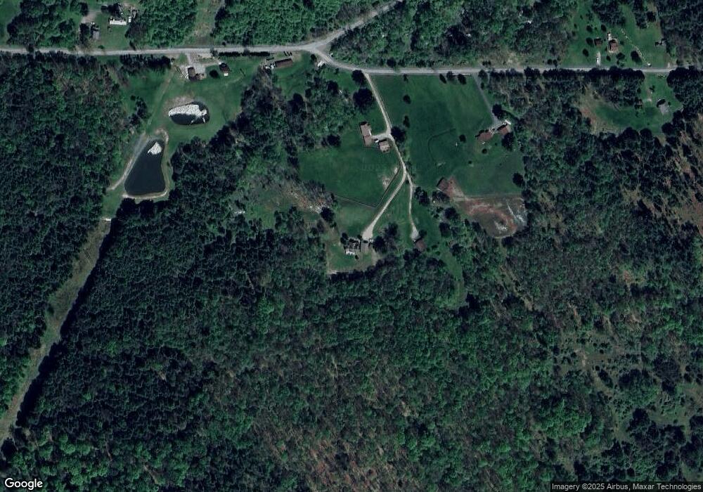
Map
Nearby Homes
- 101 Howard Rd
- 3323 Mount Daniels Rd
- 425 Zuccolotto Ln
- 47 Caruso Rd
- 1083 Rattlesnake Rd
- 601 Sandbank Rd
- 924 Elm St
- 598 Sandbank Rd
- 1549 Main St
- 0 Cap Haitien Rd Unit SEC 17 LOT 14
- 537 Lynyard Ln Bonefish Rd
- Section 19 Lot 181 Dolphin Head Rd
- 181 Dolphin Head Rd
- 129 Dolphin Head Rd
- 744 Dolphin Head Rd Unit 19 83 & 84
- 0 U S 219
- 7956 U S 219
- 1074 10th Ave
- 3585 Shawmut Rd
- 970 Baghdad Rd
- 133 Dr Dr
- 52 Dr Dr
- 738 Boggy Run Rd
- 891 Boggy Run Rd
- 891 Boggy Run Rd
- 905 Boggy Run Rd
- 253 Hideaway Rd
- 635 Boggy Run Rd
- 294 Hideaway Rd
- 291 Hideaway Rd
- 1061 Boggy Run Rd
- 550 Boggy Run Rd
- 555 Boggy Run Rd
- 490 Boggy Run Rd
- 4099 Whetstone Road Extension
- 438 Boggy Run Rd
- 1169 Boggy Run Rd
- 41 Carlson Ln
- 4241 Whetstone Road Extension
- 408 Boggy Run Rd