Estimated Value: $337,000 - $384,000
Studio
--
Bath
2,252
Sq Ft
$159/Sq Ft
Est. Value
About This Home
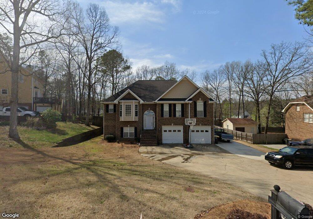
This home is located at 122 E Clinton Dr SW, Rome, GA 30165 and is currently estimated at $358,868, approximately $159 per square foot. 122 E Clinton Dr SW is a home located in Floyd County with nearby schools including Rome High School.
Ownership History
Date
Name
Owned For
Owner Type
Purchase Details
Closed on
Aug 14, 2006
Sold by
Not Provided
Bought by
Perkins Robert and Perkins Jennifer A
Current Estimated Value
Home Financials for this Owner
Home Financials are based on the most recent Mortgage that was taken out on this home.
Original Mortgage
$179,400
Outstanding Balance
$105,497
Interest Rate
6.67%
Mortgage Type
New Conventional
Estimated Equity
$253,371
Purchase Details
Closed on
Feb 15, 2000
Sold by
Mccown Madge S
Bought by
Mayes Johnny and Tanisha Tian Mayes
Purchase Details
Closed on
Feb 23, 1994
Sold by
River Ford Corporation
Bought by
Mccown Madge S
Purchase Details
Closed on
Mar 29, 1993
Sold by
Toles Temple & Wright Inc
Bought by
River Ford Corporation
Purchase Details
Closed on
Sep 5, 1988
Bought by
Toles Temple & Wright Inc
Create a Home Valuation Report for This Property
The Home Valuation Report is an in-depth analysis detailing your home's value as well as a comparison with similar homes in the area
Home Values in the Area
Average Home Value in this Area
Purchase History
| Date | Buyer | Sale Price | Title Company |
|---|---|---|---|
| Perkins Robert | $229,500 | -- | |
| Mayes Johnny | $11,300 | -- | |
| Mccown Madge S | $50,000 | -- | |
| River Ford Corporation | $80,000 | -- | |
| Toles Temple & Wright Inc | -- | -- |
Source: Public Records
Mortgage History
| Date | Status | Borrower | Loan Amount |
|---|---|---|---|
| Open | Perkins Robert | $179,400 | |
| Closed | Perkins Robert | $50,000 |
Source: Public Records
Tax History
| Year | Tax Paid | Tax Assessment Tax Assessment Total Assessment is a certain percentage of the fair market value that is determined by local assessors to be the total taxable value of land and additions on the property. | Land | Improvement |
|---|---|---|---|---|
| 2025 | $3,973 | $157,532 | $15,998 | $141,534 |
| 2024 | $3,973 | $147,384 | $14,544 | $132,840 |
| 2023 | $3,945 | $142,123 | $12,928 | $129,195 |
| 2022 | $3,591 | $119,961 | $10,504 | $109,457 |
| 2021 | $3,336 | $102,484 | $10,504 | $91,980 |
| 2020 | $3,250 | $96,163 | $8,080 | $88,083 |
| 2019 | $3,014 | $84,402 | $8,080 | $76,322 |
| 2018 | $2,936 | $80,605 | $8,080 | $72,525 |
| 2017 | $2,796 | $76,809 | $8,080 | $68,729 |
| 2016 | $2,762 | $75,656 | $8,080 | $67,576 |
| 2015 | $2,645 | $76,416 | $8,080 | $68,336 |
| 2014 | $2,645 | $76,699 | $8,080 | $68,619 |
Source: Public Records
Map
Nearby Homes
- 0 E Clinton Dr SW Unit 7497950
- 0 E Clinton Dr SW Unit 10427155
- 23 Walton Creek Dr SW
- 37 Walton Creek Dr SW
- 107 E Clinton Dr SW
- 31 Southfork Dr
- 21 Walton Creek Dr SW
- 0 Leafmore Rd SW Unit 10562671
- 1861 Burnett Ferry Rd SW
- 207 Paris Dr SW
- 14 Westwood Cir SW
- 0 Cedartown Rd Unit 10479932
- 8 A&b Harvey St
- 16 Jefferson Dr SW
- 26 Jefferson Dr SW
- 13 Jefferson Dr SW
- 40 Paris Dr SW
- 3 Lovell Ln SW
- 209 Larkspur Ln SW
- 109 Chief Vann Dr SW
- 120 E Clinton Dr SW
- 126 E Clinton Dr SW Unit 108
- 126 E Clinton Dr SW
- 0 E Clinton Dr SW Unit 10427153
- 0 E Clinton Dr SW Unit 8588555
- E E Clinton Dr SW
- 109 E Creekview Dr SW
- 118 E Clinton Dr SW
- 123 E Clinton Dr SW
- 00 E Clinton Dr SW
- 121 E Clinton Dr SW
- 125 E Clinton Dr SW
- 130 E Clinton Dr SW
- 119 E Clinton Dr SW
- 116 E Clinton Dr SW
- 129 E Clinton Dr SW
- 107 E Creekview Dr SW
- 19 Walton Creek Dr SW
- 00 Shropshire Rd SW
- 0 Shropshire Rd SW Unit 8261891
Your Personal Tour Guide
Ask me questions while you tour the home.