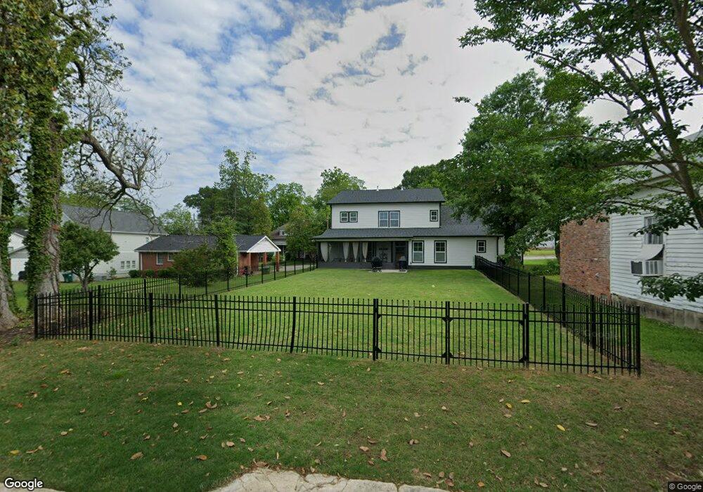
122 E Reese St Carrollton, GA 30117
Estimated Value: $440,000 - $616,000
4
Beds
4
Baths
3,032
Sq Ft
$182/Sq Ft
Est. Value
About This Home
This home is located at 122 E Reese St, Carrollton, GA 30117 and is currently estimated at $550,938, approximately $181 per square foot. 122 E Reese St is a home located in Carroll County with nearby schools including Carrollton Elementary School, Carrollton Upper Elementary School, and Carrollton Middle School.
Ownership History
Date
Name
Owned For
Owner Type
Purchase Details
Closed on
Oct 4, 2021
Sold by
60 Plus Llc
Bought by
Handel Stephen and Handel Karen C
Current Estimated Value
Purchase Details
Closed on
Sep 13, 2021
Sold by
Hale Ralph
Bought by
60 Plus Llc
Purchase Details
Closed on
Jul 22, 2002
Sold by
Dalessandro Frank
Bought by
Hale Ralph S and Hale Linda M
Purchase Details
Closed on
Jun 10, 2002
Sold by
Baker Gloria
Bought by
Dalessandro Frank
Purchase Details
Closed on
May 20, 2002
Sold by
Dalessandro Frank
Bought by
Hale Ralph S and Hale Linda M
Purchase Details
Closed on
Jan 13, 1998
Sold by
Baker Gloria F
Bought by
Dalessandro Frank
Purchase Details
Closed on
Jul 10, 1976
Bought by
Baker Gloria F
Create a Home Valuation Report for This Property
The Home Valuation Report is an in-depth analysis detailing your home's value as well as a comparison with similar homes in the area
Home Values in the Area
Average Home Value in this Area
Purchase History
| Date | Buyer | Sale Price | Title Company |
|---|---|---|---|
| Handel Stephen | $130,000 | -- | |
| 60 Plus Llc | $85,000 | -- | |
| Hale Ralph S | $15,000 | -- | |
| Dalessandro Frank | -- | -- | |
| Hale Ralph S | $79,900 | -- | |
| Dalessandro Frank | $38,000 | -- | |
| Baker Gloria F | -- | -- |
Source: Public Records
Tax History Compared to Growth
Tax History
| Year | Tax Paid | Tax Assessment Tax Assessment Total Assessment is a certain percentage of the fair market value that is determined by local assessors to be the total taxable value of land and additions on the property. | Land | Improvement |
|---|---|---|---|---|
| 2024 | $2,469 | $280,632 | $28,048 | $252,584 |
| 2023 | $2,453 | $257,233 | $28,049 | $229,184 |
| 2022 | $585 | $20,038 | $18,688 | $1,350 |
| 2021 | $1,054 | $36,108 | $8,192 | $27,916 |
| 2020 | $961 | $32,904 | $8,192 | $24,712 |
| 2019 | $923 | $31,288 | $8,192 | $23,096 |
| 2018 | $873 | $29,190 | $8,192 | $20,998 |
| 2017 | $878 | $29,190 | $8,192 | $20,998 |
| 2016 | $883 | $29,190 | $8,192 | $20,998 |
| 2015 | $1,145 | $37,059 | $5,888 | $31,171 |
| 2014 | $1,150 | $37,059 | $5,888 | $31,171 |
Source: Public Records
Map
Nearby Homes
- 110 Town Walk Ln
- 0 Ward St Unit 10390499
- 205 Johnson Ave Unit 231
- 108 Springwood Dr
- 103 W Chandler St
- 405 N Park St
- TRACT1-7 Us Highway 27
- 322 Cedar St
- 541 N White St Unit 12
- 541 N White St
- 301 C4 Bradley St
- 120 Stewart St
- 301 Bradley St
- 777 College St
- 201 Stewart St
- 109 S Park St
- 654 King St
- 27 South St
- 119 Oxford Square
- 123 Cedar Park Way
- 126 E Reese St
- 129 Rhudy St
- E E Reese St
- 45 Rhudy St
- 123 E Reese St
- 131 E Reese St
- 122 Rhudy St
- 402 College St
- 118 Rhudy St
- 0 Rhudy St Unit 8728892
- 0 Rhudy St Unit 9001320
- 0 Rhudy St Unit 8792757
- 0 Rhudy St Unit 8337696
- 0 Rhudy St Unit 8337118
- 30 E Reese St
- 128 Rhudy St Unit 130
- 35 Rhudy St
- 322 College St
- 316 College St
- 20 E Reese St