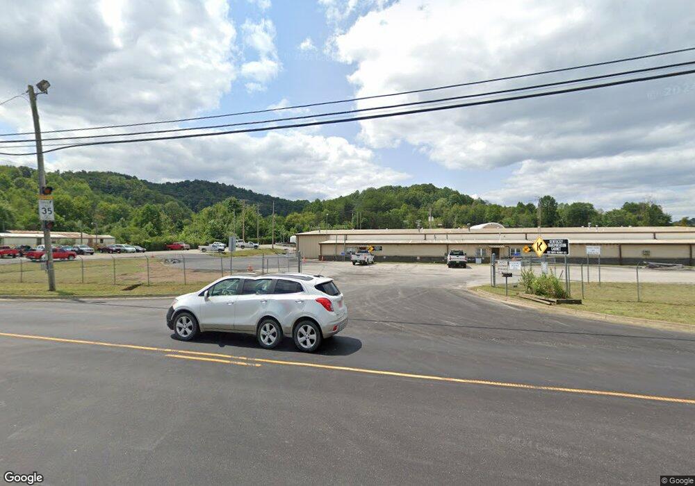
122 Highway 638 Manchester, KY 40962
Estimated Value: $64,000 - $228,000
1
Bed
1
Bath
900
Sq Ft
$148/Sq Ft
Est. Value
About This Home
This home is located at 122 Highway 638, Manchester, KY 40962 and is currently estimated at $133,193, approximately $147 per square foot. 122 Highway 638 is a home located in Clay County with nearby schools including Clay County High School and Manchester Christian Academy.
Ownership History
Date
Name
Owned For
Owner Type
Purchase Details
Closed on
Jul 17, 2023
Sold by
Peters Eric Brandon and Peters Brittany
Bought by
Peters Jacqueline Suzanne
Current Estimated Value
Purchase Details
Closed on
Nov 30, 2021
Sold by
Sue Meredith Betty
Bought by
Peters Jacqueline Suzanne and Anderson Brandon C
Purchase Details
Closed on
Jan 22, 2021
Sold by
Grubb Lowell and Grubb Patricia Ann
Bought by
Anderson Brandon Colson
Purchase Details
Closed on
Dec 22, 2014
Sold by
Grubb Geri Ashley and Grubb Adam
Bought by
Anderson Brandon
Create a Home Valuation Report for This Property
The Home Valuation Report is an in-depth analysis detailing your home's value as well as a comparison with similar homes in the area
Home Values in the Area
Average Home Value in this Area
Purchase History
| Date | Buyer | Sale Price | Title Company |
|---|---|---|---|
| Peters Jacqueline Suzanne | $100,000 | None Listed On Document | |
| Peters Jacqueline Suzanne | -- | Joseph C White Psc | |
| Anderson Brandon Colson | $2,000 | None Available | |
| Anderson Brandon | $20,000 | None Available |
Source: Public Records
Tax History Compared to Growth
Tax History
| Year | Tax Paid | Tax Assessment Tax Assessment Total Assessment is a certain percentage of the fair market value that is determined by local assessors to be the total taxable value of land and additions on the property. | Land | Improvement |
|---|---|---|---|---|
| 2024 | $633 | $53,000 | $0 | $0 |
| 2023 | $632 | $53,000 | $0 | $0 |
| 2022 | $626 | $53,000 | $0 | $0 |
| 2021 | $625 | $53,000 | $0 | $0 |
| 2020 | $622 | $53,000 | $0 | $0 |
| 2019 | $233 | $15,000 | $0 | $0 |
| 2018 | $228 | $20,000 | $0 | $0 |
| 2017 | $226 | $0 | $0 | $0 |
| 2016 | $214 | $0 | $0 | $0 |
| 2015 | $474 | $0 | $0 | $0 |
| 2014 | $474 | $0 | $0 | $0 |
| 2013 | $474 | $0 | $0 | $0 |
Source: Public Records
Map
Nearby Homes
- 111 House Ave
- 00 Hwy 421 Richmond Rd
- 9999 Memorial Dr
- 0 Kentucky 11
- 307 River St
- 85 Blackwell Dr
- 1 Kentucky 11
- 8549 Us Highway 421
- 91 Jones St
- 102 Locust St
- 239 Railroad Ave
- 215 Colony Rd
- 799 Coal Hollow Rd
- 31, 32, 33 Justice Dr
- 173 Charlie Sizemore Rd
- 000 Jackson Smith Rd
- 0 Jackson Smith Rd
- 2251 U S 421
- Tract 15 Lewis & Collins Farm
- 198 Crawford Isom Rd
- 156 Highway 638
- 180 Highway 638
- 2875 Highway 638
- 3484 Highway 638
- 171 Kennedy Hill Rd
- 298 Kennedy Hill Rd
- 146 Highway 638 Loop
- 190 Marcum Hill Rd
- 170 Marcum Hill Rd
- 114 House Ave
- 409 Richmond Rd
- 221 Green St
- 112 House Ave
- 213 Green St
- 133 Marcum Hill Rd
- 109 House Ave
- 124 Marcum Hill Rd
- 82 Marcum Hill Rd
- 72 Marcum Hill Rd
- 124 Marcum Hill Rd
