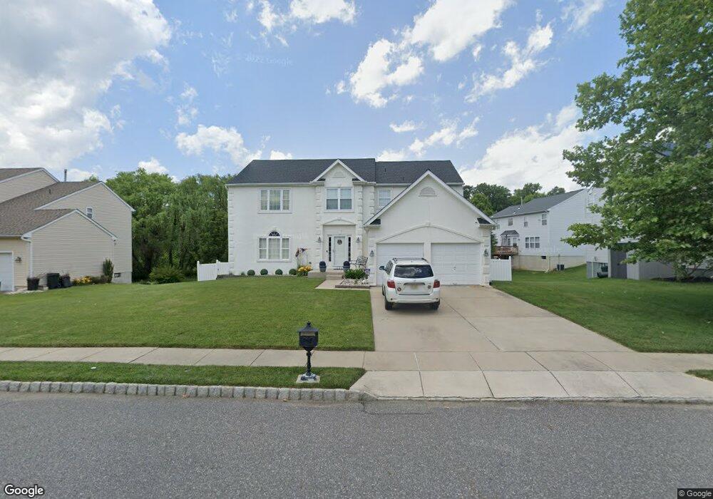
122 Independence Dr Woodbury, NJ 08096
Deptford Township NeighborhoodEstimated Value: $506,336 - $569,000
--
Bed
--
Bath
2,723
Sq Ft
$198/Sq Ft
Est. Value
About This Home
This home is located at 122 Independence Dr, Woodbury, NJ 08096 and is currently estimated at $538,834, approximately $197 per square foot. 122 Independence Dr is a home located in Gloucester County with nearby schools including Deptford Township High School, St. Teresa Regional School, and Holy Angels Catholic School.
Ownership History
Date
Name
Owned For
Owner Type
Purchase Details
Closed on
Jul 19, 2002
Sold by
Paparone At Patriots Ridge Llc
Bought by
Hagan James J and Hagan Annette C
Current Estimated Value
Home Financials for this Owner
Home Financials are based on the most recent Mortgage that was taken out on this home.
Original Mortgage
$75,000
Interest Rate
6.18%
Mortgage Type
Stand Alone First
Create a Home Valuation Report for This Property
The Home Valuation Report is an in-depth analysis detailing your home's value as well as a comparison with similar homes in the area
Home Values in the Area
Average Home Value in this Area
Purchase History
| Date | Buyer | Sale Price | Title Company |
|---|---|---|---|
| Hagan James J | $232,561 | Chicago Title Insurance Co |
Source: Public Records
Mortgage History
| Date | Status | Borrower | Loan Amount |
|---|---|---|---|
| Closed | Hagan James J | $75,000 |
Source: Public Records
Tax History Compared to Growth
Tax History
| Year | Tax Paid | Tax Assessment Tax Assessment Total Assessment is a certain percentage of the fair market value that is determined by local assessors to be the total taxable value of land and additions on the property. | Land | Improvement |
|---|---|---|---|---|
| 2025 | $10,009 | $279,200 | $48,800 | $230,400 |
| 2024 | $9,688 | $279,200 | $48,800 | $230,400 |
| 2023 | $9,688 | $279,200 | $48,800 | $230,400 |
| 2022 | $9,618 | $279,200 | $48,800 | $230,400 |
| 2021 | $9,482 | $279,200 | $48,800 | $230,400 |
| 2020 | $9,373 | $279,200 | $48,800 | $230,400 |
| 2019 | $9,194 | $279,200 | $48,800 | $230,400 |
| 2018 | $8,987 | $279,200 | $48,800 | $230,400 |
| 2017 | $8,747 | $279,200 | $48,800 | $230,400 |
| 2016 | $8,569 | $279,200 | $48,800 | $230,400 |
| 2015 | $8,303 | $279,200 | $48,800 | $230,400 |
| 2014 | $8,088 | $279,200 | $48,800 | $230,400 |
Source: Public Records
Map
Nearby Homes
- 341 Chancellor Dr
- 208 Chancellor Dr
- 622 Sweetgum Ln Unit 145
- 128 Pennsbury Ln
- 416 Dogwood Dr
- 431 Dogwood Dr
- 1287 Clements Bridge Rd
- 340 Arline Ave
- 162 Liberty Way
- 140 Liberty Way
- 13 Yorktown Ct
- 103 Carriage Way
- 1228 Burlington Ave
- 222 Steeplechase Ct Unit 22/G
- 1672 Cooper St
- 1209 Cooper St
- 265 Steeplechase Ct Unit B265
- 652 Steeplechase Ct Unit 652E
- 305 Steeplechase Ct
- 409 Steeplechase Ct Unit M409
- 124 Independence Dr
- 120 Independence Dr
- 3 Freedom Ct
- 5 Freedom Ct
- 126 Independence Dr
- 123 Independence Dr
- 121 Independence Dr
- 7 Freedom Ct
- 119 Independence Dr
- 129 Independence Dr
- 128 Independence Dr
- 4 Freedom Ct
- 2 Freedom Ct
- 6 Freedom Ct
- 115 Independence Dr
- 136 Betsy Ross Way
- 138 Betsy Ross Way
- 134 Betsy Ross Way
- 8 Freedom Ct
- 130 Independence Dr