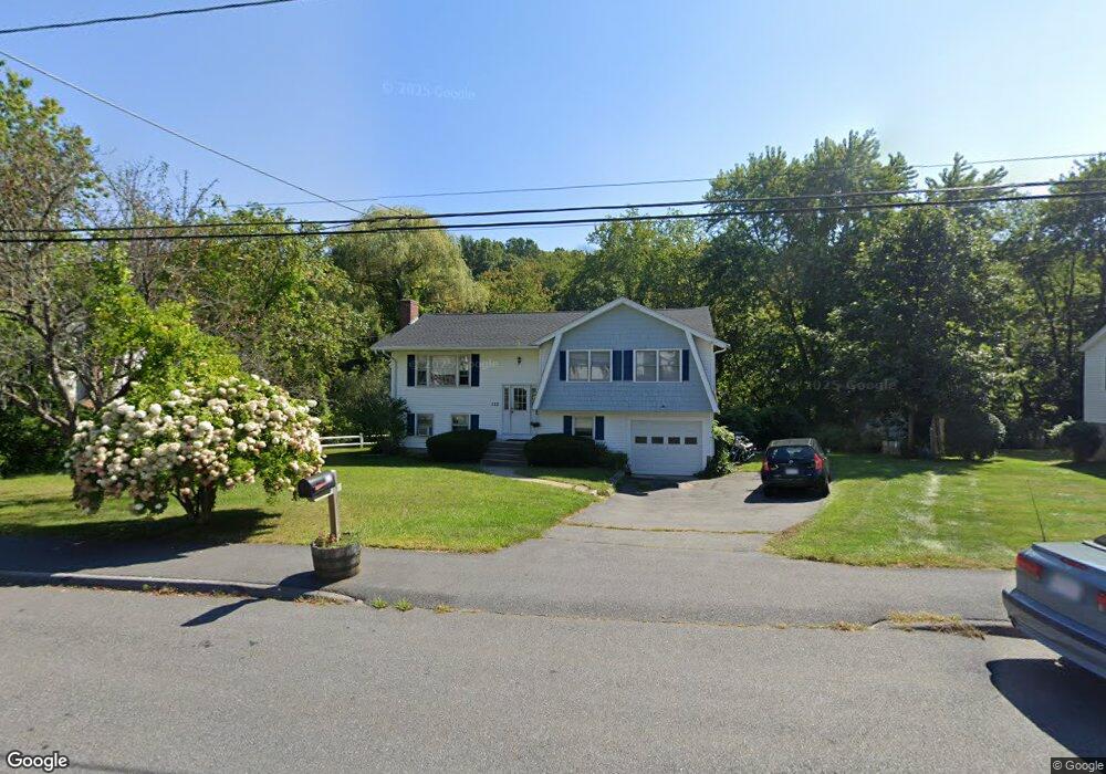
122 Leoleis Dr Marlborough, MA 01752
Estimated Value: $562,004 - $655,000
3
Beds
2
Baths
1,280
Sq Ft
$468/Sq Ft
Est. Value
About This Home
This home is located at 122 Leoleis Dr, Marlborough, MA 01752 and is currently estimated at $598,501, approximately $467 per square foot. 122 Leoleis Dr is a home located in Middlesex County with nearby schools including Marlborough High School, Advanced Math & Science Academy, and New Covenant Christian School.
Ownership History
Date
Name
Owned For
Owner Type
Purchase Details
Closed on
May 2, 1994
Sold by
Blaisdell Kathleen E
Bought by
Manfredi Alex G and Manfredi Patricia S
Current Estimated Value
Home Financials for this Owner
Home Financials are based on the most recent Mortgage that was taken out on this home.
Original Mortgage
$132,000
Interest Rate
7.7%
Mortgage Type
Purchase Money Mortgage
Purchase Details
Closed on
Jun 10, 1988
Sold by
Palmer Wyn T
Bought by
Blaisdell Kathleen E
Home Financials for this Owner
Home Financials are based on the most recent Mortgage that was taken out on this home.
Original Mortgage
$125,000
Interest Rate
10.21%
Mortgage Type
Purchase Money Mortgage
Create a Home Valuation Report for This Property
The Home Valuation Report is an in-depth analysis detailing your home's value as well as a comparison with similar homes in the area
Home Values in the Area
Average Home Value in this Area
Purchase History
| Date | Buyer | Sale Price | Title Company |
|---|---|---|---|
| Manfredi Alex G | $152,000 | -- | |
| Blaisdell Kathleen E | $173,000 | -- |
Source: Public Records
Mortgage History
| Date | Status | Borrower | Loan Amount |
|---|---|---|---|
| Closed | Blaisdell Kathleen E | $132,000 | |
| Previous Owner | Blaisdell Kathleen E | $125,000 |
Source: Public Records
Tax History Compared to Growth
Tax History
| Year | Tax Paid | Tax Assessment Tax Assessment Total Assessment is a certain percentage of the fair market value that is determined by local assessors to be the total taxable value of land and additions on the property. | Land | Improvement |
|---|---|---|---|---|
| 2025 | $5,139 | $521,200 | $222,000 | $299,200 |
| 2024 | $4,949 | $483,300 | $201,800 | $281,500 |
| 2023 | $5,112 | $443,000 | $171,200 | $271,800 |
| 2022 | $4,992 | $380,500 | $163,000 | $217,500 |
| 2021 | $4,918 | $356,400 | $135,800 | $220,600 |
| 2020 | $4,828 | $340,500 | $129,400 | $211,100 |
| 2019 | $4,711 | $334,800 | $126,800 | $208,000 |
| 2018 | $4,667 | $319,000 | $102,900 | $216,100 |
| 2017 | $4,643 | $303,100 | $101,500 | $201,600 |
| 2016 | $4,553 | $296,800 | $101,500 | $195,300 |
| 2015 | $4,219 | $267,700 | $104,000 | $163,700 |
Source: Public Records
Map
Nearby Homes
- 273 W Main St Unit B12
- 39 Desimone Dr
- 30 Broad St Unit 104
- 30A Winter Ave
- 76 Broad St
- 11 Paris St
- 102 Liberty St
- 115 W Main St
- 11 Whispering Brook Rd Unit 55
- 2 Adams St
- 61 Fairmount St Unit 11
- 32 Water St
- 87 Neil St
- 156 Chestnut St
- 111 Howe St
- 3 Madison St
- 110 Pleasant St Unit 401
- 72 Chestnut St
- 53 Mechanic St
- 118 Elm St