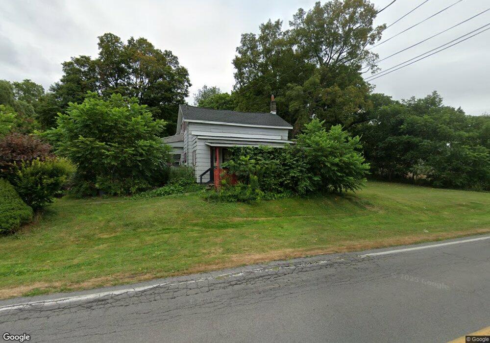
122 Lock St Phoenix, NY 13135
Estimated Value: $111,000 - $189,100
6
Beds
2
Baths
2,226
Sq Ft
$64/Sq Ft
Est. Value
About This Home
This home is located at 122 Lock St, Phoenix, NY 13135 and is currently estimated at $142,275, approximately $63 per square foot. 122 Lock St is a home located in Oswego County with nearby schools including Michael A. Maroun Elementary School, Emerson J Dillon Middle School, and John C Birdlebough High School.
Ownership History
Date
Name
Owned For
Owner Type
Purchase Details
Closed on
May 24, 2018
Sold by
Lebaudy Diego
Bought by
Pennock Brook Llc
Current Estimated Value
Purchase Details
Closed on
May 1, 2006
Sold by
Pulis Thomas C
Bought by
Darling Anthony O
Home Financials for this Owner
Home Financials are based on the most recent Mortgage that was taken out on this home.
Original Mortgage
$84,295
Interest Rate
6.4%
Purchase Details
Closed on
Aug 25, 2005
Sold by
Bank One Na
Bought by
Pulis Thomas C
Purchase Details
Closed on
Apr 1, 1996
Sold by
Margrey Douglas M
Bought by
Sims John D and Sims Donna M
Create a Home Valuation Report for This Property
The Home Valuation Report is an in-depth analysis detailing your home's value as well as a comparison with similar homes in the area
Home Values in the Area
Average Home Value in this Area
Purchase History
| Date | Buyer | Sale Price | Title Company |
|---|---|---|---|
| Pennock Brook Llc | $11,251 | None Available | |
| Darling Anthony O | $85,500 | Ticor | |
| Pulis Thomas C | $40,500 | Douglas Taylor | |
| Sims John D | $65,000 | -- |
Source: Public Records
Mortgage History
| Date | Status | Borrower | Loan Amount |
|---|---|---|---|
| Previous Owner | Darling Anthony O | $84,295 |
Source: Public Records
Tax History
| Year | Tax Paid | Tax Assessment Tax Assessment Total Assessment is a certain percentage of the fair market value that is determined by local assessors to be the total taxable value of land and additions on the property. | Land | Improvement |
|---|---|---|---|---|
| 2024 | $2,506 | $50,000 | $26,500 | $23,500 |
| 2023 | $2,490 | $50,000 | $26,500 | $23,500 |
| 2022 | $2,355 | $50,000 | $26,500 | $23,500 |
| 2021 | $3,063 | $50,000 | $26,500 | $23,500 |
| 2020 | $3,964 | $50,000 | $26,500 | $23,500 |
| 2019 | $4,557 | $50,000 | $26,500 | $23,500 |
| 2018 | $4,557 | $50,000 | $26,500 | $23,500 |
| 2017 | $1,513 | $50,000 | $26,500 | $23,500 |
| 2016 | $2,967 | $50,000 | $26,500 | $23,500 |
| 2015 | -- | $50,000 | $26,500 | $23,500 |
| 2014 | -- | $50,000 | $26,500 | $23,500 |
Source: Public Records
Map
Nearby Homes
- 16 Candee St
- 7 Homestead Ave
- 110 Jefferson St
- 40 Culvert St Unit 1
- 21 Mechanic St
- 0 New York 264 Unit 22491769
- 0 New York 264 Unit 22491771
- 24 Loomis Terrace
- 377 Main St
- 355 Main St
- 561 Main St
- 9260 River Rd
- 37 Hilltop Dr
- 9553 Horseshoe Island
- 432 County Route 12
- 97 Oswego River Rd
- 9541 Horseshoe Island Rd
- 507 County Route 12
- 2 Pendergast Rd
- 9110 Frenchmans Creek Dr
Your Personal Tour Guide
Ask me questions while you tour the home.