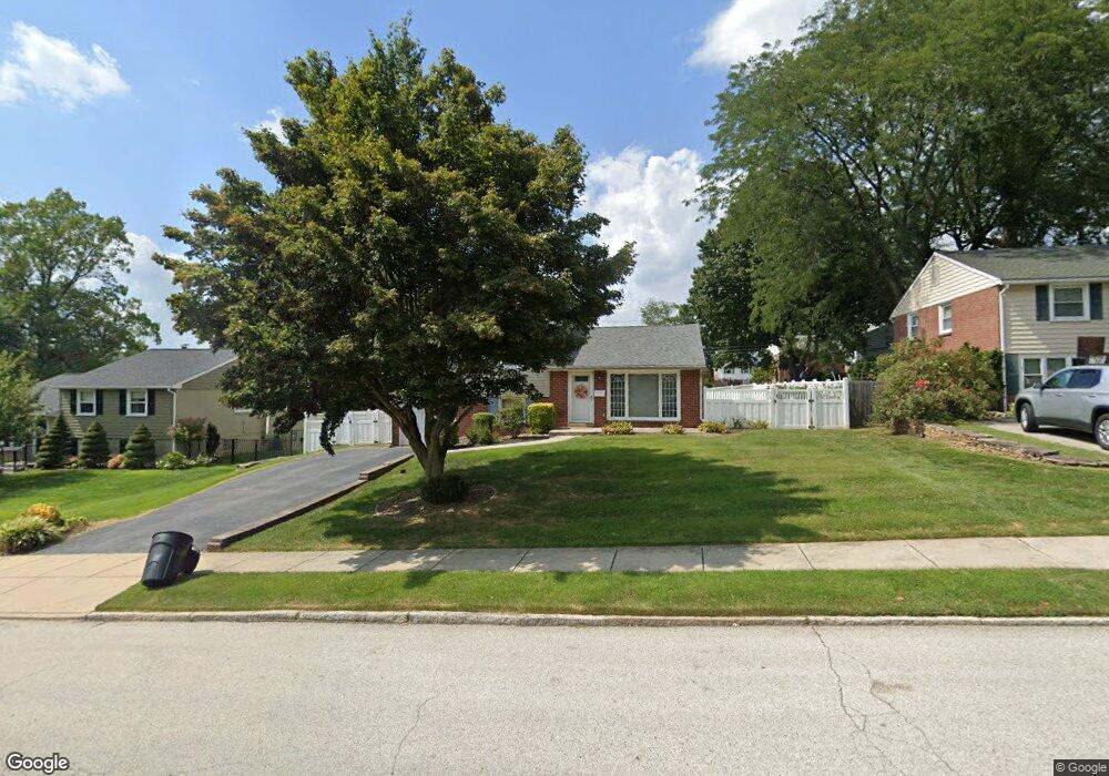
122 Locust Ave Springfield, PA 19064
Estimated Value: $479,933 - $573,000
3
Beds
2
Baths
1,783
Sq Ft
$298/Sq Ft
Est. Value
About This Home
This home is located at 122 Locust Ave, Springfield, PA 19064 and is currently estimated at $531,233, approximately $297 per square foot. 122 Locust Ave is a home located in Delaware County with nearby schools including Springfield High School, St Francis Of Assisi School, and Holy Cross School.
Ownership History
Date
Name
Owned For
Owner Type
Purchase Details
Closed on
Sep 9, 2005
Sold by
Frederico Charles A and Frederico Cherry J
Bought by
Finsterbusch Susan
Current Estimated Value
Home Financials for this Owner
Home Financials are based on the most recent Mortgage that was taken out on this home.
Original Mortgage
$266,400
Outstanding Balance
$141,987
Interest Rate
5.79%
Mortgage Type
Fannie Mae Freddie Mac
Estimated Equity
$389,246
Create a Home Valuation Report for This Property
The Home Valuation Report is an in-depth analysis detailing your home's value as well as a comparison with similar homes in the area
Home Values in the Area
Average Home Value in this Area
Purchase History
| Date | Buyer | Sale Price | Title Company |
|---|---|---|---|
| Finsterbusch Susan | $296,000 | -- |
Source: Public Records
Mortgage History
| Date | Status | Borrower | Loan Amount |
|---|---|---|---|
| Open | Finsterbusch Susan | $266,400 |
Source: Public Records
Tax History
| Year | Tax Paid | Tax Assessment Tax Assessment Total Assessment is a certain percentage of the fair market value that is determined by local assessors to be the total taxable value of land and additions on the property. | Land | Improvement |
|---|---|---|---|---|
| 2025 | $7,840 | $278,920 | $98,570 | $180,350 |
| 2024 | $7,840 | $278,920 | $98,570 | $180,350 |
| 2023 | $7,549 | $278,920 | $98,570 | $180,350 |
| 2022 | $7,385 | $278,920 | $98,570 | $180,350 |
| 2021 | $11,438 | $278,920 | $98,570 | $180,350 |
| 2020 | $6,562 | $144,810 | $47,390 | $97,420 |
| 2019 | $6,408 | $144,810 | $47,390 | $97,420 |
| 2018 | $6,316 | $144,810 | $0 | $0 |
| 2017 | $6,170 | $144,810 | $0 | $0 |
| 2016 | $795 | $144,810 | $0 | $0 |
| 2015 | $795 | $144,810 | $0 | $0 |
| 2014 | $795 | $144,810 | $0 | $0 |
Source: Public Records
Map
Nearby Homes
- 606 W Springfield Rd
- 641 W Sproul Rd
- 436 Kerr Ln
- 359 Spring Valley Rd
- 412 Foster Dr
- 499 Collins Dr
- 501 Flora Cir
- 249 Gleaves Rd
- 364 S Rolling Rd
- 120 W Springfield Rd
- 264 Pancoast Ave
- 208 Parham Rd
- 493 Wheatsheaf Rd
- 231 E Woodland Ave
- 225 Lynbrooke Rd
- 1291 Country Club Dr Unit Q137
- 109 Jackdaw Aly
- 208 Jackdaw Aly
- 238 Alliston Rd
- 42 Greenhill Rd
- 116 Locust Ave
- 123 Longview Dr
- 117 Longview Dr
- 110 Locust Ave
- 129 Longview Dr
- 134 Locust Ave
- 121 Locust Ave
- 111 Longview Dr
- 115 Locust Ave
- 127 Locust Ave
- 104 Locust Ave
- 135 Longview Dr
- 140 Locust Ave
- 109 Locust Ave
- 103 Locust Ave
- 72 Snyder Ln
- 100 Locust Ave
- 128 Longview Dr
- 139 Locust Ave
- 122 Longview Dr
Your Personal Tour Guide
Ask me questions while you tour the home.