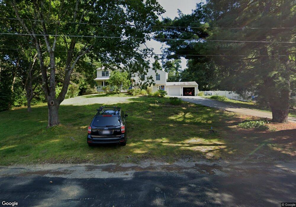
122 Minot Rd Concord, MA 01742
Estimated Value: $1,076,000 - $1,467,436
4
Beds
4
Baths
2,554
Sq Ft
$513/Sq Ft
Est. Value
About This Home
This home is located at 122 Minot Rd, Concord, MA 01742 and is currently estimated at $1,310,609, approximately $513 per square foot. 122 Minot Rd is a home located in Middlesex County with nearby schools including Alcott Elementary School, Concord Middle School, and Concord Carlisle High School.
Ownership History
Date
Name
Owned For
Owner Type
Purchase Details
Closed on
Jul 1, 1993
Sold by
Gaber Ppendpamela and Dever William G
Bought by
Drisko Robert A and Hwang Hewon
Current Estimated Value
Home Financials for this Owner
Home Financials are based on the most recent Mortgage that was taken out on this home.
Original Mortgage
$186,000
Interest Rate
7.46%
Mortgage Type
Purchase Money Mortgage
Purchase Details
Closed on
Nov 22, 1988
Sold by
Saletan Timothy L
Bought by
Gaber Pamela
Create a Home Valuation Report for This Property
The Home Valuation Report is an in-depth analysis detailing your home's value as well as a comparison with similar homes in the area
Home Values in the Area
Average Home Value in this Area
Purchase History
| Date | Buyer | Sale Price | Title Company |
|---|---|---|---|
| Drisko Robert A | $232,500 | -- | |
| Gaber Pamela | $113,000 | -- |
Source: Public Records
Mortgage History
| Date | Status | Borrower | Loan Amount |
|---|---|---|---|
| Open | Gaber Pamela | $200,000 | |
| Closed | Gaber Pamela | $175,000 | |
| Closed | Gaber Pamela | $186,000 |
Source: Public Records
Tax History
| Year | Tax Paid | Tax Assessment Tax Assessment Total Assessment is a certain percentage of the fair market value that is determined by local assessors to be the total taxable value of land and additions on the property. | Land | Improvement |
|---|---|---|---|---|
| 2025 | $168 | $1,269,100 | $584,000 | $685,100 |
| 2024 | $16,153 | $1,230,200 | $545,100 | $685,100 |
| 2023 | $15,183 | $1,171,500 | $519,200 | $652,300 |
| 2022 | $13,603 | $921,600 | $377,500 | $544,100 |
| 2021 | $13,126 | $891,700 | $377,500 | $514,200 |
| 2020 | $12,280 | $863,000 | $330,300 | $532,700 |
| 2019 | $11,471 | $808,400 | $339,000 | $469,400 |
| 2018 | $11,479 | $803,300 | $340,300 | $463,000 |
| 2017 | $11,053 | $785,600 | $324,000 | $461,600 |
| 2016 | $10,483 | $753,100 | $290,800 | $462,300 |
| 2015 | $10,446 | $731,000 | $307,800 | $423,200 |
Source: Public Records
Map
Nearby Homes
- 7 Blue Heron Way
- 6 Parker Rd
- 389 Concord Rd
- 28 Hatch Farm Ln
- 22 Hatch Farm Ln
- 10 Hatch Farm Ln
- 16 Hatch Farm Ln
- 25 Glenridge Dr
- 82 Ash St
- 1 Hillcrest Rd
- 425 Bedford St
- 186 Concord Rd
- 96 Independence Rd
- 1409 Monument St
- 612 Lexington Rd
- 73 Ridge Rd
- 1437-3 Monument St
- 45 Winterberry Way
- 212 Hawthorne Ln
- 210 Monument Farm Rd
- 112 Minot Rd
- 134 Minot Rd
- 699 Old Bedford Rd
- 100 Minot Rd
- 36 Blue Heron Way
- 36 Blue Heron Way
- 36 Blue Heron Way Unit o
- 36 Blue Heron Way Unit SF
- 123 Minot Rd
- 148 Minot Rd
- 109 Minot Rd
- 135 Minot Rd
- 147 Minot Rd
- 97 Minot Rd
- 74 Minot Rd
- 40 Minot Rd
- 721 Old Bedford Rd
- 691-693 Old Bedford Rd
- 691 Old Bedford Rd
- 709 Old Bedford Rd