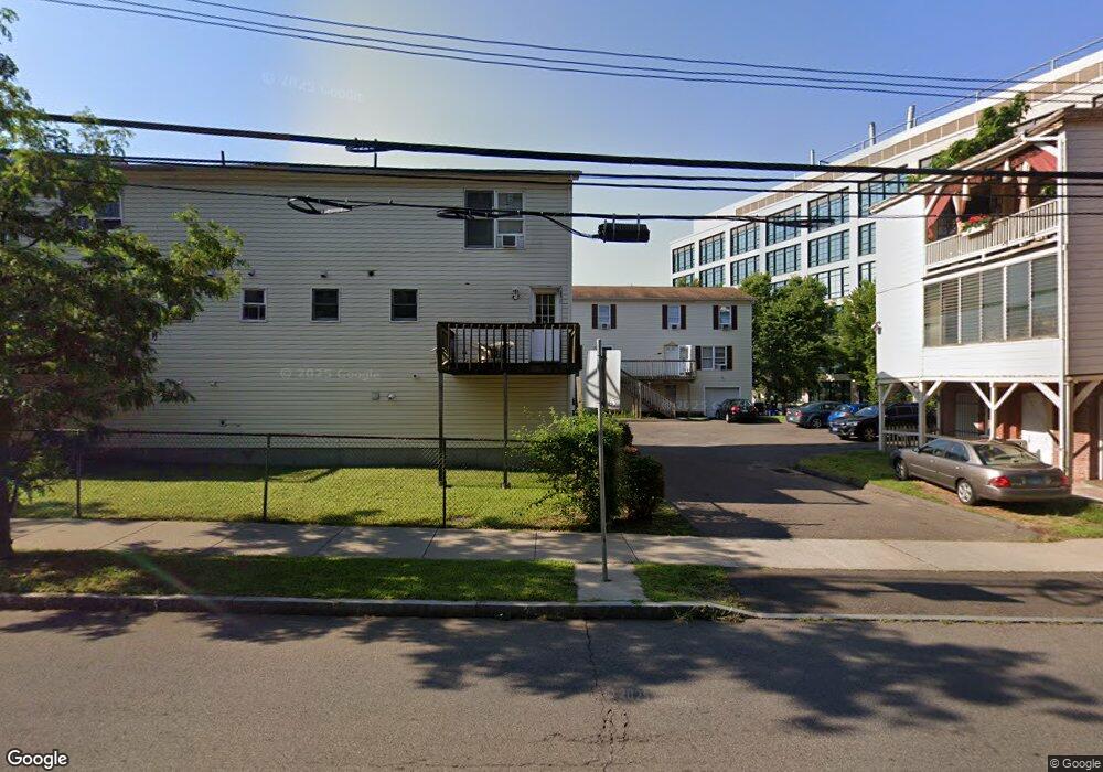
122 Munson St Unit 2 New Haven, CT 06511
Dixwell NeighborhoodEstimated Value: $185,000 - $287,000
3
Beds
2
Baths
1,350
Sq Ft
$175/Sq Ft
Est. Value
About This Home
This home is located at 122 Munson St Unit 2, New Haven, CT 06511 and is currently estimated at $235,708, approximately $174 per square foot. 122 Munson St Unit 2 is a home located in New Haven County with nearby schools including Highville Charter School and The Foote School.
Ownership History
Date
Name
Owned For
Owner Type
Purchase Details
Closed on
Feb 25, 1992
Sold by
Munsons Walk Inc
Bought by
Mcclease Lester M and Mcclease Gwendolyn
Current Estimated Value
Home Financials for this Owner
Home Financials are based on the most recent Mortgage that was taken out on this home.
Original Mortgage
$94,700
Interest Rate
8.19%
Mortgage Type
Unknown
Create a Home Valuation Report for This Property
The Home Valuation Report is an in-depth analysis detailing your home's value as well as a comparison with similar homes in the area
Home Values in the Area
Average Home Value in this Area
Purchase History
| Date | Buyer | Sale Price | Title Company |
|---|---|---|---|
| Mcclease Lester M | $98,000 | -- |
Source: Public Records
Mortgage History
| Date | Status | Borrower | Loan Amount |
|---|---|---|---|
| Closed | Mcclease Lester M | $94,700 |
Source: Public Records
Tax History
| Year | Tax Paid | Tax Assessment Tax Assessment Total Assessment is a certain percentage of the fair market value that is determined by local assessors to be the total taxable value of land and additions on the property. | Land | Improvement |
|---|---|---|---|---|
| 2025 | $1,829 | $46,410 | $0 | $46,410 |
| 2024 | $1,787 | $46,410 | $0 | $46,410 |
| 2023 | $1,726 | $46,410 | $0 | $46,410 |
| 2022 | $1,845 | $46,410 | $0 | $46,410 |
| 2021 | $1,474 | $33,600 | $0 | $33,600 |
| 2020 | $1,474 | $33,600 | $0 | $33,600 |
| 2019 | $1,444 | $33,600 | $0 | $33,600 |
| 2018 | $1,444 | $33,600 | $0 | $33,600 |
| 2017 | $1,300 | $33,600 | $0 | $33,600 |
| 2016 | $1,486 | $35,770 | $0 | $35,770 |
| 2015 | $1,486 | $35,770 | $0 | $35,770 |
| 2014 | -- | $35,770 | $0 | $35,770 |
Source: Public Records
Map
Nearby Homes
- 35 Tilton St
- 130 Winchester Ave Unit 400
- 41 Admiral St
- 130 Mansfield St
- 80 Henry St
- 80 Admiral St
- 269 Dixwell Ave
- 265 Dixwell Ave
- 38 Townsend St
- 437 Dixwell Ave
- 449 Dixwell Ave
- 77 Gibbs St
- 182 Henry St Unit 182
- 126 Sheffield Ave
- 500 Prospect St Unit 3B
- 500 Prospect St Unit 2C
- 500 Prospect St Unit 1E
- 254 Starr St
- 622 Winchester Ave
- 251 Starr St
- 122 Munson St Unit 10
- 122 Munson St Unit 4
- 122 Munson St Unit 3
- 122 Munson St Unit 1
- 0 Ct
- 124 Munson St Unit 10
- 124 Munson St Unit 9
- 124 Munson St Unit 8
- 124 Munson St Unit 7
- 124 Munson St Unit 6
- 124 Munson St Unit 5
- 115 Munson St Unit 5th
- 115 Munson St
- 225 Winchester Ave
- 225 Winchester Ave Unit 3
- 225 Winchester Ave Unit 2
- 225 Winchester Ave Unit 1
- 319 Winchester Ave Unit 241
- 319 Winchester Ave Unit 119
Your Personal Tour Guide
Ask me questions while you tour the home.