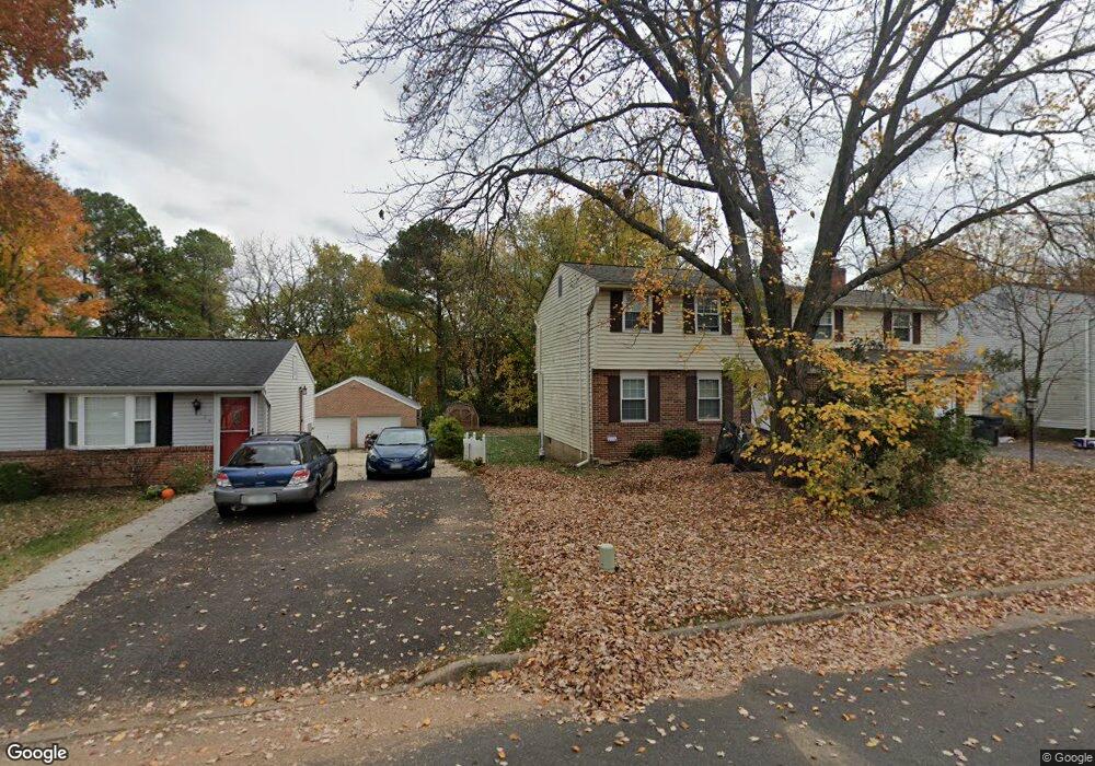
122 N Johnson Rd Sterling, VA 20164
Estimated Value: $710,000 - $794,000
5
Beds
3
Baths
3,813
Sq Ft
$196/Sq Ft
Est. Value
About This Home
This home is located at 122 N Johnson Rd, Sterling, VA 20164 and is currently estimated at $745,763, approximately $195 per square foot. 122 N Johnson Rd is a home located in Loudoun County with nearby schools including Sully Elementary School, Sterling Middle School, and Park View High School.
Ownership History
Date
Name
Owned For
Owner Type
Purchase Details
Closed on
May 16, 2008
Sold by
Waters Joseph P
Bought by
Thorpe Garnet S B
Current Estimated Value
Home Financials for this Owner
Home Financials are based on the most recent Mortgage that was taken out on this home.
Original Mortgage
$413,700
Outstanding Balance
$262,405
Interest Rate
5.91%
Mortgage Type
FHA
Estimated Equity
$483,358
Create a Home Valuation Report for This Property
The Home Valuation Report is an in-depth analysis detailing your home's value as well as a comparison with similar homes in the area
Home Values in the Area
Average Home Value in this Area
Purchase History
| Date | Buyer | Sale Price | Title Company |
|---|---|---|---|
| Thorpe Garnet S B | $417,000 | -- |
Source: Public Records
Mortgage History
| Date | Status | Borrower | Loan Amount |
|---|---|---|---|
| Open | Thorpe Garnet S B | $413,700 |
Source: Public Records
Tax History
| Year | Tax Paid | Tax Assessment Tax Assessment Total Assessment is a certain percentage of the fair market value that is determined by local assessors to be the total taxable value of land and additions on the property. | Land | Improvement |
|---|---|---|---|---|
| 2025 | $5,619 | $697,960 | $234,700 | $463,260 |
| 2024 | $5,463 | $631,540 | $209,700 | $421,840 |
| 2023 | $5,496 | $628,090 | $209,700 | $418,390 |
| 2022 | $5,077 | $570,440 | $189,700 | $380,740 |
| 2021 | $4,985 | $508,690 | $179,700 | $328,990 |
| 2020 | $5,073 | $490,110 | $154,700 | $335,410 |
| 2019 | $4,937 | $472,450 | $154,700 | $317,750 |
| 2018 | $4,703 | $433,420 | $139,700 | $293,720 |
| 2017 | $4,704 | $418,160 | $139,700 | $278,460 |
| 2016 | $4,802 | $419,410 | $0 | $0 |
| 2015 | $4,318 | $259,280 | $0 | $259,280 |
| 2014 | $4,441 | $263,330 | $0 | $263,330 |
Source: Public Records
Map
Nearby Homes
- 112 N Kennedy Rd
- 125 N Lincoln Ave
- 138 N Ithaca Ct
- 1314 E Holly Ave
- 207 N Laura Anne Dr
- 204 Elizabeth Ct
- 1201 E Holly Ave
- 108 N Garfield Rd
- 221 N Emory Dr Unit 8
- 141 N Fillmore Ave Unit 10
- 308 E Cornell Dr
- 303 N Argonne Ave
- 211 Amy Ct
- 115 N Duke Dr
- 1530 Powells Tavern Place
- 133 N Baylor Dr Unit 97
- 709 N Belfort St
- 503 S Maple Ct
- 1439 Millikens Bend Rd
- 102 Evergreen St
- 124 N Johnson Rd
- 120 N Johnson Rd
- 126 N Johnson Rd
- 118 N Johnson Rd
- 117 N Johnson Rd
- 119 N Johnson Rd
- 116 N Johnson Rd
- 119 N Kennedy Rd
- 1400 E Beech Rd
- 121 N Kennedy Rd
- 115 N Johnson Rd
- 117 N Kennedy Rd
- 123 N Kennedy Rd
- 1312 E Beech Rd
- 147 N Harrison Rd
- 114 N Johnson Rd
- 115 N Kennedy Rd
- 125 N Kennedy Rd
- 144 N Harrison Rd
- 1310 E Beech Rd
Your Personal Tour Guide
Ask me questions while you tour the home.