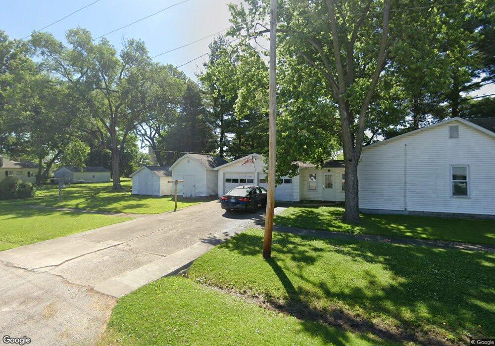
122 N Maple St Nokomis, IL 62075
Estimated Value: $56,236 - $91,000
--
Bed
--
Bath
--
Sq Ft
6,926
Sq Ft Lot
About This Home
This home is located at 122 N Maple St, Nokomis, IL 62075 and is currently estimated at $71,059. 122 N Maple St is a home located in Montgomery County with nearby schools including North Elementary School, Nokomis Junior/Senior High School, and St. Louis Catholic School.
Ownership History
Date
Name
Owned For
Owner Type
Purchase Details
Closed on
Nov 21, 2022
Sold by
Maretti Anthony R and Maretti Sonya D
Bought by
Strissel Tyler
Current Estimated Value
Purchase Details
Closed on
Oct 28, 2011
Sold by
Buchholz Lloyd E and Maretti Sonya
Bought by
Maretti Anthony R and Maretti Sonya D
Home Financials for this Owner
Home Financials are based on the most recent Mortgage that was taken out on this home.
Original Mortgage
$20,000
Interest Rate
4.12%
Mortgage Type
Future Advance Clause Open End Mortgage
Create a Home Valuation Report for This Property
The Home Valuation Report is an in-depth analysis detailing your home's value as well as a comparison with similar homes in the area
Home Values in the Area
Average Home Value in this Area
Purchase History
| Date | Buyer | Sale Price | Title Company |
|---|---|---|---|
| Strissel Tyler | $53,000 | None Available | |
| Maretti Anthony R | $25,000 | None Available |
Source: Public Records
Mortgage History
| Date | Status | Borrower | Loan Amount |
|---|---|---|---|
| Previous Owner | Maretti Anthony R | $20,000 |
Source: Public Records
Tax History Compared to Growth
Tax History
| Year | Tax Paid | Tax Assessment Tax Assessment Total Assessment is a certain percentage of the fair market value that is determined by local assessors to be the total taxable value of land and additions on the property. | Land | Improvement |
|---|---|---|---|---|
| 2024 | $797 | $15,160 | $1,730 | $13,430 |
| 2023 | $721 | $14,210 | $1,620 | $12,590 |
| 2022 | $1,226 | $13,660 | $1,560 | $12,100 |
| 2021 | $1,262 | $14,270 | $1,630 | $12,640 |
| 2020 | $1,212 | $13,610 | $1,550 | $12,060 |
| 2019 | $1,272 | $14,380 | $1,640 | $12,740 |
| 2018 | $1,235 | $13,530 | $1,540 | $11,990 |
| 2017 | $1,204 | $12,720 | $1,450 | $11,270 |
| 2016 | $1,206 | $12,370 | $1,410 | $10,960 |
| 2015 | $1,174 | $11,990 | $1,370 | $10,620 |
| 2013 | $1,146 | $12,140 | $1,390 | $10,750 |
Source: Public Records
Map
Nearby Homes
- 222 E Franklin St
- 114 N Maple St
- 203 E Franklin St
- 123 N Maple St
- 211 N Maple St
- 117 N Maple St
- 208 N Maple St
- 110 N Maple St
- 119 E Franklin St
- 211 E Front St
- 121 E Front St
- 215 E Front St
- 209 N Oak St
- 214 N Maple St
- 219 E Front St
- 223 E Front St
- 200 N Oak St
- 215 N Maple St
- 116 N Oak St
- 114 N Oak St