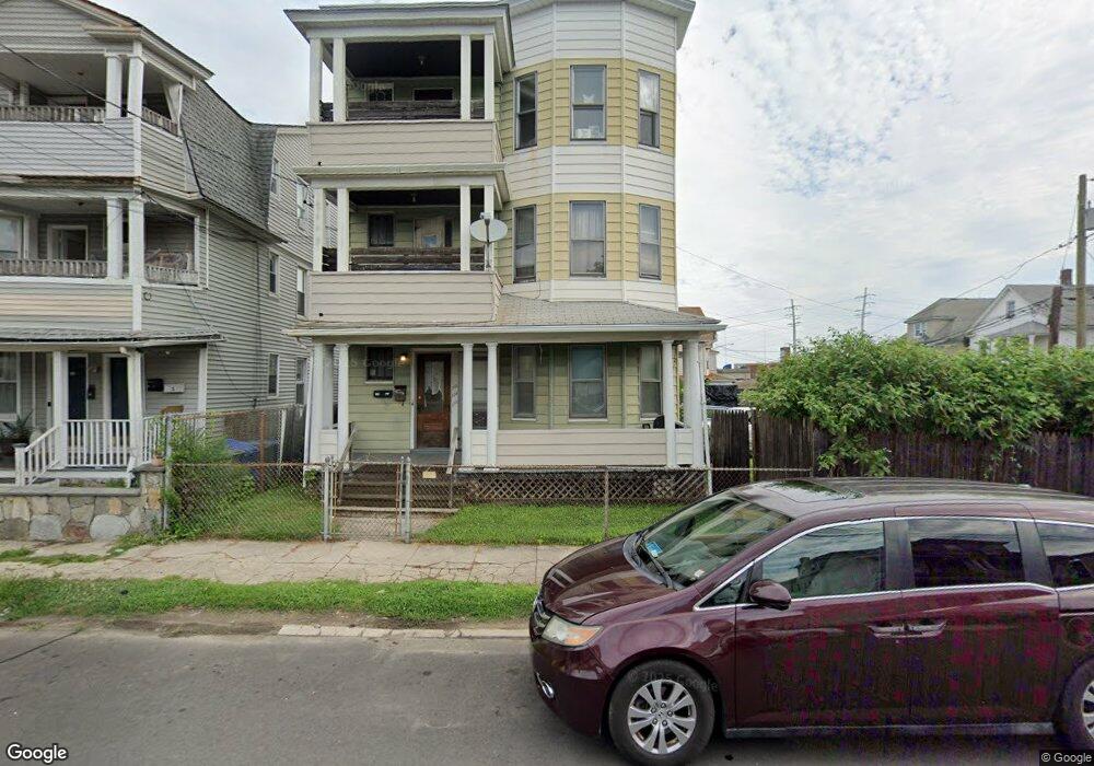
122 Orland St Unit 126 Bridgeport, CT 06605
Black Rock NeighborhoodEstimated Value: $414,103 - $616,000
6
Beds
3
Baths
2,502
Sq Ft
$203/Sq Ft
Est. Value
About This Home
This home is located at 122 Orland St Unit 126, Bridgeport, CT 06605 and is currently estimated at $507,526, approximately $202 per square foot. 122 Orland St Unit 126 is a home located in Fairfield County with nearby schools including Bassick High School, Park City Prep Charter School, and St. Ann Campus - Catholic Academy of Bridgeport.
Ownership History
Date
Name
Owned For
Owner Type
Purchase Details
Closed on
Jan 16, 2020
Sold by
122 Orland St Llc
Bought by
Orland St Llc
Current Estimated Value
Purchase Details
Closed on
Sep 24, 2019
Sold by
Merly Richard
Bought by
122 Orland St Llc
Purchase Details
Closed on
Apr 10, 1981
Bought by
Merly Richard and Merly Thomas
Create a Home Valuation Report for This Property
The Home Valuation Report is an in-depth analysis detailing your home's value as well as a comparison with similar homes in the area
Home Values in the Area
Average Home Value in this Area
Purchase History
| Date | Buyer | Sale Price | Title Company |
|---|---|---|---|
| Orland St Llc | $247,000 | None Available | |
| Orland St Llc | $247,000 | None Available | |
| 122 Orland St Llc | $140,000 | -- | |
| 122 Orland St Llc | $140,000 | -- | |
| Merly Richard | -- | -- |
Source: Public Records
Tax History Compared to Growth
Tax History
| Year | Tax Paid | Tax Assessment Tax Assessment Total Assessment is a certain percentage of the fair market value that is determined by local assessors to be the total taxable value of land and additions on the property. | Land | Improvement |
|---|---|---|---|---|
| 2025 | $8,567 | $197,160 | $80,300 | $116,860 |
| 2024 | $8,567 | $197,160 | $80,300 | $116,860 |
| 2023 | $8,567 | $197,160 | $80,300 | $116,860 |
| 2022 | $8,567 | $197,160 | $80,300 | $116,860 |
| 2021 | $8,567 | $197,160 | $80,300 | $116,860 |
| 2020 | $6,308 | $116,830 | $34,460 | $82,370 |
| 2019 | $6,308 | $116,830 | $34,460 | $82,370 |
| 2018 | $6,352 | $116,830 | $34,460 | $82,370 |
| 2017 | $6,352 | $116,830 | $34,460 | $82,370 |
| 2016 | $7,218 | $132,760 | $34,460 | $98,300 |
| 2015 | $4,726 | $112,000 | $22,090 | $89,910 |
| 2014 | $4,726 | $112,000 | $22,090 | $89,910 |
Source: Public Records
Map
Nearby Homes
- 144 Whittier St
- 135 Whittier St
- 31 Whittier St
- 25 Whittier St
- 82 Waldorf Ave
- 95 Bedford Ave
- 167 Scofield Ave
- 118 Berwick Ave
- 105 Scofield Ave
- 130 Brentwood Ave
- 145 Brentwood Ave
- 195 Lenox Ave Unit 197
- 47 Lenox Ave
- 166 Alfred St
- 51 Princeton St
- 246 Lenox Ave
- 1059 Hancock Ave Unit 1061
- 368 Lenox Ave
- 500 Dewey St
- 855 Brewster St Unit 857
- 130 Orland St Unit 134
- 144 Orland St Unit 148
- 101 Orland St
- 101 Orland St Unit 1ST F
- 37R Wakeman St
- 56 Bryant St Unit 58
- 17 Bryant St
- 125 Orland St
- 31 Wakeman St
- 52 Bryant St
- 166 Orland St
- 174 Orland St Unit 3
- 174 Orland St Unit 2
- 172 Orland St Unit 174
- 172 Orland St Unit 3
- 172 Orland St Unit 2
- 98 Orland St Unit 100
- 98 Orland St Unit 1R
- 98 Orland St Unit 2F