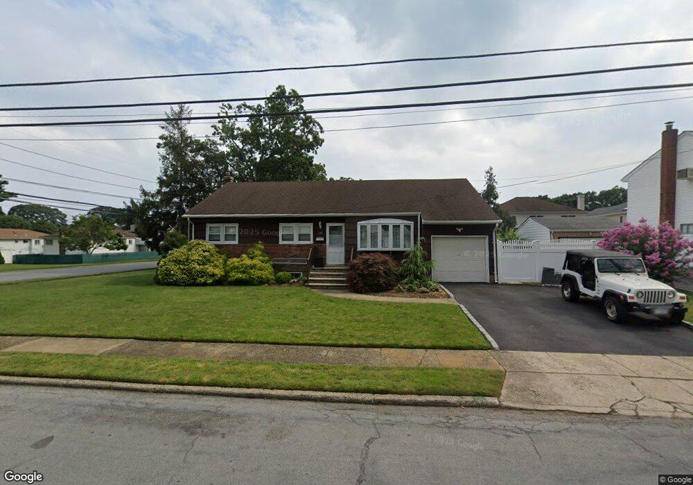
122 Rhode Island Ave Massapequa, NY 11758
Estimated Value: $674,000 - $725,854
3
Beds
2
Baths
1,258
Sq Ft
$556/Sq Ft
Est. Value
About This Home
This home is located at 122 Rhode Island Ave, Massapequa, NY 11758 and is currently estimated at $699,927, approximately $556 per square foot. 122 Rhode Island Ave is a home located in Nassau County with nearby schools including Massapequa High School - Ames Campus, Berner Middle School, and Massapequa High School.
Ownership History
Date
Name
Owned For
Owner Type
Purchase Details
Closed on
May 19, 2016
Sold by
Graham Nancy and Last Will And Testament Of Alv
Bought by
Finn James K and Finn Garrett J
Current Estimated Value
Home Financials for this Owner
Home Financials are based on the most recent Mortgage that was taken out on this home.
Original Mortgage
$287,200
Outstanding Balance
$228,108
Interest Rate
3.59%
Mortgage Type
New Conventional
Estimated Equity
$471,819
Create a Home Valuation Report for This Property
The Home Valuation Report is an in-depth analysis detailing your home's value as well as a comparison with similar homes in the area
Home Values in the Area
Average Home Value in this Area
Purchase History
| Date | Buyer | Sale Price | Title Company |
|---|---|---|---|
| Finn James K | $359,000 | Commonwealth Land Title Insu |
Source: Public Records
Mortgage History
| Date | Status | Borrower | Loan Amount |
|---|---|---|---|
| Open | Finn James K | $287,200 |
Source: Public Records
Tax History Compared to Growth
Tax History
| Year | Tax Paid | Tax Assessment Tax Assessment Total Assessment is a certain percentage of the fair market value that is determined by local assessors to be the total taxable value of land and additions on the property. | Land | Improvement |
|---|---|---|---|---|
| 2025 | $12,394 | $435 | $182 | $253 |
| 2024 | $3,950 | $463 | $194 | $269 |
| 2023 | $14,209 | $523 | $219 | $304 |
| 2022 | $14,209 | $523 | $219 | $304 |
| 2021 | $14,048 | $504 | $211 | $293 |
| 2020 | $13,757 | $748 | $532 | $216 |
| 2019 | $12,393 | $695 | $532 | $163 |
| 2018 | $12,393 | $695 | $0 | $0 |
| 2017 | $5,238 | $695 | $532 | $163 |
| 2016 | $7,253 | $695 | $532 | $163 |
| 2015 | $1,743 | $695 | $532 | $163 |
| 2014 | $1,743 | $695 | $532 | $163 |
| 2013 | $1,605 | $695 | $532 | $163 |
Source: Public Records
Map
Nearby Homes
- 128 Massachusetts Ave
- 163 Massachusetts Ave
- 121 Ontario Ave
- 102 Boston Ave
- 101 Toronto Ave
- 136 Euclid Ave
- 86 Cleveland Ave
- 73 Massachusetts Ave
- 70 Pittsburgh Ave
- 254 N Richmond Ave
- 76 Hamilton Ave
- 203 N Manhattan Ave
- 116 Parkhill Ave
- 73 Chicago Ave
- 104 Clark Ave
- 20 Boston Ave
- 262 New Hampshire Ave
- 11 Pittsburgh Ave
- 22 Commonwealth Ave
- 51 Michigan Ave
- 136 Rhode Island Ave
- 659 Franklin Ave
- 124 Rhode Island Ave
- 139 Rhode Island Ave
- 135 Commonwealth Ave
- 135 Rhode Island Ave
- 133 Commonwealth Ave Unit A
- 120 Rhode Island Ave
- 662 Franklin Ave
- 667 Franklin Ave
- 137 Commonwealth Ave
- 129 Rhode Island Ave
- 0 Commonwealth Ave Unit P1199996
- 118 Rhode Island Ave
- 666 Franklin Ave
- 139 Commonwealth Ave
- 673 Franklin Ave
- 138 New Hampshire Ave
- 131 Commonwealth Ave
- 142 Rhode Island Ave