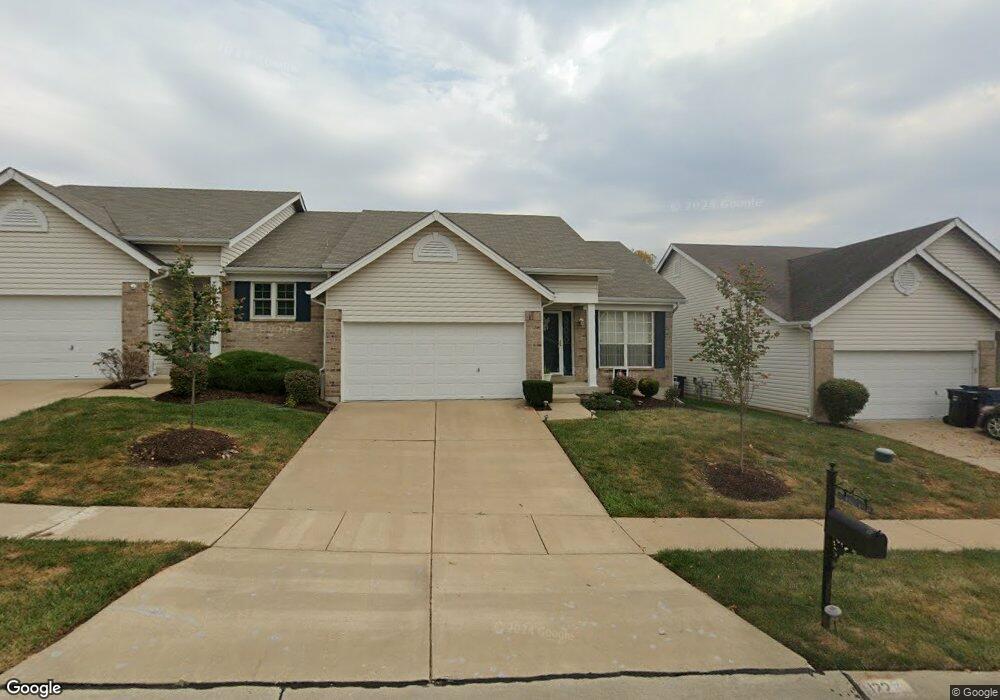
122 Robbins Way Dr Florissant, MO 63034
Estimated Value: $195,627 - $276,000
2
Beds
2
Baths
1,024
Sq Ft
$217/Sq Ft
Est. Value
About This Home
This home is located at 122 Robbins Way Dr, Florissant, MO 63034 and is currently estimated at $222,157, approximately $216 per square foot. 122 Robbins Way Dr is a home located in St. Louis County with nearby schools including Barrington Elementary School, Central Middle School, and Hazelwood Central High School.
Ownership History
Date
Name
Owned For
Owner Type
Purchase Details
Closed on
Feb 21, 2013
Sold by
Mcelroy Mia and Mcelroy Walter
Bought by
Taylor Angela M
Current Estimated Value
Home Financials for this Owner
Home Financials are based on the most recent Mortgage that was taken out on this home.
Original Mortgage
$112,917
Outstanding Balance
$78,789
Interest Rate
3.37%
Mortgage Type
FHA
Estimated Equity
$143,368
Purchase Details
Closed on
Sep 26, 2002
Sold by
Mcbride & Son Homes Inc
Bought by
Hollins Mia A
Home Financials for this Owner
Home Financials are based on the most recent Mortgage that was taken out on this home.
Original Mortgage
$130,790
Interest Rate
6.21%
Mortgage Type
FHA
Create a Home Valuation Report for This Property
The Home Valuation Report is an in-depth analysis detailing your home's value as well as a comparison with similar homes in the area
Home Values in the Area
Average Home Value in this Area
Purchase History
| Date | Buyer | Sale Price | Title Company |
|---|---|---|---|
| Taylor Angela M | $115,000 | Continental Title Company | |
| Hollins Mia A | $131,825 | -- |
Source: Public Records
Mortgage History
| Date | Status | Borrower | Loan Amount |
|---|---|---|---|
| Open | Taylor Angela M | $112,917 | |
| Previous Owner | Hollins Mia A | $130,790 |
Source: Public Records
Tax History Compared to Growth
Tax History
| Year | Tax Paid | Tax Assessment Tax Assessment Total Assessment is a certain percentage of the fair market value that is determined by local assessors to be the total taxable value of land and additions on the property. | Land | Improvement |
|---|---|---|---|---|
| 2025 | $2,707 | $35,300 | $4,350 | $30,950 |
| 2024 | $2,707 | $29,700 | $2,640 | $27,060 |
| 2023 | $2,697 | $29,700 | $2,640 | $27,060 |
| 2022 | $2,726 | $26,710 | $5,680 | $21,030 |
| 2021 | $2,580 | $26,710 | $5,680 | $21,030 |
| 2020 | $2,247 | $21,640 | $2,280 | $19,360 |
| 2019 | $2,212 | $21,640 | $2,280 | $19,360 |
| 2018 | $2,168 | $19,610 | $1,520 | $18,090 |
| 2017 | $2,165 | $19,610 | $1,520 | $18,090 |
| 2016 | $2,356 | $21,010 | $1,900 | $19,110 |
| 2015 | $2,302 | $21,010 | $1,900 | $19,110 |
| 2014 | $2,035 | $18,460 | $5,050 | $13,410 |
Source: Public Records
Map
Nearby Homes
- 4629 Richmond Forest Dr
- 173 Behlmann Meadows Way
- 210 Behlmann Meadows Way
- 107 Behlmann Orchard Ct
- 14333 River Oaks Ct
- 4304 Inlet Isle Dr Unit 7
- 4328 Inlet Isle Dr
- 13630 Old Halls Ferry Rd
- 5220 Delcastle Dr
- 14214 Ashbury Meadows Dr
- 13124 Crestwood Bend Ln
- 13125 Crestwood Bend Ln
- 13136 Crestwood Bend Ln
- 13140 Crestwood Bend Ln
- 13141 Crestwood Bend Ln
- 4846 Trees Edge Ln
- 13144 Crestwood Bend Ln
- 13107 Ambrose Ct
- 4866 Trees Edge Ln
- 13145 Crestwood Bend Ln
- 120 Robbins Way Dr
- 116 Robbins Way Dr
- 126 Robbins Way Dr
- 114 Robbins Way Dr
- 128 Robbins Way Dr
- 121 Robbins Way Dr
- 123 Robbins Way Dr
- 4541 Robbins Grove Dr
- 132 Robbins Way Dr
- 4537 Robbins Grove Dr
- 110 Robbins Way Dr
- 4545 Robbins Grove Dr
- 4533 Robbins Grove Dr
- 127 Robbins Way Dr
- 4549 Robbins Grove Dr
- 134 Robbins Way Dr
- 129 Robbins Way Dr
- 108 Robbins Way Dr
- 4529 Robbins Grove Dr
- 4553 Robbins Grove Dr