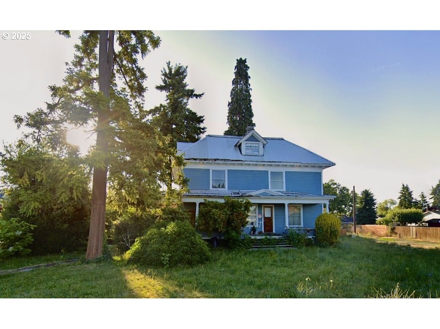
122 S 12th Ave Cornelius, OR 97113
Estimated payment $4,575/month
Highlights
- City View
- No HOA
- No Heating
- Corner Lot
- Garage
About This Lot
This property represents a unique opportunity to completely redevelop an existing property (SFH sits on lot at this time). Preliminary meetings with the City have been favorable and indicate support for multi-family housing. Buyer to perform their own diligence. Seller will carry for up to 24 months with 15% down for qualified Buyer.
Listing Agent
Epique Realty Brokerage Phone: 503-889-6780 License #201102087 Listed on: 10/15/2025

Property Details
Property Type
- Land
Est. Annual Taxes
- $4,256
Lot Details
- Corner Lot
- Level Lot
- Property is zoned A2
Parking
- Garage
Home Design
- Fixer Upper
Schools
- Echo Shaw Elementary School
- Neil Armstrong Middle School
- Forest Grove High School
Additional Features
- City Views
- Residence on Property
- No Utilities
Community Details
- No Home Owners Association
Listing and Financial Details
- Assessor Parcel Number R406242
Map
Home Values in the Area
Average Home Value in this Area
Tax History
| Year | Tax Paid | Tax Assessment Tax Assessment Total Assessment is a certain percentage of the fair market value that is determined by local assessors to be the total taxable value of land and additions on the property. | Land | Improvement |
|---|---|---|---|---|
| 2026 | $4,256 | $244,980 | -- | -- |
| 2025 | $4,256 | $237,850 | -- | -- |
| 2024 | $3,887 | $230,930 | -- | -- |
| 2023 | $3,887 | $224,210 | $0 | $0 |
| 2022 | $3,444 | $224,210 | $0 | $0 |
| 2021 | $3,403 | $211,340 | $0 | $0 |
| 2020 | $3,390 | $205,190 | $0 | $0 |
| 2019 | $3,316 | $199,220 | $0 | $0 |
| 2018 | $3,214 | $193,420 | $0 | $0 |
| 2017 | $3,115 | $187,790 | $0 | $0 |
| 2016 | $3,027 | $182,330 | $0 | $0 |
| 2015 | $2,848 | $177,020 | $0 | $0 |
| 2014 | $2,750 | $171,870 | $0 | $0 |
Property History
| Date | Event | Price | List to Sale | Price per Sq Ft |
|---|---|---|---|---|
| 10/15/2025 10/15/25 | For Sale | $799,000 | -- | -- |
Purchase History
| Date | Type | Sale Price | Title Company |
|---|---|---|---|
| Warranty Deed | $800,000 | Old Republic Title | |
| Interfamily Deed Transfer | -- | None Available |
Mortgage History
| Date | Status | Loan Amount | Loan Type |
|---|---|---|---|
| Open | $700,000 | Seller Take Back |
Source: Regional Multiple Listing Service (RMLS)
MLS Number: 410551666
APN: R0406242
Disclaimer: Certain information contained herein is derived from information provided by parties other than Homes.com. All information provided is deemed reliable, but is not guaranteed to be accurate and should be independently verified.
![]() The content relating to real estate for sale on this web site comes in part from the IDX program of the RMLS™ of Portland, Oregon. Real estate listings held by brokerage firms other than Ten-X are marked with the RMLS™ logo, and detailed information about these properties includes the names of the listing brokers. Listing content is copyright © 2025 RMLS™, Portland, Oregon. Some properties which appear for sale on this web site may subsequently have sold or may no longer be available. All information provided is deemed reliable but is not guaranteed and should be independently verified.
The content relating to real estate for sale on this web site comes in part from the IDX program of the RMLS™ of Portland, Oregon. Real estate listings held by brokerage firms other than Ten-X are marked with the RMLS™ logo, and detailed information about these properties includes the names of the listing brokers. Listing content is copyright © 2025 RMLS™, Portland, Oregon. Some properties which appear for sale on this web site may subsequently have sold or may no longer be available. All information provided is deemed reliable but is not guaranteed and should be independently verified.
- 1341 S Beech St
- 1701 S Alpine St
- 1686 N Barlow St
- 328 N 15th Ave
- 1134 S Ginger St
- 440 N 14th Ave
- 570 N 10th St Unit 29
- 570 N 10th Ave Unit 59
- 570 N 10th Ave Unit 2
- 570 N 10th Ave Unit 6
- 570 N 10th Ave Unit 80
- 570 N 10th Ave Unit 10
- 570 N 10th Ave Unit 58
- 570 N 10th Ave Unit 110
- 570 N 10th Ave Unit 30
- 1126 S Jasper St
- 385 S Cherry Dr
- 507 N 19th Ave Unit 99
- 507 N 19th Ave Unit 15
- 507 N 19th Ave Unit 18
- 1045 S Jasper St Unit a
- 133 N 29th Ave
- 151 N 29th Ave Unit C
- 3802 Pacific Ave
- 1921 Fir Rd Unit 34
- 1900 Poplar St
- 2812 25th Place
- 1903 Hawthorne St Unit A
- 2229 Hawthorne St Unit D
- 2434 15th Ave
- 1642 Ash St
- 2701 Main St
- 2715 Main St Unit 4
- 1837 Pacific Ave
- 357 S 1st Ave
- 110 SE Washington St
- 160 SE Washington St
- 224 NE Jefferson St Unit 224 A
- 390 SE Main St
- 300 NE Autumn Rose Way