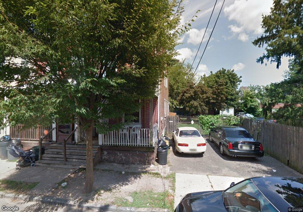
122 S Logan Ave Trenton, NJ 08609
Wilbur NeighborhoodEstimated Value: $133,424 - $275,000
--
Bed
--
Bath
1,316
Sq Ft
$173/Sq Ft
Est. Value
About This Home
This home is located at 122 S Logan Ave, Trenton, NJ 08609 and is currently estimated at $227,356, approximately $172 per square foot. 122 S Logan Ave is a home located in Mercer County with nearby schools including Grant Elementary School, Dr. Martin Luther King Middle School, and Trenton Central High School - Main Campus.
Ownership History
Date
Name
Owned For
Owner Type
Purchase Details
Closed on
Aug 3, 2009
Sold by
Colon Ada
Bought by
Quinones Hector
Current Estimated Value
Purchase Details
Closed on
Jun 9, 2003
Sold by
Rosario Gloria
Bought by
Colon Ada
Purchase Details
Closed on
May 18, 2001
Sold by
Eusebio Christobal
Bought by
Rosario Gloria
Home Financials for this Owner
Home Financials are based on the most recent Mortgage that was taken out on this home.
Original Mortgage
$55,114
Interest Rate
6.77%
Mortgage Type
FHA
Create a Home Valuation Report for This Property
The Home Valuation Report is an in-depth analysis detailing your home's value as well as a comparison with similar homes in the area
Home Values in the Area
Average Home Value in this Area
Purchase History
| Date | Buyer | Sale Price | Title Company |
|---|---|---|---|
| Quinones Hector | -- | None Available | |
| Colon Ada | -- | -- | |
| Rosario Gloria | $56,000 | -- |
Source: Public Records
Mortgage History
| Date | Status | Borrower | Loan Amount |
|---|---|---|---|
| Previous Owner | Rosario Gloria | $55,114 |
Source: Public Records
Tax History Compared to Growth
Tax History
| Year | Tax Paid | Tax Assessment Tax Assessment Total Assessment is a certain percentage of the fair market value that is determined by local assessors to be the total taxable value of land and additions on the property. | Land | Improvement |
|---|---|---|---|---|
| 2025 | $2,912 | $50,200 | $7,100 | $43,100 |
| 2024 | $2,795 | $50,200 | $7,100 | $43,100 |
| 2023 | $2,795 | $50,200 | $7,100 | $43,100 |
| 2022 | $2,740 | $50,200 | $7,100 | $43,100 |
| 2021 | $2,788 | $50,200 | $7,100 | $43,100 |
| 2020 | $2,779 | $50,200 | $7,100 | $43,100 |
| 2019 | $2,734 | $50,200 | $7,100 | $43,100 |
| 2018 | $2,617 | $50,200 | $7,100 | $43,100 |
| 2017 | $2,487 | $50,200 | $7,100 | $43,100 |
| 2016 | $3,682 | $64,000 | $11,600 | $52,400 |
| 2015 | $3,669 | $64,000 | $11,600 | $52,400 |
| 2014 | $3,652 | $64,000 | $11,600 | $52,400 |
Source: Public Records
Map
Nearby Homes
- 43 1/2 S Logan Ave
- 116 Cleveland Ave
- 151 S Logan Ave
- 194 Atlantic Ave
- 63 Garfield Ave
- 224 Garfield Ave
- 82-84 Ward Ave
- 254 S Olden Ave
- 66 N Olden Ave
- 812 E State St
- 238 S Walter Ave
- 365 Cleveland Ave
- 251 S Walter Ave
- 448 Lynwood Ave
- 325 Cuyler Ave
- 1524 Elizabeth Ave
- 937 Greenwood Ave
- 19 Scammel Ave
- 618 Atlantic Ave
- 225 S Cook Ave
- 120 S Logan Ave
- 118 S Logan Ave
- 128 S Logan Ave
- 211 Woodlawn Ave
- 213 Woodlawn Ave
- 209 Woodlawn Ave
- 215 Woodlawn Ave
- 207 Woodlawn Ave
- 217 Woodlawn Ave
- 132 S Logan Ave
- 205 Woodlawn Ave
- 219 Woodlawn Ave
- 203 Woodlawn Ave
- 221 Woodlawn Ave
- 119 S Logan Ave
- 117 S Logan Ave
- 121 S Logan Ave
- 115 S Logan Ave
- 113 S Logan Ave
- 129 S Logan Ave