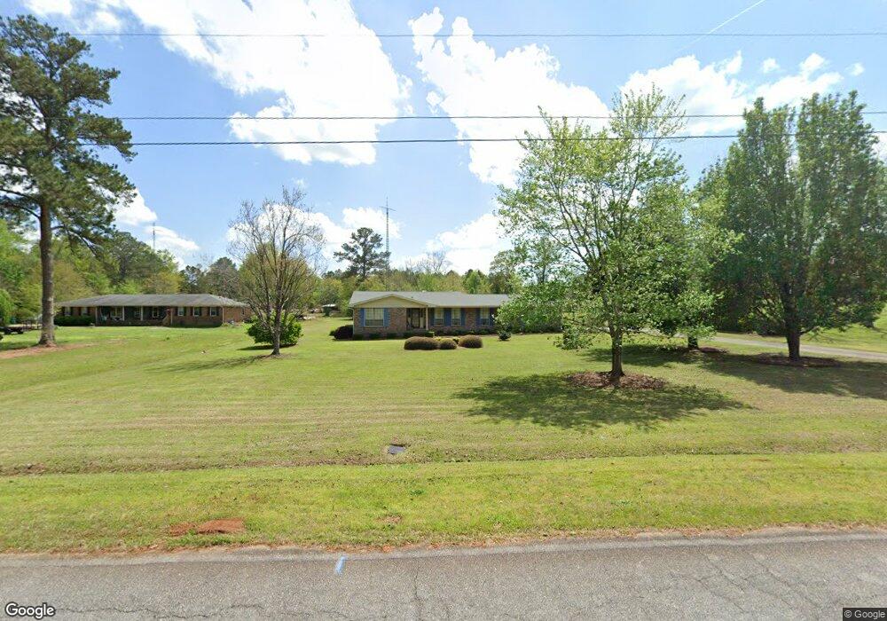
122 S Tamie Cir Kathleen, GA 31047
Estimated Value: $289,000 - $324,678
3
Beds
2
Baths
2,162
Sq Ft
$145/Sq Ft
Est. Value
About This Home
This home is located at 122 S Tamie Cir, Kathleen, GA 31047 and is currently estimated at $313,670, approximately $145 per square foot. 122 S Tamie Cir is a home located in Houston County with nearby schools including Hilltop Elementary School, Bonaire Middle School, and Veterans High School.
Ownership History
Date
Name
Owned For
Owner Type
Purchase Details
Closed on
Mar 31, 1978
Sold by
Gavins Thomas D
Bought by
Gardner Charles M and Gardner Oveda H
Current Estimated Value
Purchase Details
Closed on
Sep 16, 1977
Sold by
Gardner Charles M and Gardner Oveda H
Bought by
Gavins Thomas D
Purchase Details
Closed on
May 29, 1974
Sold by
Arnold Lloyd R
Bought by
Gardner Charles M and Gardner Oveda H
Purchase Details
Closed on
Aug 11, 1972
Sold by
Clark Clark W and Clark Margaret T
Bought by
Arnold Lloyd R
Purchase Details
Closed on
Jun 12, 1967
Sold by
Clark W J Etal
Bought by
Clark Clark W and Clark Margaret T
Purchase Details
Closed on
May 1, 1967
Sold by
Tamie Land Dev Co Inc
Bought by
Clark W J Etal
Create a Home Valuation Report for This Property
The Home Valuation Report is an in-depth analysis detailing your home's value as well as a comparison with similar homes in the area
Home Values in the Area
Average Home Value in this Area
Purchase History
| Date | Buyer | Sale Price | Title Company |
|---|---|---|---|
| Gardner Charles M | $46,000 | -- | |
| Gavins Thomas D | -- | -- | |
| Gardner Charles M | -- | -- | |
| Gardner Charles M | -- | -- | |
| Arnold Lloyd R | -- | -- | |
| Clark Clark W | -- | -- | |
| Clark W J Etal | -- | -- |
Source: Public Records
Tax History Compared to Growth
Tax History
| Year | Tax Paid | Tax Assessment Tax Assessment Total Assessment is a certain percentage of the fair market value that is determined by local assessors to be the total taxable value of land and additions on the property. | Land | Improvement |
|---|---|---|---|---|
| 2024 | $2,194 | $100,840 | $37,320 | $63,520 |
| 2023 | $1,907 | $88,000 | $37,040 | $50,960 |
| 2022 | $2,062 | $87,320 | $37,040 | $50,280 |
| 2021 | $1,775 | $75,040 | $31,560 | $43,480 |
| 2020 | $1,418 | $60,080 | $22,080 | $38,000 |
| 2019 | $1,418 | $60,080 | $22,080 | $38,000 |
| 2018 | $1,418 | $60,080 | $22,080 | $38,000 |
| 2017 | $1,419 | $60,080 | $22,080 | $38,000 |
| 2016 | $1,419 | $60,000 | $22,080 | $37,920 |
| 2015 | $1,422 | $60,000 | $22,080 | $37,920 |
| 2014 | -- | $60,000 | $22,080 | $37,920 |
| 2013 | -- | $60,000 | $22,080 | $37,920 |
Source: Public Records
Map
Nearby Homes
- 119 Richfield Cir
- 231 Grove Ln
- 135 Pond Dr
- 101 Pond Dr
- 2006 Melrose Place
- 204 Weeping Moss Way
- 105 Cabin Cove Dr
- 527 Bristleleaf Path
- 117 Black Birch Ln
- 115 Black Birch Ln
- 102 Emberwood Dr
- 200 Emberwood Way
- 102 Emberwood Way
- 206 Emberwood Way
- 510 Mt Zion Rd
- 108 Cloverdale Dr
- 510 Mount Zion Rd
- 410 Woodlands Blvd
- 105 Selwyn Ct
- 216 Hearthwood Dr
- 124 S Tamie Cir
- 118 S Tamie Cir
- 106 Birdsview Trace
- 126 S Tamie Cir
- 115 S Tamie Cir
- 117 S Tamie Cir
- S S Tamie Cir
- 128 S Tamie Cir
- 116 S Tamie Cir
- 113 S Tamie Cir
- 121 S Tamie Cir
- 114 S Tamie Cir
- 130 S Tamie Cir
- 119 S Tamie Cir
- 203 Grove Ln
- 133 Grove Ln
- 205 Grove Ln
- 131 Grove Ln
- 207 Grove Ln
- 129 Grove Ln