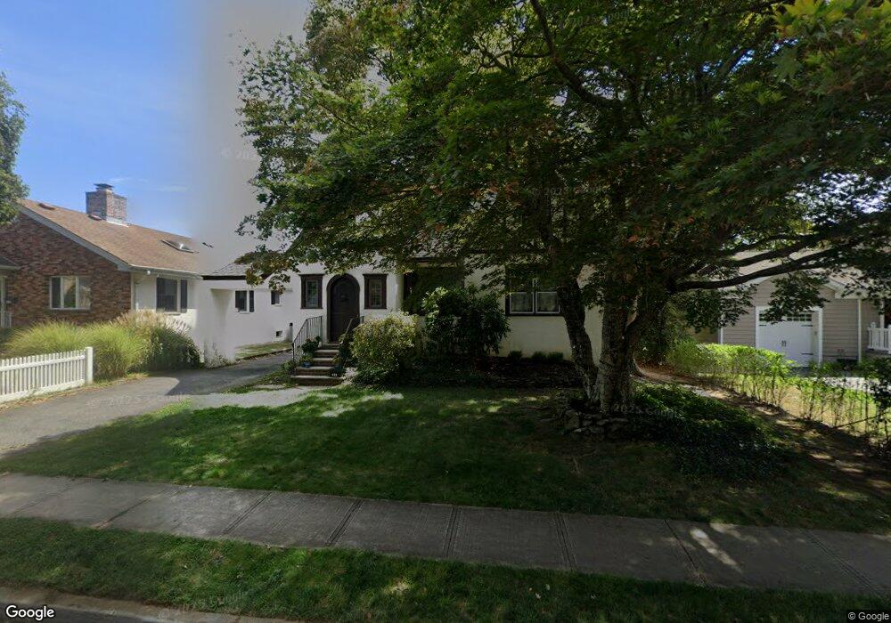
122 Silverton Ave Little Silver, NJ 07739
Estimated Value: $885,295 - $1,106,000
3
Beds
2
Baths
1,935
Sq Ft
$529/Sq Ft
Est. Value
About This Home
This home is located at 122 Silverton Ave, Little Silver, NJ 07739 and is currently estimated at $1,023,574, approximately $528 per square foot. 122 Silverton Ave is a home located in Monmouth County with nearby schools including Point Road School, Markham Place School, and Red Bank Regional High School.
Ownership History
Date
Name
Owned For
Owner Type
Purchase Details
Closed on
Jun 28, 2002
Sold by
Grady Neil
Bought by
Oneill John and Oneill Kimberly Levin
Current Estimated Value
Home Financials for this Owner
Home Financials are based on the most recent Mortgage that was taken out on this home.
Original Mortgage
$250,000
Outstanding Balance
$106,806
Interest Rate
6.82%
Estimated Equity
$916,768
Purchase Details
Closed on
Jan 24, 1997
Sold by
Peewett Annmarie
Bought by
Grady Neil and Grady Madeline
Home Financials for this Owner
Home Financials are based on the most recent Mortgage that was taken out on this home.
Original Mortgage
$207,000
Interest Rate
7.57%
Create a Home Valuation Report for This Property
The Home Valuation Report is an in-depth analysis detailing your home's value as well as a comparison with similar homes in the area
Home Values in the Area
Average Home Value in this Area
Purchase History
| Date | Buyer | Sale Price | Title Company |
|---|---|---|---|
| Oneill John | $420,000 | -- | |
| Grady Neil | $218,500 | -- |
Source: Public Records
Mortgage History
| Date | Status | Borrower | Loan Amount |
|---|---|---|---|
| Open | Oneill John | $250,000 | |
| Previous Owner | Grady Neil | $207,000 |
Source: Public Records
Tax History Compared to Growth
Tax History
| Year | Tax Paid | Tax Assessment Tax Assessment Total Assessment is a certain percentage of the fair market value that is determined by local assessors to be the total taxable value of land and additions on the property. | Land | Improvement |
|---|---|---|---|---|
| 2025 | $10,874 | $817,700 | $565,500 | $252,200 |
| 2024 | $10,418 | $644,200 | $414,500 | $229,700 |
| 2023 | $10,418 | $578,800 | $354,500 | $224,300 |
| 2022 | $9,663 | $513,100 | $299,500 | $213,600 |
| 2021 | $9,663 | $489,500 | $299,500 | $190,000 |
| 2020 | $9,835 | $485,200 | $299,500 | $185,700 |
| 2019 | $9,570 | $480,900 | $299,500 | $181,400 |
| 2018 | $9,439 | $472,400 | $299,500 | $172,900 |
| 2017 | $9,381 | $467,200 | $299,500 | $167,700 |
| 2016 | $9,184 | $462,900 | $299,500 | $163,400 |
| 2015 | $9,167 | $456,300 | $279,500 | $176,800 |
| 2014 | $9,271 | $431,200 | $279,500 | $151,700 |
Source: Public Records
Map
Nearby Homes
- 87 Rumson Rd
- 30 Crest Dr
- 32 Woodbine Ave
- 172 Woods End Dr
- 55 Cheshire Square
- 199 Pinckney Rd
- 82 Little Silver Pkwy
- 26 Prince Place
- 33 Willow Dr
- 1 George St
- 50 Willow Dr
- 132 Harrison Ave
- 135 Harrison Ave
- 82 Ridge Rd
- 69 Harvard Rd
- 40 Brookside Ln
- 85 Tower Hill Dr Unit 608
- 83 Tower Hill Dr
- 420 Rumson Rd
- 492 Hance Rd
- 128 Silverton Ave
- 118 Silverton Ave
- 132 Silverton Ave
- 110 Silverton Ave
- 372 Prospect Ave
- 366 Prospect Ave
- 121 Silverton Ave
- 37 Tabor St
- 378 Prospect Ave
- 111 Silverton Ave
- 133 Silverton Ave
- 41 Tabor St
- 33 Tabor St
- 45 Tabor St
- 104 Silverton Ave
- 384 Prospect Ave
- 105 Silverton Ave
- 139 Silverton Ave
- 386 Prospect Ave
- 27 Tabor St