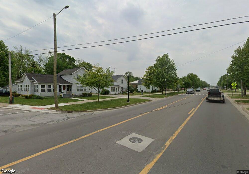
122 South St Dundee, MI 48131
Estimated Value: $150,000 - $215,000
--
Bed
--
Bath
1,416
Sq Ft
$135/Sq Ft
Est. Value
About This Home
This home is located at 122 South St, Dundee, MI 48131 and is currently estimated at $191,249, approximately $135 per square foot. 122 South St is a home located in Jackson County with nearby schools including Ezra Eby Elementary School, Napoleon Middle School, and Napoleon High School.
Ownership History
Date
Name
Owned For
Owner Type
Purchase Details
Closed on
Jul 26, 2017
Sold by
Wyckoff Elizabeth J and Hilder Elizabeth J
Bought by
Donnelly Stephanie L
Current Estimated Value
Home Financials for this Owner
Home Financials are based on the most recent Mortgage that was taken out on this home.
Original Mortgage
$83,460
Outstanding Balance
$69,547
Interest Rate
3.91%
Mortgage Type
FHA
Estimated Equity
$121,702
Purchase Details
Closed on
Oct 14, 1997
Sold by
Strahle Bryan and Strahle Rebecca
Bought by
Wyckoff Carl E and Wyckoff Elizabeth J
Purchase Details
Closed on
Jun 1, 1993
Bought by
Strahle
Create a Home Valuation Report for This Property
The Home Valuation Report is an in-depth analysis detailing your home's value as well as a comparison with similar homes in the area
Home Values in the Area
Average Home Value in this Area
Purchase History
| Date | Buyer | Sale Price | Title Company |
|---|---|---|---|
| Donnelly Stephanie L | $85,300 | None Available | |
| Wyckoff Carl E | $65,000 | -- | |
| Strahle | $23,500 | -- |
Source: Public Records
Mortgage History
| Date | Status | Borrower | Loan Amount |
|---|---|---|---|
| Open | Donnelly Stephanie L | $83,460 |
Source: Public Records
Tax History Compared to Growth
Tax History
| Year | Tax Paid | Tax Assessment Tax Assessment Total Assessment is a certain percentage of the fair market value that is determined by local assessors to be the total taxable value of land and additions on the property. | Land | Improvement |
|---|---|---|---|---|
| 2025 | $1,680 | $88,900 | $88,900 | $0 |
| 2024 | $995 | $79,000 | $0 | $0 |
| 2023 | $947 | $70,000 | $0 | $0 |
| 2022 | $1,456 | $64,000 | $0 | $0 |
| 2021 | $1,440 | $56,900 | $0 | $0 |
| 2020 | $1,439 | $56,900 | $0 | $0 |
| 2019 | $1,879 | $48,600 | $0 | $0 |
| 2018 | $1,765 | $40,347 | $0 | $0 |
| 2017 | $2,387 | $36,800 | $0 | $0 |
| 2016 | $742 | $36,175 | $1,600 | $34,575 |
| 2015 | $1,613 | $36,081 | $36,081 | $0 |
| 2014 | $1,613 | $42,645 | $0 | $0 |
| 2013 | -- | $42,645 | $42,645 | $0 |
Source: Public Records
Map
Nearby Homes
- V/L Nottawasepee
- 8514 S Stony Lake Rd
- 5791 Oakpoint Rd
- 7958 Hively Rd
- 7004 Solitude Dr
- V/L Brooklyn Rd
- 6057 Amberton Dr
- 7914 Stony Lake Rd
- 6533 Bluebird Ct
- 5820 Squires Rd
- 0 Silkworth Blvd Unit 25050358
- 0 Silkworth Blvd Unit 25007599
- 6345 Wolf Lake Rd
- 8020 Greenes Dr
- 6800 Wheaton Rd
- 8065 S Portage Rd
- 10228 Rexford Rd
- 8000 S Portage Rd
- 6284 Brooklyn Rd
- 4849 Wolf Lake Rd
- 200 Plymouth St
- 115 South St
- 160 N Street Ct
- 0 Plymouth Unit M21032828
- 204 Plymouth St
- 151 N Street Ct
- 151 N Street Ct
- 151 North
- 144 N Street Ct
- 160 N Street Ct
- 196 Plymouth St
- 208 Plymouth St
- 161 N Street Ct
- 209 Plymouth St
- 209 Plymouth Rd
- 211 Plymouth St
- 210 Plymouth
- 210 Plymouth St
- 150 Plymouth St
- 135 N Street Ct
