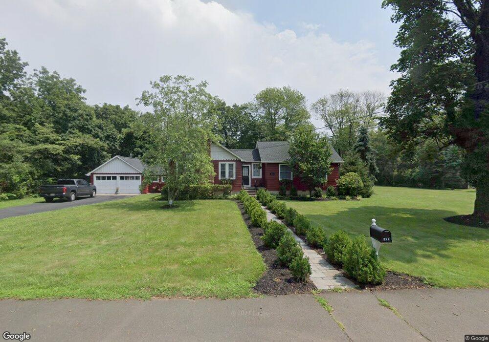
122 Stockton Ave Princeton, NJ 08540
Estimated Value: $499,000 - $586,110
--
Bed
--
Bath
1,550
Sq Ft
$343/Sq Ft
Est. Value
About This Home
This home is located at 122 Stockton Ave, Princeton, NJ 08540 and is currently estimated at $531,028, approximately $342 per square foot. 122 Stockton Ave is a home located in Somerset County with nearby schools including Franklin High School, Guidepost Montessori at Kendall Park, and St. Augustine of Canterbury School.
Ownership History
Date
Name
Owned For
Owner Type
Purchase Details
Closed on
Jan 16, 2023
Sold by
Davitt Richard J
Bought by
Bloschock Richard and Bloschock Gustine
Current Estimated Value
Purchase Details
Closed on
Nov 20, 1992
Sold by
Holst Jay E and Holst Dolores
Bought by
Davitt Richard J and Davitt Gustina
Purchase Details
Closed on
Sep 19, 1990
Sold by
Holst Ruth L
Bought by
Holst Jay E and Holst Dolores
Create a Home Valuation Report for This Property
The Home Valuation Report is an in-depth analysis detailing your home's value as well as a comparison with similar homes in the area
Home Values in the Area
Average Home Value in this Area
Purchase History
| Date | Buyer | Sale Price | Title Company |
|---|---|---|---|
| Bloschock Richard | $247,166 | -- | |
| Davitt Richard J | $152,000 | -- | |
| Holst Jay E | -- | -- |
Source: Public Records
Tax History Compared to Growth
Tax History
| Year | Tax Paid | Tax Assessment Tax Assessment Total Assessment is a certain percentage of the fair market value that is determined by local assessors to be the total taxable value of land and additions on the property. | Land | Improvement |
|---|---|---|---|---|
| 2025 | $8,523 | $533,700 | $340,700 | $193,000 |
| 2024 | $8,523 | $472,700 | $340,700 | $132,000 |
| 2023 | $8,117 | $422,300 | $290,300 | $132,000 |
| 2022 | $7,550 | $372,300 | $240,300 | $132,000 |
| 2021 | $7,113 | $322,300 | $190,300 | $132,000 |
| 2020 | $7,055 | $312,300 | $180,300 | $132,000 |
| 2019 | $7,106 | $310,700 | $180,300 | $130,400 |
| 2018 | $7,177 | $310,700 | $180,300 | $130,400 |
| 2017 | $6,973 | $300,700 | $170,300 | $130,400 |
| 2016 | $7,033 | $300,700 | $170,300 | $130,400 |
| 2015 | $6,985 | $300,700 | $170,300 | $130,400 |
| 2014 | $6,830 | $298,500 | $169,300 | $129,200 |
Source: Public Records
Map
Nearby Homes
- 128 Butler Rd
- 900 Canal Rd
- 912 Canal Rd
- 140 Bunker Hill Rd
- 93 Mosher Rd
- 9 Stirrup Way
- 8 Colts Run Rd
- 101 Timberhill Dr
- 19 Desoto Dr
- 730 Township Line Rd
- 22 Arthur Glick Blvd Unit 2506
- 22 Balboa Ln Unit 3806
- 139 Gregory Ln
- 21 Gregory Ln Unit F1
- 93 Gregory La Ln
- 93 Gregory Ln
- 8 Amethyst Way
- 5 Stanworth Rd
- 118 Stockton Ave
- 103 Bergen Ave
- 125 Sunset Ave
- 118 Bergen Ave
- 117 Stockton Ave
- 129 Stockton Ave
- 110 Stockton Ave
- 105 Bergen Ave
- 114 Bergen Ave
- 121 Sunset Ave
- 117 Sunset Ave
- 109 Stockton Ave
- 109 Sunset Ave
- 101 Stockton Ave
- 106 Bergen Ave
- 102 Stockton Ave
- 125 Linden Ave
- 118 Sunset Ave
- 325 Ridge Blvd
- 121 Stockton Ave