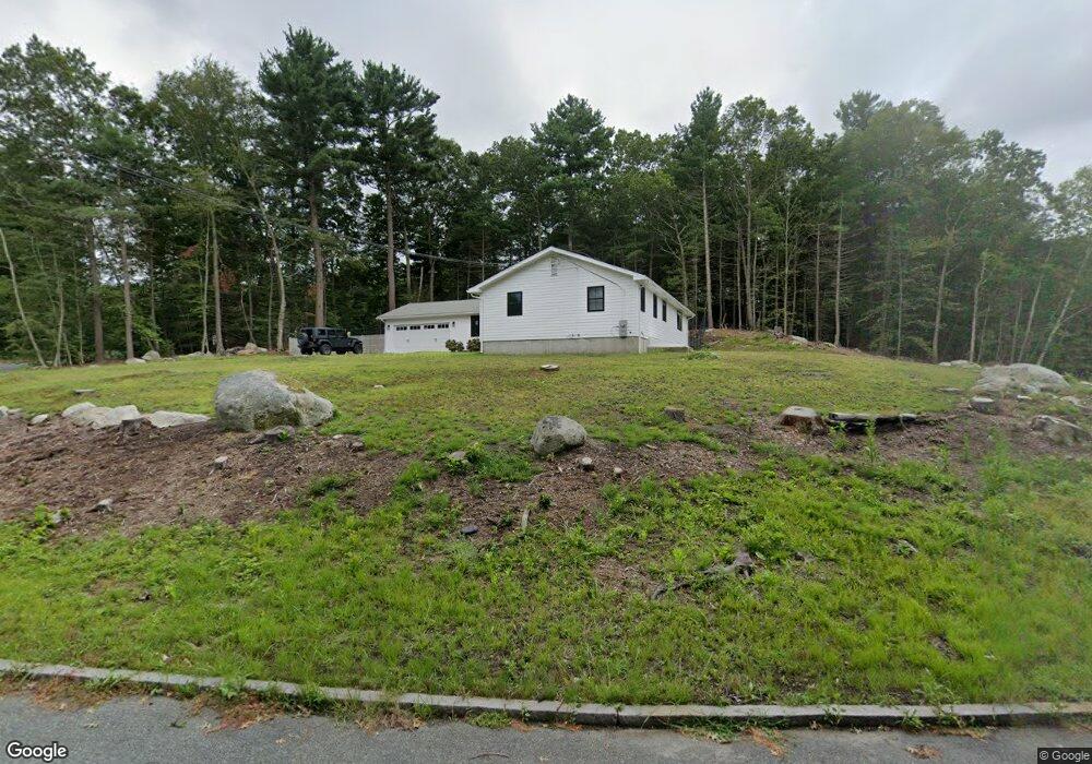
122 Tower Hill Dr Hanover, MA 02339
Estimated Value: $522,000 - $766,000
3
Beds
1
Bath
1,736
Sq Ft
$375/Sq Ft
Est. Value
About This Home
This home is located at 122 Tower Hill Dr, Hanover, MA 02339 and is currently estimated at $650,690, approximately $374 per square foot. 122 Tower Hill Dr is a home located in Plymouth County with nearby schools including Hanover High School, Cadence Academy Preschool - Hanover, and The Master's Academy.
Ownership History
Date
Name
Owned For
Owner Type
Purchase Details
Closed on
Nov 22, 2023
Sold by
Loth Ft and Zielinski
Bought by
Flynn Erin E
Current Estimated Value
Purchase Details
Closed on
Feb 8, 2023
Sold by
Loth Walter C
Bought by
Loth Ft and Zielinski
Purchase Details
Closed on
Oct 15, 1976
Bought by
Loth Walter C and Loth Diane J
Create a Home Valuation Report for This Property
The Home Valuation Report is an in-depth analysis detailing your home's value as well as a comparison with similar homes in the area
Home Values in the Area
Average Home Value in this Area
Purchase History
| Date | Buyer | Sale Price | Title Company |
|---|---|---|---|
| Flynn Erin E | $445,000 | None Available | |
| Flynn Erin E | $445,000 | None Available | |
| Loth Ft | -- | None Available | |
| Loth Ft | -- | None Available | |
| Loth Walter C | $40,500 | -- |
Source: Public Records
Mortgage History
| Date | Status | Borrower | Loan Amount |
|---|---|---|---|
| Previous Owner | Loth Walter C | $150,000 | |
| Previous Owner | Loth Walter C | $150,000 | |
| Previous Owner | Loth Walter C | $100,000 |
Source: Public Records
Tax History Compared to Growth
Tax History
| Year | Tax Paid | Tax Assessment Tax Assessment Total Assessment is a certain percentage of the fair market value that is determined by local assessors to be the total taxable value of land and additions on the property. | Land | Improvement |
|---|---|---|---|---|
| 2025 | $7,185 | $581,800 | $271,900 | $309,900 |
| 2024 | $7,470 | $581,800 | $271,900 | $309,900 |
| 2023 | $7,098 | $526,200 | $247,100 | $279,100 |
| 2022 | $7,030 | $461,000 | $234,800 | $226,200 |
| 2021 | $6,695 | $410,000 | $191,300 | $218,700 |
| 2020 | $6,770 | $415,100 | $202,600 | $212,500 |
| 2019 | $6,406 | $390,400 | $202,600 | $187,800 |
| 2018 | $6,221 | $382,100 | $202,600 | $179,500 |
| 2017 | $5,913 | $357,900 | $203,700 | $154,200 |
| 2016 | $5,719 | $339,200 | $185,000 | $154,200 |
| 2015 | $4,950 | $306,500 | $171,400 | $135,100 |
Source: Public Records
Map
Nearby Homes
- 61 Deborah Rd
- 248 Larchmont Ln
- 276 Woodland Dr
- 8 Merritt Rd
- 11 Silver Brook Ln Unit 11
- 43 Simmons Rd
- 44 Stone Meadow Ln
- 14 Longwood Ln Unit 14
- 118 Bates Way
- 116 Spring Meadow Ln
- 114 Main St
- 239 Candlewood Ln
- 7 Assinippi Ave Unit 216
- 1239 Main St
- 205 Pleasant St
- 250 Center St
- 256 Center St
- 1225 Hanover St
- 983 Webster St
- 80 Coolidge Rd
- 96 Tower Hill Dr
- 131 Tower Hill Dr
- 111 Tower Hill Dr
- 95 Tower Hill Dr
- 121 Tower Hill Dr
- 140 Tower Hill Dr
- 141 Tower Hill Dr
- 86 Tower Hill Dr
- 144 Tower Hill Dr
- 73 Tower Hill Dr
- 76 Tower Hill Dr
- 55 Tower Hill Dr
- 96 Deborah Rd
- 6 Tower Hill Cir
- 41 Tower Hill Dr
- 60 Tower Hill Dr
- 46 Tower Hill Dr
- 94 Deborah Rd
- 2 Tower Hill Cir
- 4 Tower Hill Cir