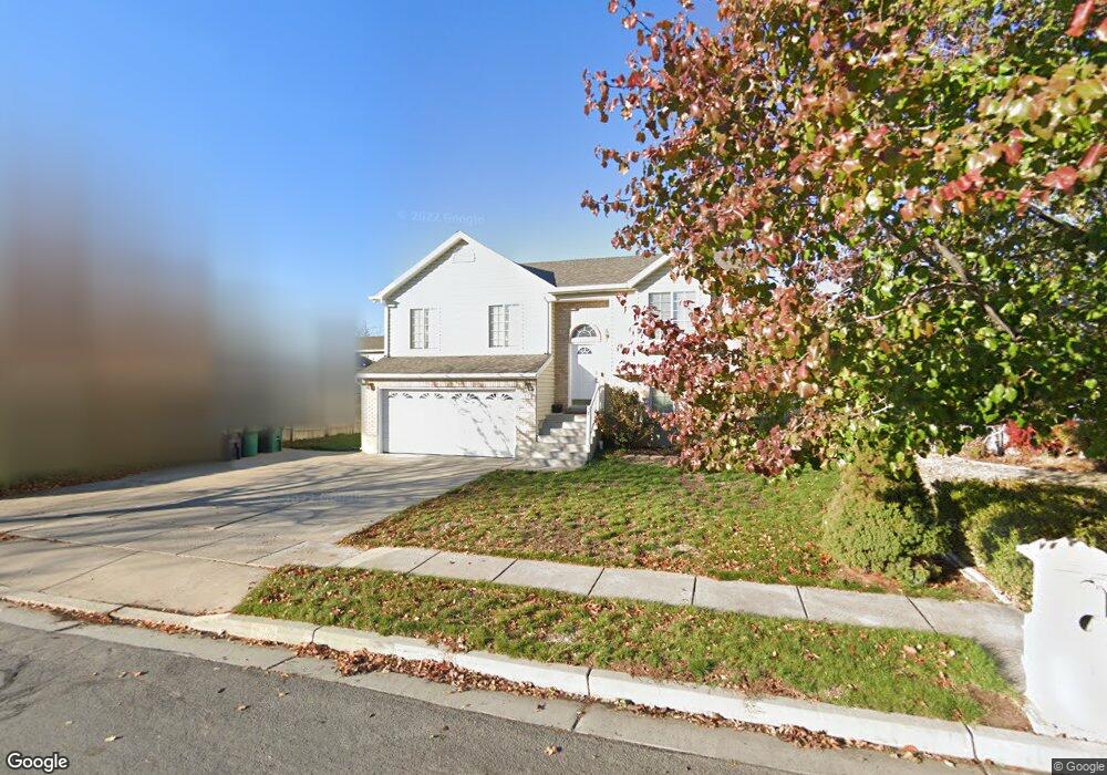
122 W 1275 N Layton, UT 84041
Estimated Value: $454,000 - $474,000
4
Beds
2
Baths
1,768
Sq Ft
$263/Sq Ft
Est. Value
About This Home
This home is located at 122 W 1275 N, Layton, UT 84041 and is currently estimated at $464,565, approximately $262 per square foot. 122 W 1275 N is a home located in Davis County with nearby schools including Crestview Elementary School, Central Davis Junior High School, and Northridge High School.
Ownership History
Date
Name
Owned For
Owner Type
Purchase Details
Closed on
Aug 4, 2021
Sold by
Higueros Herbert F and Higueros Silvia L
Bought by
Bickley Jason
Current Estimated Value
Home Financials for this Owner
Home Financials are based on the most recent Mortgage that was taken out on this home.
Original Mortgage
$315,000
Outstanding Balance
$241,183
Interest Rate
3%
Mortgage Type
New Conventional
Estimated Equity
$223,382
Purchase Details
Closed on
Dec 30, 2003
Sold by
Browning Gail and Browning Jeffrey
Bought by
Higueros Herbert F and Higueros Silvia L
Home Financials for this Owner
Home Financials are based on the most recent Mortgage that was taken out on this home.
Original Mortgage
$131,929
Interest Rate
6.03%
Mortgage Type
FHA
Purchase Details
Closed on
Mar 3, 2003
Sold by
Fairbourn Gail
Bought by
Browning Gail and Browning Jeffrey
Home Financials for this Owner
Home Financials are based on the most recent Mortgage that was taken out on this home.
Original Mortgage
$125,230
Interest Rate
6.06%
Purchase Details
Closed on
Jan 10, 2003
Sold by
Johnson Robert J
Bought by
Fairbourn Gail
Home Financials for this Owner
Home Financials are based on the most recent Mortgage that was taken out on this home.
Original Mortgage
$125,230
Interest Rate
6.06%
Purchase Details
Closed on
Dec 19, 1998
Sold by
Johnson Bob
Bought by
Johnson Robert J
Home Financials for this Owner
Home Financials are based on the most recent Mortgage that was taken out on this home.
Original Mortgage
$105,000
Interest Rate
6.91%
Purchase Details
Closed on
Dec 9, 1998
Sold by
Love Adams
Bought by
Johnson Robert J
Home Financials for this Owner
Home Financials are based on the most recent Mortgage that was taken out on this home.
Original Mortgage
$105,000
Interest Rate
6.91%
Purchase Details
Closed on
Aug 4, 1998
Sold by
Chournos Lanse A
Bought by
Love Adams
Purchase Details
Closed on
Jul 31, 1998
Sold by
Sill Robert K
Bought by
Chournos Lanse A
Create a Home Valuation Report for This Property
The Home Valuation Report is an in-depth analysis detailing your home's value as well as a comparison with similar homes in the area
Home Values in the Area
Average Home Value in this Area
Purchase History
| Date | Buyer | Sale Price | Title Company |
|---|---|---|---|
| Bickley Jason | -- | Cottonwood Title In | |
| Higueros Herbert F | -- | Bonneville Title Company Inc | |
| Browning Gail | -- | -- | |
| Fairbourn Gail | -- | Mountain View Title & Escrow | |
| Johnson Robert J | -- | Associated Title Company | |
| Johnson Bob | -- | Associated Title Company | |
| Johnson Robert J | -- | Associated Title Company | |
| Love Adams | -- | Security Title | |
| Chournos Lanse A | -- | Security Title |
Source: Public Records
Mortgage History
| Date | Status | Borrower | Loan Amount |
|---|---|---|---|
| Open | Bickley Jason | $315,000 | |
| Previous Owner | Higueros Herbert F | $131,929 | |
| Previous Owner | Fairbourn Gail | $125,230 | |
| Previous Owner | Johnson Bob | $105,000 | |
| Previous Owner | Johnson Robert J | $105,000 |
Source: Public Records
Tax History Compared to Growth
Tax History
| Year | Tax Paid | Tax Assessment Tax Assessment Total Assessment is a certain percentage of the fair market value that is determined by local assessors to be the total taxable value of land and additions on the property. | Land | Improvement |
|---|---|---|---|---|
| 2025 | $2,196 | $230,450 | $101,220 | $129,230 |
| 2024 | $2,101 | $222,199 | $117,988 | $104,211 |
| 2023 | $2,092 | $214,500 | $77,392 | $137,107 |
| 2022 | $2,168 | $399,000 | $135,029 | $263,971 |
| 2021 | $1,908 | $288,000 | $103,826 | $184,174 |
| 2020 | $1,719 | $249,000 | $87,509 | $161,491 |
| 2019 | $1,692 | $240,000 | $83,247 | $156,753 |
| 2018 | $1,510 | $215,000 | $83,247 | $131,753 |
| 2016 | $1,416 | $104,005 | $26,501 | $77,504 |
| 2015 | $1,432 | $99,880 | $26,501 | $73,379 |
| 2014 | $1,406 | $100,268 | $26,501 | $73,767 |
| 2013 | -- | $99,139 | $26,884 | $72,255 |
Source: Public Records
Map
Nearby Homes
- 103 W 1275 N
- 1490 N 175 W
- 1180 N 100 E
- 1583 N 25 E
- 324 E 1325 N
- 1474 N 285 E
- 1553 N 250 E
- 398 Paul Ave
- 1908 N 200 W
- 1837 N 440 W
- 937 Rainbow Dr
- 2044 Evans Cove Loop
- 2048 Evans Cove Loop
- 2053 Evans Cove Loop Unit 39
- 785 Sherwood Dr
- 1366 N Main St Unit 5
- 495 Spurlock St
- 480 Spurlock St
- 9 W 2150 N
- 441 Church St