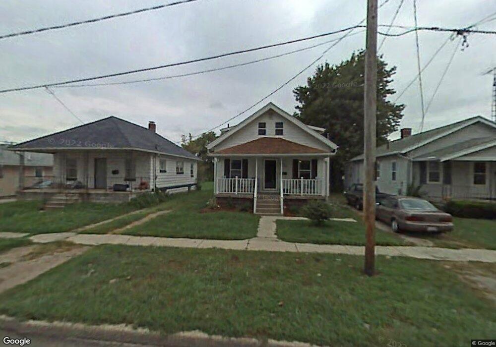
122 W Perry St Walbridge, OH 43465
Estimated Value: $162,000 - $227,000
4
Beds
2
Baths
1,494
Sq Ft
$129/Sq Ft
Est. Value
About This Home
This home is located at 122 W Perry St, Walbridge, OH 43465 and is currently estimated at $193,006, approximately $129 per square foot. 122 W Perry St is a home located in Wood County with nearby schools including Lake Elementary School, Lake Middle School, and Lake High School.
Ownership History
Date
Name
Owned For
Owner Type
Purchase Details
Closed on
Aug 31, 2007
Sold by
Duvall Bobbi and Duvall Larry G
Bought by
Deanda Peter J and Deanda Amy L
Current Estimated Value
Home Financials for this Owner
Home Financials are based on the most recent Mortgage that was taken out on this home.
Original Mortgage
$118,000
Outstanding Balance
$75,282
Interest Rate
6.72%
Mortgage Type
Purchase Money Mortgage
Estimated Equity
$117,724
Purchase Details
Closed on
Aug 31, 2006
Sold by
Wells Fargo Bank Na
Bought by
Duvall Bobbi
Purchase Details
Closed on
Feb 28, 2006
Sold by
Rountree Robert and Case #05-Cv-458
Bought by
Wells Fargo Bank Na and Ace Securities Corp Equity Loan Trust
Purchase Details
Closed on
Jan 21, 2004
Sold by
Rountree Linda L
Bought by
Rountree Robert and Rountree Linda L
Home Financials for this Owner
Home Financials are based on the most recent Mortgage that was taken out on this home.
Original Mortgage
$50,000
Interest Rate
7.8%
Mortgage Type
New Conventional
Purchase Details
Closed on
Jul 25, 2001
Sold by
Elliott Walter L
Bought by
Roundtree Linda L
Purchase Details
Closed on
Jan 1, 1990
Bought by
Elliott Walter L
Create a Home Valuation Report for This Property
The Home Valuation Report is an in-depth analysis detailing your home's value as well as a comparison with similar homes in the area
Home Values in the Area
Average Home Value in this Area
Purchase History
| Date | Buyer | Sale Price | Title Company |
|---|---|---|---|
| Deanda Peter J | $118,000 | Chicago Title Insurance Co | |
| Duvall Bobbi | $28,000 | Intitle Agency Inc | |
| Wells Fargo Bank Na | $30,000 | None Available | |
| Rountree Robert | -- | Royal Land Title Agency Ltd | |
| Roundtree Linda L | -- | -- | |
| Elliott Walter L | -- | -- |
Source: Public Records
Mortgage History
| Date | Status | Borrower | Loan Amount |
|---|---|---|---|
| Open | Deanda Peter J | $118,000 | |
| Previous Owner | Rountree Robert | $50,000 |
Source: Public Records
Tax History Compared to Growth
Tax History
| Year | Tax Paid | Tax Assessment Tax Assessment Total Assessment is a certain percentage of the fair market value that is determined by local assessors to be the total taxable value of land and additions on the property. | Land | Improvement |
|---|---|---|---|---|
| 2024 | $1,833 | $40,390 | $6,370 | $34,020 |
| 2023 | $1,833 | $40,390 | $6,370 | $34,020 |
| 2021 | $1,761 | $33,040 | $6,370 | $26,670 |
| 2020 | $1,693 | $33,040 | $6,370 | $26,670 |
| 2019 | $1,569 | $28,210 | $6,370 | $21,840 |
| 2018 | $1,566 | $28,210 | $6,370 | $21,840 |
| 2017 | $1,342 | $28,210 | $6,370 | $21,840 |
| 2016 | $1,092 | $20,200 | $5,740 | $14,460 |
| 2015 | $1,092 | $20,200 | $5,740 | $14,460 |
| 2014 | $1,153 | $20,200 | $5,740 | $14,460 |
| 2013 | $1,337 | $22,440 | $6,370 | $16,070 |
Source: Public Records
Map
Nearby Homes
- 101 W Perry St
- 106 E Union St
- 111 Wilber St
- 504 N Main St
- 225 E Union St
- 110 Mount Vernon Place
- 30643 Drouillard Rd
- 30619 Drouillard Rd
- Integrity 1750 Plan at Meadowgate
- Integrity 1530 Plan at Meadowgate
- Integrity 1605 Plan at Meadowgate
- integrity 2280 Plan at Meadowgate
- Integrity 2061 V8.1a Plan at Meadowgate
- Integrity 2080 Plan at Meadowgate
- Integrity 1830 Plan at Meadowgate
- Integrity 1910 Plan at Meadowgate
- Integrity 2060 Plan at Meadowgate
- Integrity 2000 Plan at Meadowgate
- Integrity 1880 Plan at Meadowgate
- Integrity 1250 Plan at Meadowgate