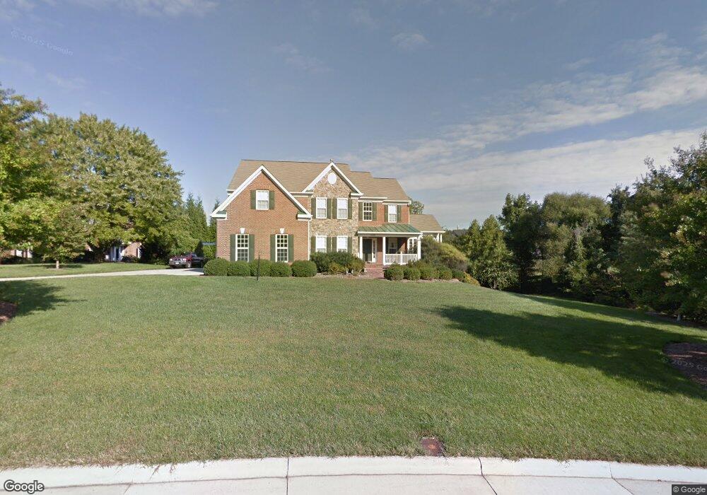
1220 Admiral Zumwalt Ln Herndon, VA 20170
Estimated Value: $1,393,912 - $1,437,000
5
Beds
5
Baths
4,149
Sq Ft
$341/Sq Ft
Est. Value
About This Home
This home is located at 1220 Admiral Zumwalt Ln, Herndon, VA 20170 and is currently estimated at $1,416,478, approximately $341 per square foot. 1220 Admiral Zumwalt Ln is a home located in Fairfax County with nearby schools including Armstrong Elementary, Herndon Middle School, and Herndon High School.
Ownership History
Date
Name
Owned For
Owner Type
Purchase Details
Closed on
Jun 2, 2004
Sold by
Calvert Homes Inc
Bought by
Wattawa Verne V
Current Estimated Value
Home Financials for this Owner
Home Financials are based on the most recent Mortgage that was taken out on this home.
Original Mortgage
$400,000
Outstanding Balance
$194,748
Interest Rate
5.94%
Mortgage Type
New Conventional
Estimated Equity
$1,221,730
Purchase Details
Closed on
Apr 18, 2003
Sold by
Kenney Builders Inc
Bought by
Calvert Homes Inc
Create a Home Valuation Report for This Property
The Home Valuation Report is an in-depth analysis detailing your home's value as well as a comparison with similar homes in the area
Home Values in the Area
Average Home Value in this Area
Purchase History
| Date | Buyer | Sale Price | Title Company |
|---|---|---|---|
| Wattawa Verne V | $930,539 | -- | |
| Calvert Homes Inc | $215,000 | -- |
Source: Public Records
Mortgage History
| Date | Status | Borrower | Loan Amount |
|---|---|---|---|
| Open | Wattawa Verne V | $400,000 |
Source: Public Records
Tax History Compared to Growth
Tax History
| Year | Tax Paid | Tax Assessment Tax Assessment Total Assessment is a certain percentage of the fair market value that is determined by local assessors to be the total taxable value of land and additions on the property. | Land | Improvement |
|---|---|---|---|---|
| 2025 | $13,588 | $1,244,270 | $492,000 | $752,270 |
| 2024 | $13,588 | $1,172,920 | $482,000 | $690,920 |
| 2023 | $13,000 | $1,151,980 | $482,000 | $669,980 |
| 2022 | $12,151 | $1,062,590 | $461,000 | $601,590 |
| 2021 | $11,017 | $938,840 | $419,000 | $519,840 |
| 2020 | $10,709 | $904,830 | $419,000 | $485,830 |
| 2019 | $10,578 | $893,830 | $408,000 | $485,830 |
| 2018 | $11,265 | $979,570 | $408,000 | $571,570 |
| 2017 | $11,373 | $979,570 | $408,000 | $571,570 |
| 2016 | $11,348 | $979,570 | $408,000 | $571,570 |
| 2015 | $10,820 | $969,570 | $398,000 | $571,570 |
| 2014 | $10,993 | $987,250 | $398,000 | $589,250 |
Source: Public Records
Map
Nearby Homes
- 0 Caris Glenne Outlot B
- 1235 Gilman Ct
- 11665 Gilman Ln
- 11555 Southington Ln
- 1205 Cameo Ct
- 11603 Auburn Grove Ct
- 1350 Red Hawk Cir
- 11405 Northwind Ct
- 1307 Windleaf Dr Unit 139
- 11723 Summerchase Cir
- 12406 Shallow Ford Ct
- 1403 Church Hill Place
- 1435 Church Hill Place
- 11504 Turnbridge Ln
- 1334 Garden Wall Cir Unit "E"
- 1407 Skyhaven Ct
- 11737 Summerchase Cir
- 1532 Church Hill Place
- 1314 Garden Wall Cir Unit C
- 1281 Wedgewood Manor Way
- 1222 Admiral Zumwalt Ln
- 11719 Shaker Knolls Ct
- 1219 Admiral Zumwalt Ln
- 11721 Shaker Knolls Ct
- 1221 Admiral Zumwalt Ln
- 1224 Admiral Zumwalt Ln
- 1134 Stuart Hills Way
- 1223 Admiral Zumwalt Ln
- 11722 Shaker Knolls Ct
- 1132 Stuart Hills Way
- 1226 Admiral Zumwalt Ln
- 1225 Admiral Zumwalt Ln
- 1130 Stuart Hills Way
- 1201 Danlea Ct
- 11715 Caris Glenne Dr
- 11724 Shaker Knolls Ct
- 1214 Shaker Woods Rd
- 11720 Shaker Knolls Ct
- 11699 Carson Overlook Ct
- 1204 Danlea Ct
