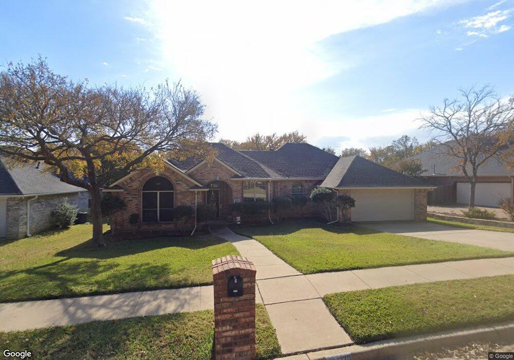
1220 Briar Dr Bedford, TX 76022
Estimated Value: $383,784 - $432,000
3
Beds
2
Baths
1,856
Sq Ft
$221/Sq Ft
Est. Value
About This Home
This home is located at 1220 Briar Dr, Bedford, TX 76022 and is currently estimated at $409,696, approximately $220 per square foot. 1220 Briar Dr is a home located in Tarrant County with nearby schools including Stonegate Elementary School, Central J High School, and L.D. Bell High School.
Ownership History
Date
Name
Owned For
Owner Type
Purchase Details
Closed on
Jul 10, 2015
Sold by
Lewis Patrick Tim and Lewls Carrie Cristen
Bought by
Harness Tracey
Current Estimated Value
Home Financials for this Owner
Home Financials are based on the most recent Mortgage that was taken out on this home.
Original Mortgage
$105,000
Outstanding Balance
$82,016
Interest Rate
3.91%
Mortgage Type
New Conventional
Estimated Equity
$327,680
Purchase Details
Closed on
Nov 10, 2011
Sold by
Schubert Teresa
Bought by
Lewis Patrick Tim and Lewis Carrie Cristen
Home Financials for this Owner
Home Financials are based on the most recent Mortgage that was taken out on this home.
Original Mortgage
$180,775
Interest Rate
4.08%
Mortgage Type
VA
Purchase Details
Closed on
Oct 20, 1998
Sold by
Howie Judy A
Bought by
Schubert Helmut and Schubert Teresa
Home Financials for this Owner
Home Financials are based on the most recent Mortgage that was taken out on this home.
Original Mortgage
$114,400
Interest Rate
6.73%
Purchase Details
Closed on
Dec 13, 1993
Sold by
Howie Robert C
Bought by
Howie Judy A
Home Financials for this Owner
Home Financials are based on the most recent Mortgage that was taken out on this home.
Original Mortgage
$98,000
Interest Rate
7.12%
Purchase Details
Closed on
Jun 9, 1993
Sold by
Howie Judy A
Bought by
Howie Robert C and Jetstream Builders
Create a Home Valuation Report for This Property
The Home Valuation Report is an in-depth analysis detailing your home's value as well as a comparison with similar homes in the area
Home Values in the Area
Average Home Value in this Area
Purchase History
| Date | Buyer | Sale Price | Title Company |
|---|---|---|---|
| Harness Tracey | $105,000 | Freedom Title Company | |
| Lewis Patrick Tim | -- | Old Republic Title | |
| Schubert Helmut | -- | American Title Company | |
| Howie Judy A | -- | Safeco Land Title | |
| Howie Robert C | -- | Fidelity National Title Agen |
Source: Public Records
Mortgage History
| Date | Status | Borrower | Loan Amount |
|---|---|---|---|
| Open | Harness Tracey | $105,000 | |
| Previous Owner | Lewis Patrick Tim | $180,775 | |
| Previous Owner | Schubert Helmut | $114,400 | |
| Previous Owner | Howie Judy A | $98,000 |
Source: Public Records
Tax History Compared to Growth
Tax History
| Year | Tax Paid | Tax Assessment Tax Assessment Total Assessment is a certain percentage of the fair market value that is determined by local assessors to be the total taxable value of land and additions on the property. | Land | Improvement |
|---|---|---|---|---|
| 2025 | $5,488 | $347,662 | $75,000 | $272,662 |
| 2024 | $5,488 | $347,662 | $75,000 | $272,662 |
| 2023 | $6,500 | $363,346 | $55,000 | $308,346 |
| 2022 | $6,729 | $319,322 | $55,000 | $264,322 |
| 2021 | $6,598 | $294,803 | $55,000 | $239,803 |
| 2020 | $6,054 | $254,617 | $55,000 | $199,617 |
| 2019 | $6,155 | $256,106 | $55,000 | $201,106 |
| 2018 | $5,214 | $230,335 | $35,000 | $195,335 |
| 2017 | $5,959 | $246,309 | $35,000 | $211,309 |
| 2016 | $5,371 | $222,017 | $35,000 | $187,017 |
| 2015 | $4,167 | $210,615 | $35,000 | $175,615 |
| 2014 | $4,167 | $176,900 | $28,000 | $148,900 |
Source: Public Records
Map
Nearby Homes
- 1213 Briar Dr
- 1204 Edgecliff Dr
- 1509 Shirley Way
- 604 Donna Ln
- 1004 Overhill Dr
- 1416 Wade Dr
- 1108 Wade Dr
- 921 Overhill Dr
- 1031 Boston Blvd
- 909 Overhill Dr
- 501 Merrill Dr
- 933 Wade Dr
- 49 Coffee Tavern Rd
- 1701 Winchester Way
- 1236 King Dr
- 345 Somerset Cir
- 1008 Russell Ln
- 904 Nelson Terrace
- 258 Somerset Terrace
- 832 Chateau Valee Cir