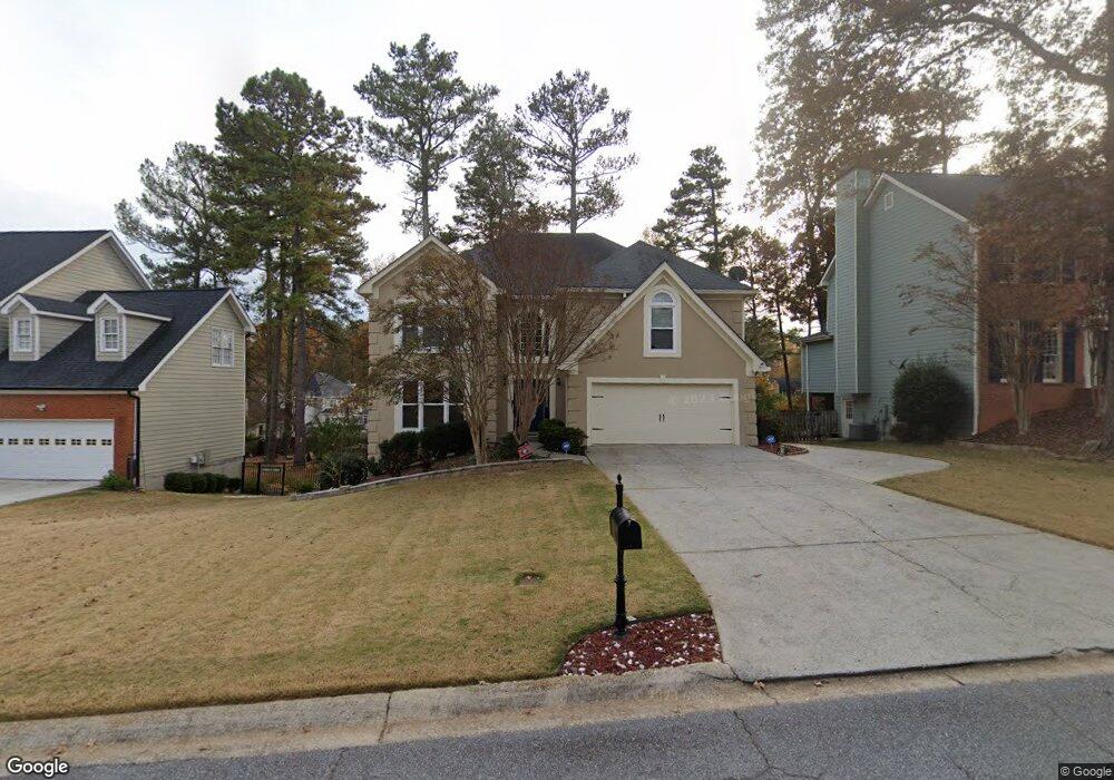
1220 Brook Knoll Place Unit 4 Lawrenceville, GA 30043
Estimated Value: $493,097 - $570,000
4
Beds
3
Baths
2,979
Sq Ft
$177/Sq Ft
Est. Value
About This Home
This home is located at 1220 Brook Knoll Place Unit 4, Lawrenceville, GA 30043 and is currently estimated at $526,774, approximately $176 per square foot. 1220 Brook Knoll Place Unit 4 is a home located in Gwinnett County with nearby schools including Taylor Elementary School, Creekland Middle School, and Collins Hill High School.
Ownership History
Date
Name
Owned For
Owner Type
Purchase Details
Closed on
Feb 26, 1999
Sold by
Hamilton Alison A and Radford Jr, C
Bought by
Rojo Anthony A and Rojo Traci J
Current Estimated Value
Home Financials for this Owner
Home Financials are based on the most recent Mortgage that was taken out on this home.
Original Mortgage
$189,000
Outstanding Balance
$45,664
Interest Rate
6.73%
Mortgage Type
VA
Estimated Equity
$481,110
Create a Home Valuation Report for This Property
The Home Valuation Report is an in-depth analysis detailing your home's value as well as a comparison with similar homes in the area
Home Values in the Area
Average Home Value in this Area
Purchase History
| Date | Buyer | Sale Price | Title Company |
|---|---|---|---|
| Rojo Anthony A | $185,300 | -- |
Source: Public Records
Mortgage History
| Date | Status | Borrower | Loan Amount |
|---|---|---|---|
| Open | Rojo Anthony A | $189,000 |
Source: Public Records
Tax History Compared to Growth
Tax History
| Year | Tax Paid | Tax Assessment Tax Assessment Total Assessment is a certain percentage of the fair market value that is determined by local assessors to be the total taxable value of land and additions on the property. | Land | Improvement |
|---|---|---|---|---|
| 2024 | $5,046 | $189,400 | $32,800 | $156,600 |
| 2023 | $5,046 | $195,520 | $32,800 | $162,720 |
| 2022 | $4,723 | $175,520 | $32,800 | $142,720 |
| 2021 | $3,932 | $133,840 | $23,520 | $110,320 |
| 2020 | $3,502 | $112,520 | $23,520 | $89,000 |
| 2019 | $3,113 | $98,320 | $18,720 | $79,600 |
| 2018 | $3,116 | $98,320 | $18,720 | $79,600 |
| 2016 | $3,036 | $93,520 | $16,400 | $77,120 |
| 2015 | $3,060 | $93,520 | $16,400 | $77,120 |
| 2014 | $3,073 | $93,520 | $16,400 | $77,120 |
Source: Public Records
Map
Nearby Homes
- 134 Waterloch Ct
- 1201 Brook Knoll Place
- 1490 Rivershyre Pkwy
- 221 Larkshyre Trail
- 1230 Rivershyre Pkwy
- 531 Shyrewood Dr
- 260 Timber Laurel Ln
- 210 Timber Laurel Ct
- 937 Sonny Boy Ln Unit 1
- 1244 Riverloch Way
- 340 Channings Lake Dr
- 980 Charter Club Dr
- 664 Sunstone Ln
- 662 Sunstone Ln
- 660 Sunstone Ln
- 658 Sunstone Ln
- Brooks Plan at River Walk Place
- Bryson Plan at River Walk Place
- 1574 Glenfield Dr Unit 1
- 695 Sunstone Ln
- 1210 Brook Knoll Place
- 1230 Brook Knoll Place
- 0 Brook Knoll Place
- 1240 Brook Knoll Place
- 1211 Lochshyre Way
- 1200 Brook Knoll Place
- 1221 Lochshyre Way
- 135 Waterloch Ct
- 1231 Lochshyre Way
- 1250 Brook Knoll Place
- 90 Shyrewood Dr
- 1241 Lochshyre Way
- 0 Waterloch Ct Unit 8750440
- 0 Waterloch Ct Unit 8685518
- 0 Waterloch Ct Unit 8167020
- 0 Waterloch Ct Unit 7587147
- 0 Waterloch Ct Unit 7530025
- 0 Waterloch Ct Unit 8618044
- 0 Waterloch Ct
- 155 Waterloch Ct