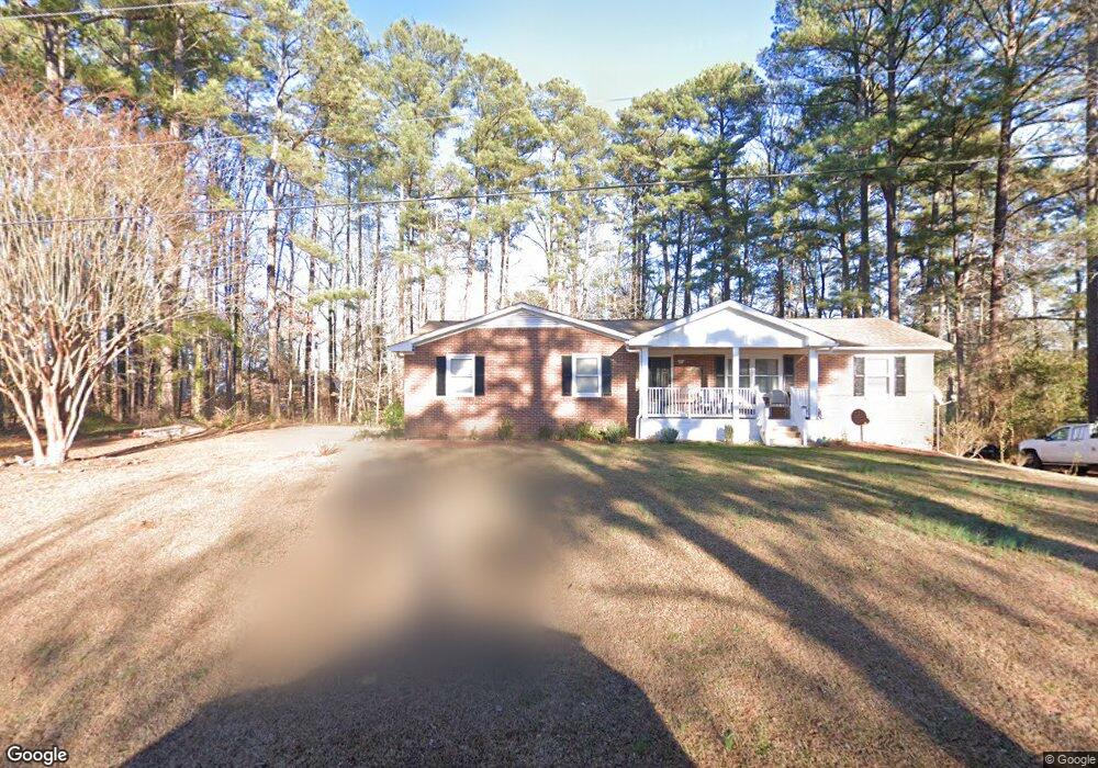
1220 Caviness Dr Sanford, NC 27330
Estimated Value: $265,801 - $301,000
3
Beds
2
Baths
2,290
Sq Ft
$124/Sq Ft
Est. Value
About This Home
This home is located at 1220 Caviness Dr, Sanford, NC 27330 and is currently estimated at $284,950, approximately $124 per square foot. 1220 Caviness Dr is a home located in Lee County with nearby schools including J.R. Ingram Jr. Elementary School, West Lee Middle School, and Lee County High School.
Ownership History
Date
Name
Owned For
Owner Type
Purchase Details
Closed on
Oct 29, 2012
Sold by
Emerson Kenneth M and Emerson Sara Jane Arnette
Bought by
Galeano Raul H and Cruz Elida A
Current Estimated Value
Home Financials for this Owner
Home Financials are based on the most recent Mortgage that was taken out on this home.
Original Mortgage
$126,755
Outstanding Balance
$88,456
Interest Rate
3.6%
Mortgage Type
New Conventional
Estimated Equity
$196,494
Create a Home Valuation Report for This Property
The Home Valuation Report is an in-depth analysis detailing your home's value as well as a comparison with similar homes in the area
Home Values in the Area
Average Home Value in this Area
Purchase History
| Date | Buyer | Sale Price | Title Company |
|---|---|---|---|
| Galeano Raul H | $124,000 | None Available |
Source: Public Records
Mortgage History
| Date | Status | Borrower | Loan Amount |
|---|---|---|---|
| Open | Galeano Raul H | $126,755 |
Source: Public Records
Tax History Compared to Growth
Tax History
| Year | Tax Paid | Tax Assessment Tax Assessment Total Assessment is a certain percentage of the fair market value that is determined by local assessors to be the total taxable value of land and additions on the property. | Land | Improvement |
|---|---|---|---|---|
| 2025 | $2,598 | $188,000 | $30,000 | $158,000 |
| 2024 | $2,578 | $188,000 | $30,000 | $158,000 |
| 2023 | $2,525 | $184,400 | $30,000 | $154,400 |
| 2022 | $1,991 | $123,800 | $25,000 | $98,800 |
| 2021 | $2,018 | $123,800 | $25,000 | $98,800 |
| 2020 | $2,012 | $123,800 | $25,000 | $98,800 |
| 2019 | $1,972 | $123,800 | $25,000 | $98,800 |
| 2018 | $1,946 | $121,600 | $25,000 | $96,600 |
| 2017 | $1,921 | $121,600 | $25,000 | $96,600 |
| 2016 | $1,896 | $121,600 | $25,000 | $96,600 |
| 2014 | $1,805 | $121,600 | $25,000 | $96,600 |
Source: Public Records
Map
Nearby Homes
- 1701 Portico Cir
- 0 Lot A Carbonton Rd
- 2018 Sutphin Rd
- 2400 Carbonton Rd
- 3003 Carbonton Rd
- 0 Carbonton Rd Unit 100529193
- 0 Carbonton Rd Unit 749750
- 0 Carbonton Rd Unit 24371434
- 2043 Plantation Dr
- 2007 Windmill Dr
- 511 Maplewood Dr
- 113 Rosemont Ln
- 2305 Weatherwood Ct
- 2313 Weatherwood Ct
- 2313 Grassmere Ct
- 612 W Chisholm St
- 702 N Vance St
- 815 Park Ave
- 2600 Taton Ct
- 0 Mcleod Dr
- 1216 Caviness Dr
- 1001 Wilkins Dr
- 939 Wilkins Dr
- 1217 Caviness Dr
- 935 Wilkins Dr
- 1212 Caviness Dr
- 1005 Wilkins Dr
- 1213 Caviness Dr
- 1228 Lemmond Dr
- 931 Wilkins Dr
- 1208 Caviness Dr
- 1009 Wilkins Dr
- 1211 Caviness Dr
- 1207 Caviness Dr
- 927 Wilkins Dr
- 1224 Lemmond Dr
- 901 Falls Park Dr
- 901 Falls Park Dr
- 923 Wilkins Dr
- 1220 Lemmond Dr