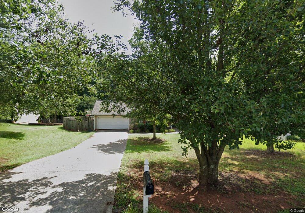
1220 Dale Dr Monroe, GA 30656
Estimated Value: $310,000 - $331,000
Studio
2
Baths
1,422
Sq Ft
$223/Sq Ft
Est. Value
About This Home
This home is located at 1220 Dale Dr, Monroe, GA 30656 and is currently estimated at $316,591, approximately $222 per square foot. 1220 Dale Dr is a home located in Barrow County with nearby schools including Bethlehem Elementary School, Haymon-Morris Middle School, and Apalachee High School.
Ownership History
Date
Name
Owned For
Owner Type
Purchase Details
Closed on
Jul 18, 2007
Sold by
Fearman Stephanie and Fearman Kory
Bought by
Rusnic Alexandra L
Current Estimated Value
Home Financials for this Owner
Home Financials are based on the most recent Mortgage that was taken out on this home.
Original Mortgage
$129,900
Outstanding Balance
$80,127
Interest Rate
6.52%
Mortgage Type
New Conventional
Estimated Equity
$236,464
Purchase Details
Closed on
Apr 28, 2000
Sold by
White Oaks Homes Inc
Bought by
Fearman Kory and Fearman Stephanie
Home Financials for this Owner
Home Financials are based on the most recent Mortgage that was taken out on this home.
Original Mortgage
$100,200
Interest Rate
10.75%
Mortgage Type
New Conventional
Purchase Details
Closed on
Nov 4, 1999
Sold by
Ado Inc
Bought by
White Oak Homes Inc
Purchase Details
Closed on
Feb 19, 1998
Bought by
Ado Inc
Create a Home Valuation Report for This Property
The Home Valuation Report is an in-depth analysis detailing your home's value as well as a comparison with similar homes in the area
Home Values in the Area
Average Home Value in this Area
Purchase History
| Date | Buyer | Sale Price | Title Company |
|---|---|---|---|
| Rusnic Alexandra L | $129,900 | -- | |
| Fearman Kory | $105,500 | -- | |
| White Oak Homes Inc | $304,000 | -- | |
| Ado Inc | -- | -- |
Source: Public Records
Mortgage History
| Date | Status | Borrower | Loan Amount |
|---|---|---|---|
| Open | Rusnic Alexandra L | $129,900 | |
| Previous Owner | Fearman Kory | $100,200 |
Source: Public Records
Tax History
| Year | Tax Paid | Tax Assessment Tax Assessment Total Assessment is a certain percentage of the fair market value that is determined by local assessors to be the total taxable value of land and additions on the property. | Land | Improvement |
|---|---|---|---|---|
| 2025 | $2,218 | $100,028 | $23,200 | $76,828 |
| 2024 | $2,018 | $82,134 | $20,000 | $62,134 |
| 2023 | $1,466 | $76,534 | $14,000 | $62,534 |
| 2022 | $1,956 | $69,342 | $14,000 | $55,342 |
| 2021 | $1,840 | $62,022 | $14,000 | $48,022 |
| 2020 | $1,840 | $62,022 | $14,000 | $48,022 |
| 2019 | $1,871 | $62,022 | $14,000 | $48,022 |
| 2018 | $1,665 | $56,022 | $8,000 | $48,022 |
| 2017 | $1,151 | $39,544 | $8,000 | $31,544 |
| 2016 | $1,061 | $37,046 | $8,000 | $29,046 |
| 2015 | $1,076 | $37,374 | $8,000 | $29,374 |
| 2014 | $1,025 | $35,548 | $6,174 | $29,374 |
| 2013 | -- | $34,134 | $6,174 | $27,960 |
Source: Public Records
Map
Nearby Homes
- 1224 Dale Dr
- 465 Cade Ct
- 463 Gin Mill Dr
- 590 Manning Gin Rd
- 439 Vinings Ct
- 3207 Jack Glass Rd
- 1101 Kailie Dr
- 1210 Austin Rd
- 864 Ode Peppers Ct
- 916 Elijah Way
- 884 Jackson Trail Rd
- 123 Regency Dr
- 1408 Wyndham Way
- 103 McElhannon Rd SE
- 1015 Smith Chapel Rd
- 698 Smith Cemetery Rd
- 269 Knightsbridge Ln
- 259 Dunagan Ct
- 222 Knightsbridge Ln
- 136 Bristol Blvd
Your Personal Tour Guide
Ask me questions while you tour the home.