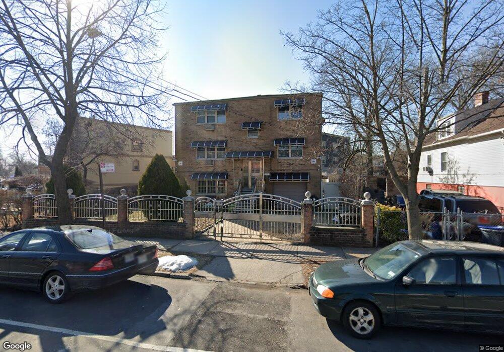
1220 E 222nd St Bronx, NY 10469
Williamsbridge NeighborhoodEstimated Value: $964,000 - $1,294,000
Studio
--
Bath
4,032
Sq Ft
$265/Sq Ft
Est. Value
About This Home
This home is located at 1220 E 222nd St, Bronx, NY 10469 and is currently estimated at $1,070,417, approximately $265 per square foot. 1220 E 222nd St is a home located in Bronx County with nearby schools including P.S. 111 - Seton Falls, J.H.S. 144 Michelangelo, and New Covenant Christian School.
Ownership History
Date
Name
Owned For
Owner Type
Purchase Details
Closed on
Nov 18, 2005
Sold by
Jones Margaret
Bought by
Green Guiselle
Current Estimated Value
Home Financials for this Owner
Home Financials are based on the most recent Mortgage that was taken out on this home.
Original Mortgage
$440,000
Outstanding Balance
$241,558
Interest Rate
6.17%
Mortgage Type
Purchase Money Mortgage
Estimated Equity
$828,859
Purchase Details
Closed on
Apr 25, 2002
Sold by
Nugent Veronica and Nugent Branford G
Bought by
Jones Margaret
Home Financials for this Owner
Home Financials are based on the most recent Mortgage that was taken out on this home.
Original Mortgage
$349,200
Interest Rate
6.64%
Purchase Details
Closed on
Jan 12, 2000
Sold by
Nugent Veronica
Bought by
Nugent Veronica and Nugent Branford G
Create a Home Valuation Report for This Property
The Home Valuation Report is an in-depth analysis detailing your home's value as well as a comparison with similar homes in the area
Home Values in the Area
Average Home Value in this Area
Purchase History
| Date | Buyer | Sale Price | Title Company |
|---|---|---|---|
| Green Guiselle | $453,610 | -- | |
| Green Guiselle | $453,610 | -- | |
| Jones Margaret | -- | -- | |
| Jones Margaret | -- | -- | |
| Nugent Veronica | -- | Commonwealth Land Title Ins | |
| Nugent Veronica | -- | Commonwealth Land Title Ins |
Source: Public Records
Mortgage History
| Date | Status | Borrower | Loan Amount |
|---|---|---|---|
| Open | Green Guiselle | $440,000 | |
| Closed | Green Guiselle | $440,000 | |
| Previous Owner | Jones Margaret | $349,200 |
Source: Public Records
Tax History
| Year | Tax Paid | Tax Assessment Tax Assessment Total Assessment is a certain percentage of the fair market value that is determined by local assessors to be the total taxable value of land and additions on the property. | Land | Improvement |
|---|---|---|---|---|
| 2025 | $7,823 | $42,769 | $6,611 | $36,158 |
| 2024 | $7,823 | $40,349 | $6,756 | $33,593 |
| 2023 | $7,910 | $40,349 | $7,587 | $32,762 |
| 2022 | $7,836 | $53,400 | $10,740 | $42,660 |
| 2021 | $7,648 | $45,240 | $10,740 | $34,500 |
| 2020 | $7,248 | $42,480 | $10,740 | $31,740 |
| 2019 | $6,741 | $42,780 | $10,740 | $32,040 |
| 2018 | $6,557 | $33,624 | $8,864 | $24,760 |
| 2017 | $6,503 | $33,371 | $8,228 | $25,143 |
| 2016 | $5,984 | $31,483 | $9,633 | $21,850 |
| 2015 | $3,914 | $29,701 | $9,335 | $20,366 |
| 2014 | $3,914 | $28,020 | $10,560 | $17,460 |
Source: Public Records
Map
Nearby Homes
- 3485 Mickle Ave
- 1765 Needham Ave
- 3528 Tiemann Ave
- 1249 E 223rd St
- 1243 E 223rd St
- 1283 E 223rd St
- 1231 E 223rd St
- 1473 Hicks St
- 1277 E 224th St
- 1817 Schieffelin Ave
- 1657 Tillotson Ave
- 1167 E 224th St
- 1159 E 224th St
- 1427 Needham Ave
- 3339 Kingsland Ave
- 1149 E 219th St
- 1143 E 224th St
- 3532 Ely Ave
- 3325 Kingsland Ave
- 3548 Ely Ave Unit 3
- 3547 Kingsland Ave
- 1212 E 222nd St
- 3545 Kingsland Ave
- 3543 Kingsland Ave
- 1208 E 222nd St
- 3541 Kingsland Ave
- 3524 Mickle Ave
- 1206 E 222nd St
- 3539 Kingsland Ave
- 1204 E 222nd St
- 3537 Kingsland Ave
- 1202 E 222nd St
- 3535 Kingsland Ave
- 1233 E 222nd St
- 1231 E 222nd St
- 1235 E 222nd St
- 1229 E 222nd St
- 1239 E 222nd St
- 1227 E 222nd St
- 1250 E 222nd St
Your Personal Tour Guide
Ask me questions while you tour the home.