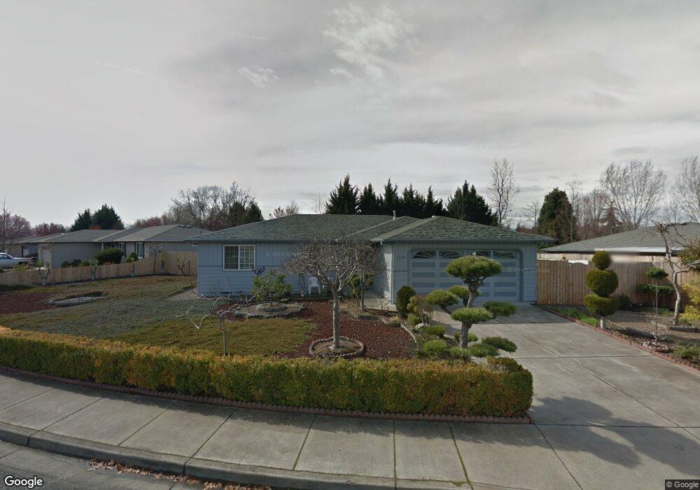
1220 Far West Ave Central Point, OR 97502
Estimated Value: $342,000 - $369,000
3
Beds
2
Baths
1,099
Sq Ft
$323/Sq Ft
Est. Value
About This Home
This home is located at 1220 Far West Ave, Central Point, OR 97502 and is currently estimated at $354,970, approximately $322 per square foot. 1220 Far West Ave is a home located in Jackson County with nearby schools including Howard Elementary School, McLoughlin Middle School, and North Medford High School.
Ownership History
Date
Name
Owned For
Owner Type
Purchase Details
Closed on
Sep 7, 2018
Sold by
Tam Kwan Tong and Lock Helen
Bought by
Tam Kwan Ton and Lock Helen
Current Estimated Value
Purchase Details
Closed on
Aug 26, 2013
Sold by
Tam Kwan Tong and Lock Helen
Bought by
Tam Kwan Tong and Lock Helen
Purchase Details
Closed on
Oct 25, 2007
Sold by
Tam Kwan Tong and Tam Mary
Bought by
Tam Kwan Tong and Lock Helen
Home Financials for this Owner
Home Financials are based on the most recent Mortgage that was taken out on this home.
Original Mortgage
$162,750
Interest Rate
6.29%
Mortgage Type
New Conventional
Purchase Details
Closed on
Oct 1, 2001
Sold by
Tam Kwan Tong
Bought by
Tam Kwan Tong and Tam Mary
Create a Home Valuation Report for This Property
The Home Valuation Report is an in-depth analysis detailing your home's value as well as a comparison with similar homes in the area
Home Values in the Area
Average Home Value in this Area
Purchase History
| Date | Buyer | Sale Price | Title Company |
|---|---|---|---|
| Tam Kwan Ton | -- | None Available | |
| Tam Kwan Tong | -- | None Available | |
| Tam Kwan Tong | -- | Lawyers Title Insurance Corp | |
| Tam Kwan Tong | -- | Amerititle |
Source: Public Records
Mortgage History
| Date | Status | Borrower | Loan Amount |
|---|---|---|---|
| Previous Owner | Tam Kwan Tong | $162,750 |
Source: Public Records
Tax History Compared to Growth
Tax History
| Year | Tax Paid | Tax Assessment Tax Assessment Total Assessment is a certain percentage of the fair market value that is determined by local assessors to be the total taxable value of land and additions on the property. | Land | Improvement |
|---|---|---|---|---|
| 2025 | $3,402 | $203,360 | $87,930 | $115,430 |
| 2024 | $3,402 | $197,440 | $85,370 | $112,070 |
| 2023 | $3,299 | $191,690 | $82,890 | $108,800 |
| 2022 | $3,216 | $191,690 | $82,890 | $108,800 |
| 2021 | $3,132 | $186,110 | $80,470 | $105,640 |
| 2020 | $3,053 | $180,690 | $78,130 | $102,560 |
| 2019 | $2,978 | $170,330 | $73,650 | $96,680 |
| 2018 | $2,900 | $165,370 | $71,510 | $93,860 |
| 2017 | $2,843 | $165,370 | $71,510 | $93,860 |
| 2016 | $2,782 | $155,890 | $67,400 | $88,490 |
| 2015 | $2,674 | $155,890 | $67,400 | $88,490 |
| 2014 | -- | $146,950 | $63,530 | $83,420 |
Source: Public Records
Map
Nearby Homes
- 3119 Merriman Rd
- 1025 Fairfield Ave
- 811 O'Hare Pkwy
- 1017 Fairfield Ave
- 2772 Merriman Rd
- 1060 Hopkins Rd
- 2825 Howard Ave
- 921 Pittview Ave
- 529 Black Bear Dr
- 881 Westrop Dr
- 460 Federal Way
- 659 Herman Ave
- 191 Mellecker Way
- 199 Mellecker Way
- 928 Brandi Way
- 450 Midway Rd Unit 16
- 450 Midway Rd Unit 5
- 745 Herman Ave
- 246 Reanna Way
- 2621 Merriman Rd Unit 3000
- 1226 Far West Ave
- 1208 Glengrove Ave
- 1226 Far Ave W
- 1216 Glengrove Ave
- 1217 Far Ave W
- 1230 Far West Ave
- 1221 Far Ave W
- 1215 Far Ave W
- 1223 Far Ave W
- 1215 Far West Ave Unit 2
- 1217 Far West Ave Unit 3
- 1223 Far West Ave
- 1225 Far West Ave
- 1221 Far West Ave
- 105 Woodbury Ct
- 1201 Far West Ave
- 147 Woodbury Ct
- 1238 Far West Ave
- 1229 Far West Ave
- 1205 Glengrove Ave