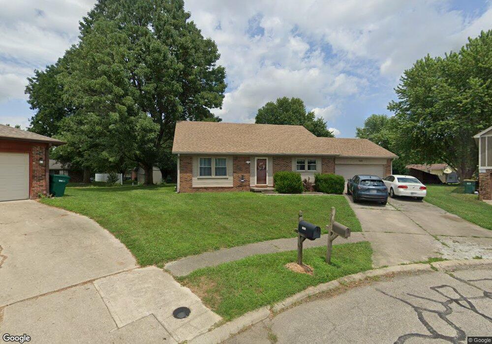
1220 Kings Ct Franklin, IN 46131
Estimated Value: $265,000 - $318,000
4
Beds
2
Baths
2,052
Sq Ft
$140/Sq Ft
Est. Value
About This Home
This home is located at 1220 Kings Ct, Franklin, IN 46131 and is currently estimated at $286,454, approximately $139 per square foot. 1220 Kings Ct is a home located in Johnson County with nearby schools including Northwood Elementary School, Custer Baker Intermediate School, and Franklin Community Middle School.
Ownership History
Date
Name
Owned For
Owner Type
Purchase Details
Closed on
Feb 19, 2020
Sold by
Miller Drake D
Bought by
Miller Judy K
Current Estimated Value
Purchase Details
Closed on
Sep 22, 2006
Sold by
Miller William G
Bought by
Miller Drake D and Miller Judy K
Home Financials for this Owner
Home Financials are based on the most recent Mortgage that was taken out on this home.
Original Mortgage
$100,000
Interest Rate
6.49%
Mortgage Type
New Conventional
Create a Home Valuation Report for This Property
The Home Valuation Report is an in-depth analysis detailing your home's value as well as a comparison with similar homes in the area
Home Values in the Area
Average Home Value in this Area
Purchase History
| Date | Buyer | Sale Price | Title Company |
|---|---|---|---|
| Miller Judy K | -- | None Available | |
| Miller Drake D | -- | None Available |
Source: Public Records
Mortgage History
| Date | Status | Borrower | Loan Amount |
|---|---|---|---|
| Closed | Miller Drake D | $100,000 |
Source: Public Records
Tax History Compared to Growth
Tax History
| Year | Tax Paid | Tax Assessment Tax Assessment Total Assessment is a certain percentage of the fair market value that is determined by local assessors to be the total taxable value of land and additions on the property. | Land | Improvement |
|---|---|---|---|---|
| 2025 | $1,911 | $224,400 | $22,800 | $201,600 |
| 2024 | $1,911 | $174,300 | $22,800 | $151,500 |
| 2023 | $1,906 | $172,100 | $22,800 | $149,300 |
| 2022 | $1,800 | $163,800 | $22,800 | $141,000 |
| 2021 | $1,637 | $149,700 | $21,700 | $128,000 |
| 2020 | $1,637 | $149,700 | $21,700 | $128,000 |
| 2019 | $1,650 | $150,900 | $21,700 | $129,200 |
| 2018 | $1,485 | $147,600 | $21,700 | $125,900 |
| 2017 | $1,464 | $143,400 | $21,700 | $121,700 |
| 2016 | $1,426 | $136,900 | $21,700 | $115,200 |
| 2014 | $1,276 | $125,800 | $25,400 | $100,400 |
| 2013 | $1,276 | $132,300 | $25,400 | $106,900 |
Source: Public Records
Map
Nearby Homes
- 492 Pelenor Dr
- 2146 Charles Dr
- 2090 Pelican Dr
- 2084 Pelican Dr
- 1338 Swan Dr
- 1397 Greenbriar Way
- 1283 Crabapple Rd
- 1213 Greenbriar Way
- 1343 Crabapple Rd
- 990 Canary Creek Dr
- Norway Plan at Westwind at Cumberland
- Bradford Plan at Westwind at Cumberland
- Juniper Plan at Westwind at Cumberland
- Aspen II Plan at Westwind at Cumberland
- Empress Plan at Westwind at Cumberland
- Cooper Plan at Westwind at Cumberland
- Spruce Plan at Westwind at Cumberland
- Palmetto Plan at Westwind at Cumberland
- Ironwood Plan at Westwind at Cumberland
- Chestnut Plan at Westwind at Cumberland
- 1215 Kings Ct
- 1239 Castle Dr
- 1240 Kings Ct
- 1227 Castle Dr
- 1253 Castle Dr
- 544 Pelenor Dr
- 1205 Kings Ct
- 590 Pelenor Dr
- 564 Pelenor Dr
- 1265 Castle Dr
- 524 Pelenor Dr
- 495 King Arthur Dr
- 1234 Castle Dr
- 547 King Arthur Dr
- 1246 Castle Dr
- 1226 Castle Dr
- 597 King Arthur Dr
- 465 King Arthur Dr
- 1256 Castle Dr
- 1214 Castle Dr