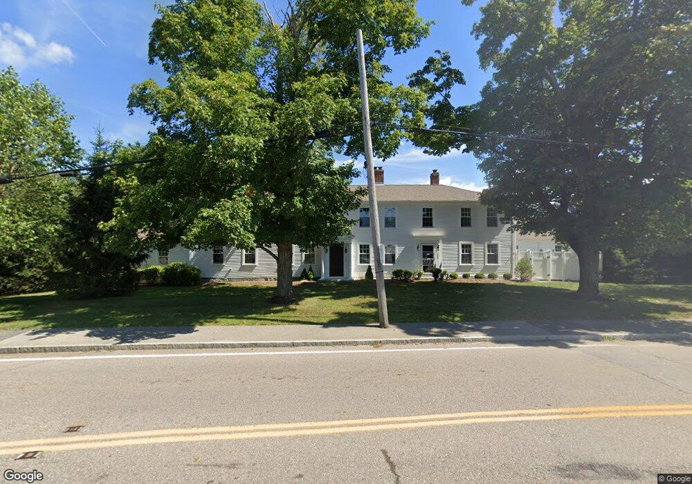
1220 Main St Hingham, MA 02043
South Hingham NeighborhoodEstimated Value: $916,000 - $1,215,000
8
Beds
5
Baths
4,928
Sq Ft
$213/Sq Ft
Est. Value
About This Home
This home is located at 1220 Main St, Hingham, MA 02043 and is currently estimated at $1,051,078, approximately $213 per square foot. 1220 Main St is a home located in Plymouth County with nearby schools including South Elementary School, Hingham Middle School, and Hingham High School.
Ownership History
Date
Name
Owned For
Owner Type
Purchase Details
Closed on
Jun 30, 2016
Sold by
Damon Farm Llc
Bought by
Turco Vincent J and Turco Sandra
Current Estimated Value
Home Financials for this Owner
Home Financials are based on the most recent Mortgage that was taken out on this home.
Original Mortgage
$592,000
Outstanding Balance
$472,595
Interest Rate
3.58%
Mortgage Type
Stand Alone Refi Refinance Of Original Loan
Estimated Equity
$578,483
Purchase Details
Closed on
Aug 6, 2013
Sold by
Tigger Rt
Bought by
Damon Farm Llc
Purchase Details
Closed on
Feb 18, 1998
Sold by
Scothorne George H
Bought by
Queen Annes Corner Llc
Create a Home Valuation Report for This Property
The Home Valuation Report is an in-depth analysis detailing your home's value as well as a comparison with similar homes in the area
Home Values in the Area
Average Home Value in this Area
Purchase History
| Date | Buyer | Sale Price | Title Company |
|---|---|---|---|
| Turco Vincent J | $740,000 | -- | |
| Damon Farm Llc | -- | -- | |
| Queen Annes Corner Llc | $180,000 | -- |
Source: Public Records
Mortgage History
| Date | Status | Borrower | Loan Amount |
|---|---|---|---|
| Open | Turco Vincent J | $592,000 |
Source: Public Records
Tax History
| Year | Tax Paid | Tax Assessment Tax Assessment Total Assessment is a certain percentage of the fair market value that is determined by local assessors to be the total taxable value of land and additions on the property. | Land | Improvement |
|---|---|---|---|---|
| 2025 | $8,543 | $799,200 | $0 | $799,200 |
| 2024 | $8,770 | $808,300 | $0 | $808,300 |
| 2023 | $7,551 | $755,100 | $0 | $755,100 |
| 2022 | $7,978 | $690,100 | $0 | $690,100 |
| 2021 | $8,504 | $720,700 | $0 | $720,700 |
| 2020 | $8,310 | $720,700 | $0 | $720,700 |
| 2019 | $8,511 | $720,700 | $0 | $720,700 |
| 2018 | $8,306 | $705,700 | $0 | $705,700 |
| 2017 | $8,887 | $725,500 | $0 | $725,500 |
| 2016 | $8,719 | $698,100 | $0 | $698,100 |
| 2015 | $3,458 | $276,000 | $0 | $276,000 |
Source: Public Records
Map
Nearby Homes
- 100 Whiting St
- 12 Country Dr
- 17 Pine Haven Cir
- 1 Kerri Ln
- 4 Kerri Ln
- 183 Gardner St
- 214 Washington St Unit 24
- 214 Washington St Unit 28
- 18 Colby St
- 5 Blueberry Ct
- 8 Blueberry Ct
- 55 Turner Rd
- 22 Longmeadow Rd
- 18 Whiting Ln
- 5 Old County Rd
- 18 Winterberry Ln
- 9 Mast Hill Rd
- 738 Whiting St
- 49 Washington Park Dr
- 251 Prospect St
- 1220 Main St
- 1220 Main St Unit 1
- 1222 Main St Unit xxxx
- 1222 Main St
- 1222 Main St Unit 2
- 1224 Main St Unit 3
- 5 Damon Farm Way Unit 5
- 2 Damon Farm Way Unit 6
- 2 Damon Farm Way
- 2 Damon Farm Way Unit 2
- 1 Damon Farm Way Unit 1
- 1 Whiting St Unit 9
- 1 Whiting St Unit 7
- 1 Whiting St Unit 22
- 1 Whiting St Unit 20
- 1 Whiting St Unit 26
- 1 Whiting St Unit 13
- 1 Whiting St Unit 12
- 1 Whiting St Unit 11
- 6 Damon Farm Way Unit 8
Your Personal Tour Guide
Ask me questions while you tour the home.