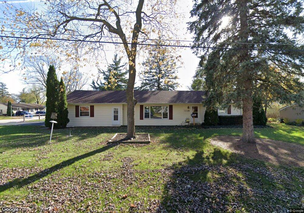
1220 McDonald Ave Aurora, IL 60506
South End NeighborhoodEstimated Value: $269,000 - $292,000
3
Beds
1
Bath
1,276
Sq Ft
$220/Sq Ft
Est. Value
About This Home
This home is located at 1220 McDonald Ave, Aurora, IL 60506 and is currently estimated at $281,138, approximately $220 per square foot. 1220 McDonald Ave is a home located in Kane County with nearby schools including Freeman Elementary School, Washington Middle School, and West Aurora High School.
Ownership History
Date
Name
Owned For
Owner Type
Purchase Details
Closed on
Nov 7, 2015
Sold by
Houtz Gerold C
Bought by
The Houtz Family Living Trust and Houtz Robin W
Current Estimated Value
Purchase Details
Closed on
Jun 27, 1997
Sold by
Johnson Antoinette
Bought by
Schober Robert E and Schober Cara H
Home Financials for this Owner
Home Financials are based on the most recent Mortgage that was taken out on this home.
Original Mortgage
$101,650
Outstanding Balance
$15,216
Interest Rate
8%
Estimated Equity
$265,922
Create a Home Valuation Report for This Property
The Home Valuation Report is an in-depth analysis detailing your home's value as well as a comparison with similar homes in the area
Home Values in the Area
Average Home Value in this Area
Purchase History
| Date | Buyer | Sale Price | Title Company |
|---|---|---|---|
| The Houtz Family Living Trust | -- | Attorney | |
| Schober Robert E | $107,000 | First American Title Ins Co |
Source: Public Records
Mortgage History
| Date | Status | Borrower | Loan Amount |
|---|---|---|---|
| Open | Schober Robert E | $101,650 |
Source: Public Records
Tax History
| Year | Tax Paid | Tax Assessment Tax Assessment Total Assessment is a certain percentage of the fair market value that is determined by local assessors to be the total taxable value of land and additions on the property. | Land | Improvement |
|---|---|---|---|---|
| 2024 | $4,279 | $72,761 | $7,496 | $65,265 |
| 2023 | $4,075 | $65,012 | $6,698 | $58,314 |
| 2022 | $3,934 | $59,317 | $6,111 | $53,206 |
| 2021 | $3,648 | $53,984 | $5,689 | $48,295 |
| 2020 | $3,442 | $50,143 | $5,284 | $44,859 |
| 2019 | $3,314 | $46,459 | $4,896 | $41,563 |
| 2018 | $3,149 | $43,343 | $4,529 | $38,814 |
| 2017 | $2,926 | $39,635 | $4,173 | $35,462 |
| 2016 | $2,631 | $35,165 | $3,974 | $31,191 |
| 2015 | -- | $30,656 | $3,417 | $27,239 |
| 2014 | -- | $36,313 | $3,140 | $33,173 |
| 2013 | -- | $36,885 | $3,095 | $33,790 |
Source: Public Records
Map
Nearby Homes
- 527 S Calumet Ave
- 1123 Prairie St
- 1035 Allaire Ave
- 1515 Prairie St
- 220 S Calumet Ave
- 160 Ingleside Ave
- 625 S Lake St
- 175 S Harrison Ave
- 528 Woodlawn Ave
- 945 Sard Ave
- 140 S Westlawn Ave
- 706 Sard Ave
- 906 Lindenwood Dr
- 231 W Downer Place
- 646-648 Hardin Ave
- 1344 W Galena Blvd
- 170 Alschuler Dr
- 2021 Radcliffe Dr
- 925 Lindenwood Dr Unit 1
- 354 Woodlawn Ave
- 621 Gilbert Terrace
- 1222 McDonald Ave
- 636 S Gladstone Ave
- 649 Gilbert Terrace
- 1253 McDonald Ave
- 1255 McDonald Ave
- 1251 McDonald Ave
- 1210 McDonald Ave
- 650 S Gladstone Ave
- 620 Gilbert Terrace
- 655 Gilbert Terrace
- 1225 McDonald Ave
- 642 Gilbert Terrace
- 656 S Gladstone Ave
- 1205 McDonald Ave
- 644 Gilbert Terrace
- 1224 Ridgeway Ave
- 1220 Ridgeway Ave
- 661 Gilbert Terrace
- 1228 Ridgeway Ave
Your Personal Tour Guide
Ask me questions while you tour the home.