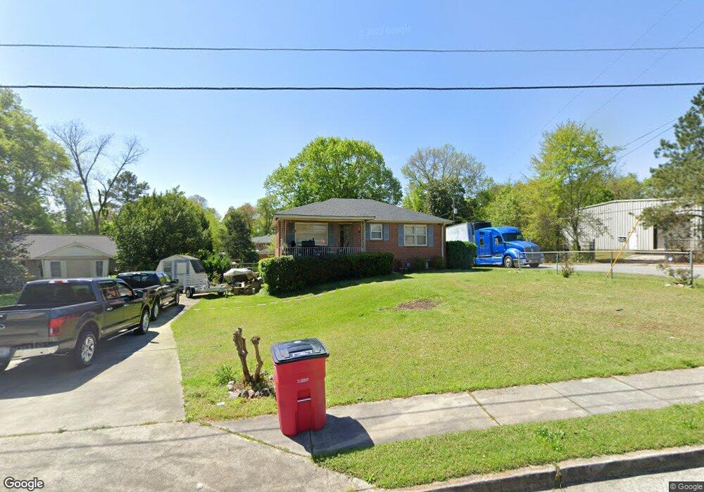
1220 Newberg Ave Macon, GA 31206
Estimated Value: $67,000 - $90,000
Studio
1
Bath
1,064
Sq Ft
$74/Sq Ft
Est. Value
About This Home
This home is located at 1220 Newberg Ave, Macon, GA 31206 and is currently estimated at $79,006, approximately $74 per square foot. 1220 Newberg Ave is a home with nearby schools including Bruce Elementary School, Rutland Middle School, and Rutland High School.
Ownership History
Date
Name
Owned For
Owner Type
Purchase Details
Closed on
Jun 22, 2009
Sold by
Nelson Charles A
Bought by
Nelson Charles A and Nelson Betty L
Current Estimated Value
Purchase Details
Closed on
Apr 24, 2006
Sold by
Cape Betty Louise and Nelson Betty L
Bought by
Nelson Charles A
Home Financials for this Owner
Home Financials are based on the most recent Mortgage that was taken out on this home.
Original Mortgage
$57,600
Outstanding Balance
$32,822
Interest Rate
6.31%
Mortgage Type
New Conventional
Estimated Equity
$46,184
Purchase Details
Closed on
Dec 28, 2003
Create a Home Valuation Report for This Property
The Home Valuation Report is an in-depth analysis detailing your home's value as well as a comparison with similar homes in the area
Purchase History
We collect this data history from publicly available records. To have your information removed, we recommend requesting removal directly through your county’s website.
| Date | Buyer | Sale Price | Title Company |
|---|---|---|---|
| Nelson Charles A | -- | Accommodation | |
| Nelson Charles A | -- | None Avilebel | |
| Nelson Betty L | -- | None Available | |
| Nelson Betty L | -- | None Availabale | |
| -- | -- | -- |
Source: Public Records
Mortgage History
We collect this data history from publicly available records. To have your information removed, we recommend requesting removal directly through your county’s website.
| Date | Status | Borrower | Loan Amount |
|---|---|---|---|
| Open | Nelson Betty L | $57,600 |
Source: Public Records
Tax History
| Year | Tax Paid | Tax Assessment Tax Assessment Total Assessment is a certain percentage of the fair market value that is determined by local assessors to be the total taxable value of land and additions on the property. | Land | Improvement |
|---|---|---|---|---|
| 2025 | $504 | $27,499 | $2,288 | $25,211 |
| 2024 | $479 | $25,850 | $2,288 | $23,562 |
| 2023 | $447 | $22,107 | $2,080 | $20,027 |
| 2022 | $249 | $14,179 | $1,971 | $12,208 |
| 2021 | $273 | $14,179 | $1,971 | $12,208 |
| 2020 | $247 | $13,365 | $1,971 | $11,394 |
| 2019 | $249 | $13,365 | $1,971 | $11,394 |
| 2018 | $562 | $13,365 | $1,971 | $11,394 |
| 2017 | $238 | $13,365 | $1,971 | $11,394 |
| 2016 | $220 | $13,364 | $1,971 | $11,394 |
| 2015 | $312 | $13,364 | $1,971 | $11,394 |
| 2014 | $796 | $20,218 | $3,941 | $16,277 |
Source: Public Records
Map
Nearby Homes
- 3108 Hollis Rd
- 3403 Tamplin Terrace
- 1290 Pio Nono Cir
- 3391 Pio Nono Cir
- 1124 N Beddingfield Dr
- 3446 Tamplin Terrace
- 3064 Margaret Dr
- 3480 Travis Blvd
- 3445 Travis Blvd
- 999 Ponce de Leon Cir N
- 1708 Timark Dr
- 1624 Randall Rd
- 981 Perdue St
- 1524 Cambridge Dr
- 3751 Travis Blvd
- 968 Quinlan Dr
- 1648 Hurley Cir
- 1464 Canterbury Rd
- 3861 Myrtle Ct
- 3930 Mathis St
- 1212 Newberg Ave
- 1283 Baker Dr
- 1286 Baker Dr
- 1282 Baker Dr
- 1282 Baker Dr Unit 92
- 1267 Baker Dr
- 3297 Marlies Cir
- 1253 Baker Dr
- 1196 Newberg Ave
- 1280 Baker Dr
- 3287 Marlies Cir
- 1243 Baker Dr
- 1274 Baker Dr
- 1176 Newberg Ave
- 1233 Baker Dr
- 3269 Marlies Cir
- 3366 Pio Nono Ave
- 1268 Baker Dr
- 1262 Baker Dr
- 1254 Baker Dr
Your Personal Tour Guide
Ask me questions while you tour the home.