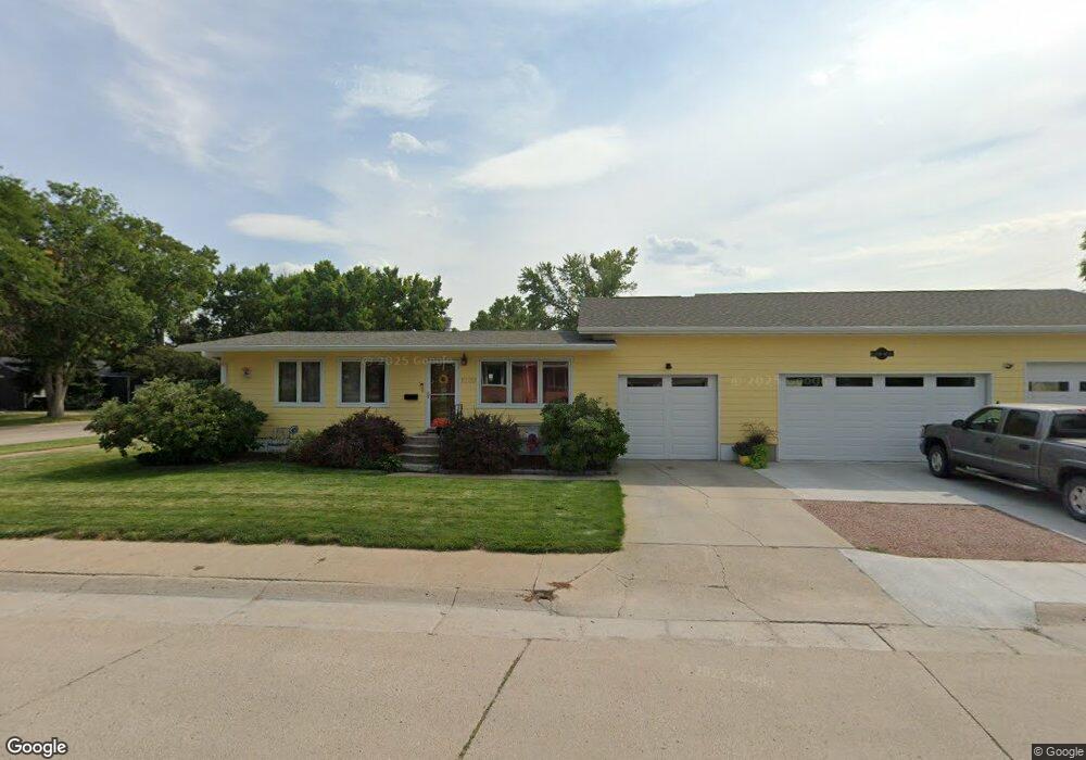
1220 Platte Ave Alliance, NE 69301
Estimated Value: $109,000 - $185,000
3
Beds
1
Bath
950
Sq Ft
$167/Sq Ft
Est. Value
About This Home
This home is located at 1220 Platte Ave, Alliance, NE 69301 and is currently estimated at $158,653, approximately $167 per square foot. 1220 Platte Ave is a home located in Box Butte County with nearby schools including Alliance High School, St. Agnes Academy, and Immanuel Evangelical Lutheran School.
Ownership History
Date
Name
Owned For
Owner Type
Purchase Details
Closed on
Mar 31, 2021
Sold by
Roby Tony L
Bought by
Vogel Rayce C and Davis Jennifer J
Current Estimated Value
Purchase Details
Closed on
Sep 20, 2019
Sold by
Schulze Nicholas J
Bought by
Roby Tony L and Hoff Carolyn R
Purchase Details
Closed on
May 26, 2015
Sold by
Schulze Nicholas J and Schulze Amber L
Bought by
Jones Nicholas W
Create a Home Valuation Report for This Property
The Home Valuation Report is an in-depth analysis detailing your home's value as well as a comparison with similar homes in the area
Home Values in the Area
Average Home Value in this Area
Purchase History
| Date | Buyer | Sale Price | Title Company |
|---|---|---|---|
| Vogel Rayce C | $60,000 | Kunzman Title | |
| Roby Tony L | $130,000 | -- | |
| Jones Nicholas W | $110,000 | -- |
Source: Public Records
Tax History Compared to Growth
Tax History
| Year | Tax Paid | Tax Assessment Tax Assessment Total Assessment is a certain percentage of the fair market value that is determined by local assessors to be the total taxable value of land and additions on the property. | Land | Improvement |
|---|---|---|---|---|
| 2024 | $1,844 | $143,967 | $7,700 | $136,267 |
| 2023 | $2,236 | $130,035 | $7,700 | $122,335 |
| 2022 | $2,152 | $118,165 | $6,930 | $111,235 |
| 2021 | $2,178 | $118,165 | $6,930 | $111,235 |
| 2020 | $2,172 | $118,165 | $6,930 | $111,235 |
| 2019 | $2,121 | $118,165 | $6,930 | $111,235 |
| 2018 | $2,111 | $118,165 | $6,930 | $111,235 |
| 2017 | $1,402 | $75,519 | $6,545 | $68,974 |
| 2016 | $1,385 | $75,519 | $6,545 | $68,974 |
| 2015 | $1,429 | $71,615 | $6,545 | $65,070 |
| 2014 | $1,429 | $71,615 | $6,545 | $65,070 |
Source: Public Records
Map
Nearby Homes
- 1021 Dakota Ave
- 1239 Toluca Ave
- 936 Platte Ave
- 911 Emerson Ave
- 819 Black Hills Ave
- 924 Big Horn Ave
- 907 Toluca Ave
- 719 Toluca Ave
- 1019 Laramie Ave
- 20th St Emerson Ave To Colorado Ave
- 904 Laramie Ave
- 672 W 20th St
- 621 Emerson Ave
- 420 Laramie Ave
- 316 Big Horn Ave
- 2039 Niobrara Ave
- 615 Sweetwater Ave
- 1004 Missouri Ave
- 917 Missouri Ave
- 1120 Potash Ave
- 1216 Platte Ave
- 1304 Platte Ave
- 1212 Platte Ave
- 719 W 13th St
- 1208 Platte Ave
- 1308 Platte Ave
- 720 W 13th St
- 723 W 13th St
- 1219 Platte Ave
- 1204 Platte Ave
- 1223 Platte Ave
- 1215 Platte Ave
- 1312 Platte Ave
- 724 W 13th St
- 720 W 12th St
- 1227 Platte Ave
- 1211 Platte Ave
- 1231 Platte Ave
- 1207 Platte Ave
- 1316 Platte Ave