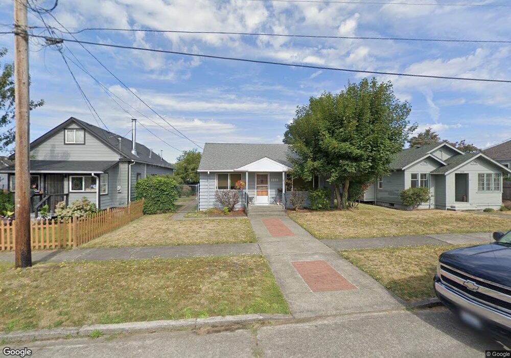
1220 Porter St Enumclaw, WA 98022
Estimated Value: $484,249 - $546,000
2
Beds
1
Bath
1,330
Sq Ft
$386/Sq Ft
Est. Value
About This Home
This home is located at 1220 Porter St, Enumclaw, WA 98022 and is currently estimated at $512,812, approximately $385 per square foot. 1220 Porter St is a home located in King County with nearby schools including Byron Kibler Elementary School, Enumclaw Middle School, and Enumclaw Senior High School.
Ownership History
Date
Name
Owned For
Owner Type
Purchase Details
Closed on
Jul 14, 2011
Sold by
Watkins Betty H and Stanley Betty H
Bought by
Watkins Betty H and Watkins Gregory R
Current Estimated Value
Home Financials for this Owner
Home Financials are based on the most recent Mortgage that was taken out on this home.
Original Mortgage
$93,000
Outstanding Balance
$63,800
Interest Rate
4.45%
Estimated Equity
$449,012
Purchase Details
Closed on
Nov 1, 1997
Sold by
Baker John W and Baker Norma L
Bought by
Stanley Betty H
Home Financials for this Owner
Home Financials are based on the most recent Mortgage that was taken out on this home.
Original Mortgage
$85,000
Interest Rate
7.26%
Create a Home Valuation Report for This Property
The Home Valuation Report is an in-depth analysis detailing your home's value as well as a comparison with similar homes in the area
Home Values in the Area
Average Home Value in this Area
Purchase History
| Date | Buyer | Sale Price | Title Company |
|---|---|---|---|
| Watkins Betty H | -- | The Talon Grou | |
| Stanley Betty H | $112,500 | Rainier Title Company |
Source: Public Records
Mortgage History
| Date | Status | Borrower | Loan Amount |
|---|---|---|---|
| Open | Watkins Betty H | $93,000 | |
| Previous Owner | Stanley Betty H | $85,000 |
Source: Public Records
Tax History
| Year | Tax Paid | Tax Assessment Tax Assessment Total Assessment is a certain percentage of the fair market value that is determined by local assessors to be the total taxable value of land and additions on the property. | Land | Improvement |
|---|---|---|---|---|
| 2024 | $4,148 | $432,000 | $174,000 | $258,000 |
| 2023 | $3,857 | $371,000 | $150,000 | $221,000 |
| 2022 | $3,454 | $424,000 | $172,000 | $252,000 |
| 2021 | $2,756 | $344,000 | $149,000 | $195,000 |
| 2020 | $2,518 | $250,000 | $97,000 | $153,000 |
| 2018 | $2,551 | $230,000 | $90,000 | $140,000 |
| 2017 | $2,270 | $208,000 | $82,000 | $126,000 |
| 2016 | $2,233 | $191,000 | $76,000 | $115,000 |
| 2015 | $2,458 | $185,000 | $72,000 | $113,000 |
| 2014 | -- | $195,000 | $76,000 | $119,000 |
| 2013 | -- | $150,000 | $61,000 | $89,000 |
Source: Public Records
Map
Nearby Homes
- 1101 Wells St
- 1234 Lincoln Ave Unit A
- 1234 Lincoln Ave Unit B
- 2054 Roosevelt Ave
- 1107 Griffin Ave
- 1705 Marshall Ave
- 1170 Cedar Dr
- 1137 Spruce Dr
- 1722 Harding St
- 1471 Florence St
- 823 Cottonwood Dr
- 915 Mountain Villa Dr
- 520 Willow Dr Unit 111
- 806 Pine Dr
- 901 Bathke Ave
- 1720 Garfield St Unit 4
- 525 Grand Fir Dr
- 936 Mountain Villa Dr
- 522 Harmony Ln
- 2921 Frederickson St
- 1214 Porter St
- 1230 Porter St
- 1259 Division St
- 1300 Porter St
- 1305 Marion St
- 1316 Porter St
- 1217 Porter St
- 1207 Porter St
- 1252 Division St
- 1244 Division St
- 1158 Porter St
- 1315 Marion St
- 1234 Division St
- 1268 Division St
- 1324 Porter St
- 1313 Porter St
- 1311 Porter St
- 1335 Marion St
- 1260 Division St
- 1155 Porter St
Your Personal Tour Guide
Ask me questions while you tour the home.