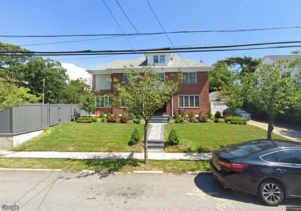
1220 Sage St Far Rockaway, NY 11691
Far Rockaway NeighborhoodEstimated Value: $1,471,088 - $1,833,000
--
Bed
--
Bath
3,476
Sq Ft
$462/Sq Ft
Est. Value
About This Home
This home is located at 1220 Sage St, Far Rockaway, NY 11691 and is currently estimated at $1,604,522, approximately $461 per square foot. 1220 Sage St is a home located in Queens County with nearby schools including The Randolph Holder School for Social Justice - Q253, P.S. 253 The Magnet School of Multicultural Humanities, and Ms 53 Brian Piccolo.
Ownership History
Date
Name
Owned For
Owner Type
Purchase Details
Closed on
Jan 24, 1996
Sold by
Talansky Marion and Talansky Morris
Bought by
Ackerman Mitchell and Ackerman Lisa
Current Estimated Value
Home Financials for this Owner
Home Financials are based on the most recent Mortgage that was taken out on this home.
Original Mortgage
$243,440
Outstanding Balance
$6,410
Interest Rate
7.04%
Estimated Equity
$1,598,112
Create a Home Valuation Report for This Property
The Home Valuation Report is an in-depth analysis detailing your home's value as well as a comparison with similar homes in the area
Home Values in the Area
Average Home Value in this Area
Purchase History
| Date | Buyer | Sale Price | Title Company |
|---|---|---|---|
| Ackerman Mitchell | $313,500 | Lawyers Title Insurance Corp |
Source: Public Records
Mortgage History
| Date | Status | Borrower | Loan Amount |
|---|---|---|---|
| Open | Ackerman Mitchell | $243,440 |
Source: Public Records
Tax History Compared to Growth
Tax History
| Year | Tax Paid | Tax Assessment Tax Assessment Total Assessment is a certain percentage of the fair market value that is determined by local assessors to be the total taxable value of land and additions on the property. | Land | Improvement |
|---|---|---|---|---|
| 2025 | $9,595 | $48,968 | $11,492 | $37,476 |
| 2024 | $9,595 | $47,774 | $13,435 | $34,339 |
| 2023 | $9,208 | $45,847 | $13,384 | $32,463 |
| 2022 | $8,635 | $67,560 | $19,320 | $48,240 |
| 2021 | $8,292 | $56,460 | $19,320 | $37,140 |
| 2020 | $8,342 | $62,040 | $19,320 | $42,720 |
| 2019 | $8,035 | $68,340 | $19,320 | $49,020 |
| 2018 | $7,491 | $38,206 | $10,295 | $27,911 |
| 2017 | $7,048 | $36,045 | $11,880 | $24,165 |
| 2016 | $6,488 | $36,045 | $11,880 | $24,165 |
| 2015 | $3,882 | $34,006 | $11,944 | $22,062 |
| 2014 | $3,882 | $33,177 | $11,562 | $21,615 |
Source: Public Records
Map
Nearby Homes
- 833 Central Ave Unit 3M
- 1260 Central Ave
- 1092 Beach 12th St
- 1029 New McNeil Ave
- 802 Empire Ave
- 1211 Brunswick Ave
- 1292 Augustina Ave
- 1040 Neilson St Unit 3B3
- 12-99 Brunswick Ave
- 1158 Redfern Ave
- 1507 Beach 11th St
- 115 Central Ave
- 15-20 Beach 12th St
- 130 Hards Ln
- 1 Hurley Ct
- 34 Monroe St
- 31 Monroe St
- 47 Monroe St
- 303 Bayview Ave
- 145 Bayview Ave