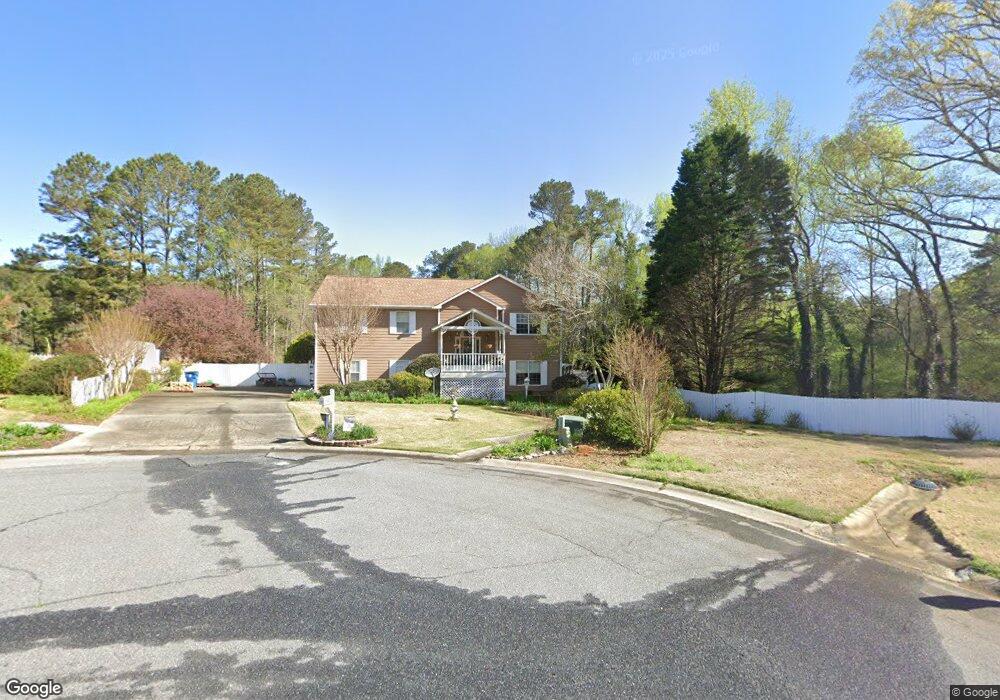
1220 Saint Andrews Dr Auburn, GA 30011
Estimated Value: $290,000 - $357,841
3
Beds
3
Baths
2,388
Sq Ft
$141/Sq Ft
Est. Value
About This Home
This home is located at 1220 Saint Andrews Dr, Auburn, GA 30011 and is currently estimated at $335,960, approximately $140 per square foot. 1220 Saint Andrews Dr is a home located in Barrow County with nearby schools including Auburn Elementary School, Westside Middle School, and Apalachee High School.
Ownership History
Date
Name
Owned For
Owner Type
Purchase Details
Closed on
Oct 29, 2014
Sold by
Barber Silvia E
Bought by
Barber Silvia E and Barber Carey H
Current Estimated Value
Purchase Details
Closed on
Nov 12, 1998
Sold by
Fleeman Joseph H
Bought by
Barber Silvia E
Purchase Details
Closed on
Jan 15, 1997
Sold by
Barber Carey H and Barber Sil
Bought by
Barber Silvia E
Purchase Details
Closed on
May 20, 1992
Bought by
Barber Carey H and Barber Sil
Create a Home Valuation Report for This Property
The Home Valuation Report is an in-depth analysis detailing your home's value as well as a comparison with similar homes in the area
Home Values in the Area
Average Home Value in this Area
Purchase History
| Date | Buyer | Sale Price | Title Company |
|---|---|---|---|
| Barber Silvia E | -- | -- | |
| Barber Silvia E | -- | -- | |
| Barber Silvia E | -- | -- | |
| Barber Carey H | $79,500 | -- |
Source: Public Records
Tax History Compared to Growth
Tax History
| Year | Tax Paid | Tax Assessment Tax Assessment Total Assessment is a certain percentage of the fair market value that is determined by local assessors to be the total taxable value of land and additions on the property. | Land | Improvement |
|---|---|---|---|---|
| 2024 | $1,355 | $89,481 | $20,000 | $69,481 |
| 2023 | $1,768 | $89,481 | $20,000 | $69,481 |
| 2022 | $1,807 | $64,703 | $11,600 | $53,103 |
| 2021 | $1,929 | $64,703 | $11,600 | $53,103 |
| 2020 | $1,937 | $64,703 | $11,600 | $53,103 |
| 2019 | $1,966 | $64,703 | $11,600 | $53,103 |
| 2018 | $1,818 | $60,399 | $11,600 | $48,799 |
| 2017 | $275 | $51,653 | $11,600 | $40,053 |
| 2016 | $1,433 | $49,049 | $11,600 | $37,449 |
| 2015 | $1,449 | $49,483 | $11,600 | $37,883 |
| 2014 | $1,252 | $45,177 | $6,860 | $38,317 |
| 2013 | -- | $43,048 | $6,860 | $36,188 |
Source: Public Records
Map
Nearby Homes
- 1236 Cabots Dr
- 1201 Saint Andrews Dr
- 410 Kilcrease Rd
- 4079 Brookmont Way
- 5779 Wheeler Ridge Rd
- 1162 Pinebrook Rd Unit 1
- 624 Red Fox Ln
- 1306 Stonemont Rd Unit 1
- 302 Jonaquil Ave
- 1308 Smokerise Ln
- 298 Dandelion Ln
- 569 Appalachee Ridge Rd
- 305 Crosswalk Dr
- 23 Woodland Rd
- 1127 Bradford Park Dr
- 1071 Atlanta Hwy NW
- 00 Atlanta Hwy
- 386 10th St Lot 57
- 41 Hydrangea Lane Lot 73
- 83 Arnold Poplar Ln
- 493 Kennedy Dr
- 1218 Saint Andrews Dr
- 1223 St Andrews Dr
- 1223 St Andrews Dr Unit 2
- 1223 Saint Andrews Dr
- 1216 Saint Andrews Dr
- 1221 St Andrews Dr
- 1219 Saint Andrews Dr
- 1221 Saint Andrews Dr
- 1221 NW Saint Andrews
- 1214 Saint Andrews Dr Unit 2
- 1217 Saint Andrews Dr
- 1215 Saint Andrews Dr
- 1224 Cabots Dr
- 1212 Saint Andrews Dr
- 1213 Saint Andrews Dr
- 1213 Saint Andrews Dr Unit 1
- 1220 Cabots Dr
- 1213 St Andrews Dr
- 1226 Cabots Dr Unit 2