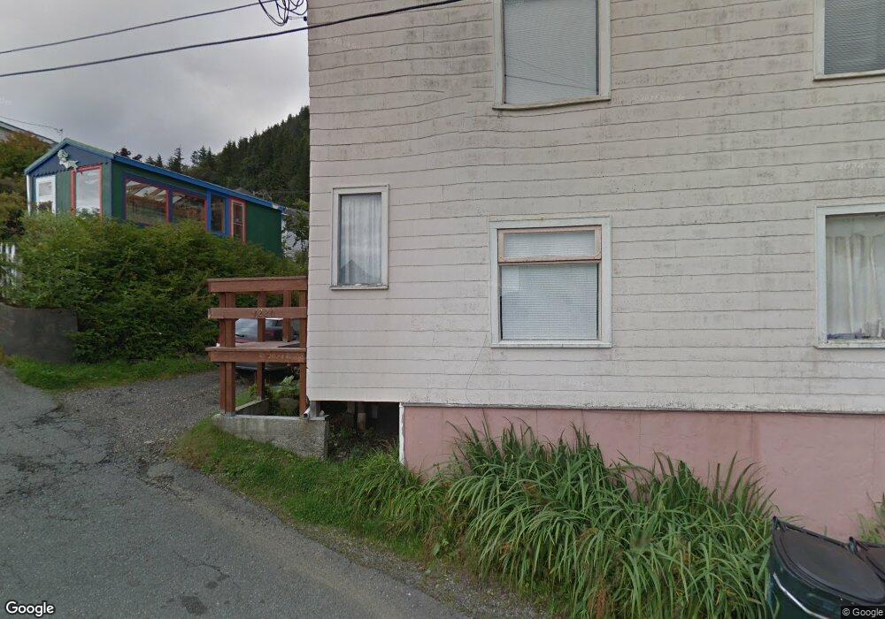
1220 Sayles St Ketchikan, AK 99901
Estimated Value: $304,264 - $435,000
12
Beds
4
Baths
2,580
Sq Ft
$132/Sq Ft
Est. Value
About This Home
This home is located at 1220 Sayles St, Ketchikan, AK 99901 and is currently estimated at $341,316, approximately $132 per square foot. 1220 Sayles St is a home located in Ketchikan Gateway Borough with nearby schools including Ketchikan High School, Tongass School of Arts & Sciences Charter School, and Ketchikan Charter School.
Ownership History
Date
Name
Owned For
Owner Type
Purchase Details
Closed on
Jul 19, 2023
Sold by
Day Patrick
Bought by
Pounds Caitlin Wolf
Current Estimated Value
Purchase Details
Closed on
Mar 28, 2019
Sold by
Ferry Theodore and Estate Of Ramona Ferry
Bought by
Day Patrick
Home Financials for this Owner
Home Financials are based on the most recent Mortgage that was taken out on this home.
Original Mortgage
$289,656
Interest Rate
4.12%
Mortgage Type
FHA
Create a Home Valuation Report for This Property
The Home Valuation Report is an in-depth analysis detailing your home's value as well as a comparison with similar homes in the area
Home Values in the Area
Average Home Value in this Area
Purchase History
| Date | Buyer | Sale Price | Title Company |
|---|---|---|---|
| Pounds Caitlin Wolf | $310,000 | None Listed On Document | |
| Day Patrick | -- | None Available |
Source: Public Records
Mortgage History
| Date | Status | Borrower | Loan Amount |
|---|---|---|---|
| Previous Owner | Day Patrick | $289,656 |
Source: Public Records
Tax History Compared to Growth
Tax History
| Year | Tax Paid | Tax Assessment Tax Assessment Total Assessment is a certain percentage of the fair market value that is determined by local assessors to be the total taxable value of land and additions on the property. | Land | Improvement |
|---|---|---|---|---|
| 2025 | $3,643 | $318,200 | $89,700 | $228,500 |
| 2024 | $3,391 | $298,800 | $85,100 | $213,700 |
| 2023 | $3,238 | $274,400 | $75,200 | $199,200 |
| 2022 | $3,238 | $274,400 | $75,200 | $199,200 |
| 2021 | $3,238 | $274,400 | $75,200 | $199,200 |
| 2020 | $3,183 | $274,400 | $75,200 | $199,200 |
| 2019 | $3,710 | $319,800 | $75,200 | $244,600 |
| 2018 | $3,648 | $314,500 | $75,200 | $239,300 |
| 2017 | $3,707 | $316,800 | $0 | $0 |
| 2016 | $3,865 | $330,300 | $0 | $0 |
| 2015 | -- | $336,900 | $0 | $0 |
| 2014 | -- | $222,400 | $0 | $0 |
Source: Public Records
Map
Nearby Homes
- 1254-1256 Water St
- 636 Water St
- 118 Elliot St
- 1770-1772 2nd Ave
- 1770 2nd Ave
- 1227 Black Bear Rd Unit 1229
- 764-766 Forest Ave
- 2010 2nd Ave
- L8 B2 Gravina Island
- 2030 2nd Ave
- 320 Bawden St Unit 613-614
- 320 Bawden St
- 320 Bawden St Unit 718
- 320 Bawden St Unit 509
- 800 BLK Miller Ridge Rd
- 119 Austin St Unit 1107
- 119 Austin St Unit 906
- 1 Creek St
- 1350 Woodside Dr
- 310 Austin St Unit A/B
- 1234 Sayles St
- 310 Lund St
- 1215 Sayles St
- 325 Lund St
- 1209 Sayles St
- 1222 Water St
- 1226 Water St
- 1214 Water St
- 1219 Millar St
- 1234 Water St
- 1245 Millar St
- 1242 Water St
- 1234 Millar St Unit 5
- 1234 Millar St Unit 4
- 1234 Millar St Unit 3
- 1270 Upper Millar St
- 1252 Upper Millar St
- 1240 Sayles St
- 1250 Water St Unit 1256
- 1248 Sayles St