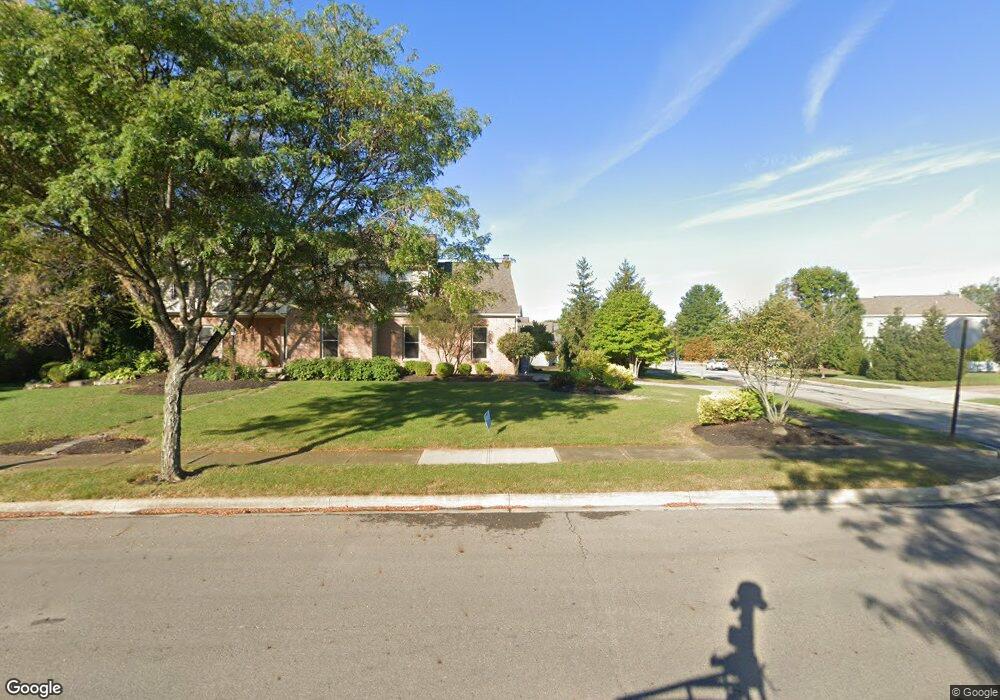
1220 Sea Shell Dr Westerville, OH 43082
Genoa NeighborhoodEstimated Value: $609,000 - $688,000
4
Beds
4
Baths
3,870
Sq Ft
$166/Sq Ft
Est. Value
About This Home
This home is located at 1220 Sea Shell Dr, Westerville, OH 43082 and is currently estimated at $643,694, approximately $166 per square foot. 1220 Sea Shell Dr is a home located in Delaware County with nearby schools including Robert Frost Elementary School, Heritage Middle School, and Westerville-North High School.
Ownership History
Date
Name
Owned For
Owner Type
Purchase Details
Closed on
Jul 21, 2025
Sold by
Welsh Robert J and Welsh Sapna K
Bought by
Robert J Welsh And Sapna K Welsh Family Trust and Welsh
Current Estimated Value
Purchase Details
Closed on
Jun 22, 1998
Sold by
Sershon Peter D
Bought by
Welsh Robert J and Welsh Sapna K
Home Financials for this Owner
Home Financials are based on the most recent Mortgage that was taken out on this home.
Original Mortgage
$193,000
Interest Rate
7.22%
Mortgage Type
New Conventional
Purchase Details
Closed on
Jun 27, 1995
Sold by
Ashbury Homes
Bought by
Sershon Peter D and Sershon Deborah M
Home Financials for this Owner
Home Financials are based on the most recent Mortgage that was taken out on this home.
Original Mortgage
$222,900
Interest Rate
8%
Mortgage Type
New Conventional
Create a Home Valuation Report for This Property
The Home Valuation Report is an in-depth analysis detailing your home's value as well as a comparison with similar homes in the area
Home Values in the Area
Average Home Value in this Area
Purchase History
| Date | Buyer | Sale Price | Title Company |
|---|---|---|---|
| Robert J Welsh And Sapna K Welsh Family Trust | -- | None Listed On Document | |
| Welsh Robert J | $252,000 | -- | |
| Sershon Peter D | $234,900 | -- |
Source: Public Records
Mortgage History
| Date | Status | Borrower | Loan Amount |
|---|---|---|---|
| Previous Owner | Welsh Robert J | $193,000 | |
| Previous Owner | Sershon Peter D | $222,900 |
Source: Public Records
Tax History Compared to Growth
Tax History
| Year | Tax Paid | Tax Assessment Tax Assessment Total Assessment is a certain percentage of the fair market value that is determined by local assessors to be the total taxable value of land and additions on the property. | Land | Improvement |
|---|---|---|---|---|
| 2024 | $8,629 | $169,370 | $37,870 | $131,500 |
| 2023 | $8,530 | $169,370 | $37,870 | $131,500 |
| 2022 | $8,223 | $126,320 | $23,910 | $102,410 |
| 2021 | $8,294 | $126,320 | $23,910 | $102,410 |
| 2020 | $8,349 | $126,320 | $23,910 | $102,410 |
| 2019 | $7,786 | $110,710 | $23,910 | $86,800 |
| 2018 | $7,656 | $110,710 | $23,910 | $86,800 |
| 2017 | $3,768 | $104,380 | $20,970 | $83,410 |
| 2016 | $7,872 | $104,380 | $20,970 | $83,410 |
| 2015 | $7,536 | $104,380 | $20,970 | $83,410 |
| 2014 | $7,484 | $104,380 | $20,970 | $83,410 |
| 2013 | $7,256 | $101,160 | $20,970 | $80,190 |
Source: Public Records
Map
Nearby Homes
- 1155 Ashford Ct
- 7568 Park Bend Ct
- 6618 Wild Rose Ln
- 9119 Robinhood Cir
- 974 Lakeland Dr
- 6611 Lake of the Woods Point
- 6685 Tussic Street Rd
- 6460 Bromfield Dr
- 73 Keethler Dr S
- 8369 Manitou Dr
- 912 Lakeway Ct E
- 656 Olde Mill Dr
- 9200 Knoll Dr
- 7663 Rolling Ridge Way
- 718 Sugar Ct
- 754 Kingsmead Rd Unit 18754
- 4485 Smothers Rd
- 90 Spring Creek Dr
- 7268 Clancy Way
- 5840 Heron Ct
- 1191 Tidewater Ct
- 1218 Sea Shell Dr
- 1190 Lake Point
- 1187 Tidewater Ct
- 1226 Sea Shell Dr
- 628 Freshwater Ct
- 1210 Sea Shell Dr
- 1225 Sea Shell Dr
- 1182 Lake Point Dr
- 1179 Tidewater Ct
- 1221 Buoy Ct
- 636 Freshwater Ct
- 1172 Lake Point
- 1228 Sea Shell Dr
- 1172 Lake Point Dr
- 1227 Sea Shell Dr
- 1169 Tidewater Ct
- 1209 Sea Shell Dr
- 644 Freshwater Ct
- 1172 Tidewater Ct