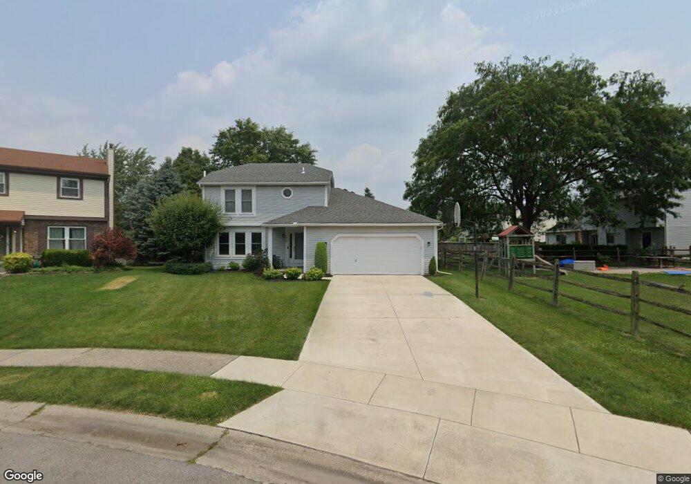
1220 Shaker Dr Maumee, OH 43537
Estimated Value: $276,976 - $304,000
3
Beds
3
Baths
1,590
Sq Ft
$185/Sq Ft
Est. Value
About This Home
This home is located at 1220 Shaker Dr, Maumee, OH 43537 and is currently estimated at $294,244, approximately $185 per square foot. 1220 Shaker Dr is a home located in Lucas County with nearby schools including Fairfield Elementary School, Maumee Intermediate School, and Maumee Middle School.
Ownership History
Date
Name
Owned For
Owner Type
Purchase Details
Closed on
Aug 31, 2000
Sold by
Johnson Brent A and Johnson Susan M
Bought by
Feher Beth A
Current Estimated Value
Home Financials for this Owner
Home Financials are based on the most recent Mortgage that was taken out on this home.
Original Mortgage
$93,000
Outstanding Balance
$33,991
Interest Rate
8.14%
Mortgage Type
Purchase Money Mortgage
Estimated Equity
$260,253
Create a Home Valuation Report for This Property
The Home Valuation Report is an in-depth analysis detailing your home's value as well as a comparison with similar homes in the area
Home Values in the Area
Average Home Value in this Area
Purchase History
| Date | Buyer | Sale Price | Title Company |
|---|---|---|---|
| Feher Beth A | $156,900 | Midland |
Source: Public Records
Mortgage History
| Date | Status | Borrower | Loan Amount |
|---|---|---|---|
| Open | Feher Beth A | $93,000 |
Source: Public Records
Tax History Compared to Growth
Tax History
| Year | Tax Paid | Tax Assessment Tax Assessment Total Assessment is a certain percentage of the fair market value that is determined by local assessors to be the total taxable value of land and additions on the property. | Land | Improvement |
|---|---|---|---|---|
| 2024 | $2,759 | $84,700 | $13,440 | $71,260 |
| 2023 | $5,390 | $70,700 | $10,710 | $59,990 |
| 2022 | $4,790 | $70,700 | $10,710 | $59,990 |
| 2021 | $5,055 | $70,700 | $10,710 | $59,990 |
| 2020 | $4,918 | $61,495 | $9,205 | $52,290 |
| 2019 | $4,796 | $61,495 | $9,205 | $52,290 |
| 2018 | $4,415 | $61,495 | $9,205 | $52,290 |
| 2017 | $4,116 | $52,255 | $11,095 | $41,160 |
| 2016 | $4,070 | $149,300 | $31,700 | $117,600 |
| 2015 | $4,051 | $149,300 | $31,700 | $117,600 |
| 2014 | $3,755 | $51,250 | $10,890 | $40,360 |
| 2013 | $3,755 | $51,250 | $10,890 | $40,360 |
Source: Public Records
Map
Nearby Homes
- 1539 Cass Rd
- 611 Greenfield Dr
- 1409 Bradshaw Ct
- 541 Fairfield Park Dr
- 538 Cambridge Park S
- 1301 Cass Rd
- 422 Chesterfield Ln
- 1441 Bradshaw Ct
- 1213 Hunt St
- 54 Homestead Place Unit 54
- 1172 Shelly Ave
- 1138 Holgate Ave
- 652 Mcintyre Ln
- 4501 Thackeray Rd
- 911 River Rd
- 706 Waite Ave
- 1466 Wilderness Dr
- 306 Clinton St
- 716 Farrer St
- 1036 River Rd
- 1224 Shaker Dr
- 605 Arlene Dr
- 601 Arlene Dr
- 536 Centerfield Dr
- 530 Centerfield Dr
- 542 Centerfield Dr
- 524 Centerfield Dr
- 1230 Shaker Dr
- 615 Arlene Dr
- 548 Centerfield Dr
- 518 Centerfield Dr
- 1229 Shaker Dr
- 554 Centerfield Dr
- 521 Arlene Dr
- 512 Centerfield Dr
- 1225 Shaker Dr
- 604 Arlene Dr
- 608 Arlene Dr
- 560 Centerfield Dr
- 600 Arlene Dr