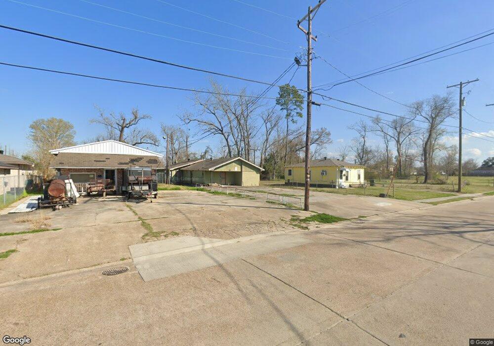
1220 Simmons St Lake Charles, LA 70601
Estimated Value: $42,000 - $139,000
--
Bed
--
Bath
--
Sq Ft
653
Sq Ft Lot
About This Home
This home is located at 1220 Simmons St, Lake Charles, LA 70601 and is currently estimated at $76,241. 1220 Simmons St is a home located in Calcasieu Parish with nearby schools including Combre-Fondel Elementary School, Ray D. Molo Middle School, and Washington-Marion Magnet High School.
Ownership History
Date
Name
Owned For
Owner Type
Purchase Details
Closed on
Feb 26, 2009
Sold by
A J & T Inc
Bought by
Bell Colston Sr Robert and Bell Colston Lena
Current Estimated Value
Home Financials for this Owner
Home Financials are based on the most recent Mortgage that was taken out on this home.
Original Mortgage
$8,600
Interest Rate
6%
Mortgage Type
Seller Take Back
Purchase Details
Closed on
Jan 7, 2009
Sold by
Mannys Enterprises Inc
Bought by
A J & T Inc
Home Financials for this Owner
Home Financials are based on the most recent Mortgage that was taken out on this home.
Original Mortgage
$8,600
Interest Rate
6%
Mortgage Type
Seller Take Back
Create a Home Valuation Report for This Property
The Home Valuation Report is an in-depth analysis detailing your home's value as well as a comparison with similar homes in the area
Home Values in the Area
Average Home Value in this Area
Purchase History
| Date | Buyer | Sale Price | Title Company |
|---|---|---|---|
| Bell Colston Sr Robert | $8,600 | Mayo Land Title Co Inc | |
| A J & T Inc | $708 | None Available |
Source: Public Records
Mortgage History
| Date | Status | Borrower | Loan Amount |
|---|---|---|---|
| Closed | Bell Colston Sr Robert | $8,600 |
Source: Public Records
Tax History Compared to Growth
Tax History
| Year | Tax Paid | Tax Assessment Tax Assessment Total Assessment is a certain percentage of the fair market value that is determined by local assessors to be the total taxable value of land and additions on the property. | Land | Improvement |
|---|---|---|---|---|
| 2024 | $368 | $3,230 | $1,100 | $2,130 |
| 2023 | $368 | $3,230 | $1,100 | $2,130 |
| 2022 | $372 | $3,230 | $1,100 | $2,130 |
| 2021 | $357 | $3,230 | $1,100 | $2,130 |
| 2020 | $386 | $2,980 | $1,060 | $1,920 |
| 2019 | $424 | $3,150 | $1,020 | $2,130 |
| 2018 | $387 | $3,150 | $1,020 | $2,130 |
| 2017 | $358 | $3,150 | $1,020 | $2,130 |
| 2016 | $356 | $3,150 | $1,020 | $2,130 |
| 2015 | $356 | $3,150 | $1,020 | $2,130 |
Source: Public Records
Map
Nearby Homes
- 2322 Poplar St
- 1017 N Lincoln St
- 206 N Lincoln St
- 822 Sally Mae St
- 0 N Booker St Unit SWL25003063
- 0 N Booker St Unit SWL24007027
- 1303 Wendell St
- 2413 Moeling St
- 2016 Woodring St
- 2402 Moeling St
- 2417 Moeling St
- 0 Moeling St
- 2337 Moeling St
- 717 N Malcolm St
- 0 Channel St Unit SWL25101437
- 2611 Pineview St
- 1035 N Prater St
- 0 Hagan St
- 1710 Graham St
- 715 N Malcolm St
- 1218 Simmons St
- 1224 N Simmons St
- 1226 Simmons St
- 2326 Channel St
- 2310 Channel St
- 1215 Simmons St
- 1211 Simmons St
- 1219 Simmons St
- 1304 Simmons St
- 1304 N Simmons St
- 2317 See St
- 2347 See St
- 1209 Simmons St
- 1308 N Simmons St
- 1308 Simmons St
- 1205 Simmons St
- 2312 Channel St
- 1312 Simmons St
- 1201 Simmons St
- 2314 Channel St