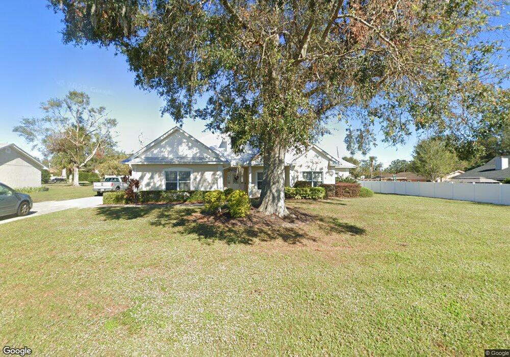
1220 Stenstrom Rd Wauchula, FL 33873
Estimated Value: $341,015 - $461,000
3
Beds
2
Baths
1,931
Sq Ft
$214/Sq Ft
Est. Value
About This Home
This home is located at 1220 Stenstrom Rd, Wauchula, FL 33873 and is currently estimated at $413,005, approximately $213 per square foot. 1220 Stenstrom Rd is a home located in Hardee County with nearby schools including Hardee Senior High School, Wauchula Elementary School, and Hardee Junior High School.
Ownership History
Date
Name
Owned For
Owner Type
Purchase Details
Closed on
Jul 5, 2011
Sold by
Smith Ken and Smith Donnelle
Bought by
First Baptist Church Of Wauchula Inc
Current Estimated Value
Purchase Details
Closed on
Oct 31, 2007
Sold by
Smith Jimmie Lee and Smith Lorraine M
Bought by
Smith Ken and Smith Donnelle
Home Financials for this Owner
Home Financials are based on the most recent Mortgage that was taken out on this home.
Original Mortgage
$243,000
Interest Rate
6.27%
Mortgage Type
Commercial
Create a Home Valuation Report for This Property
The Home Valuation Report is an in-depth analysis detailing your home's value as well as a comparison with similar homes in the area
Home Values in the Area
Average Home Value in this Area
Purchase History
| Date | Buyer | Sale Price | Title Company |
|---|---|---|---|
| First Baptist Church Of Wauchula Inc | -- | Wauchula Abstract & Title Co | |
| Smith Ken | $243,000 | Wauchula Abs & Title Co Inc |
Source: Public Records
Mortgage History
| Date | Status | Borrower | Loan Amount |
|---|---|---|---|
| Previous Owner | Smith Ken | $243,000 |
Source: Public Records
Tax History
| Year | Tax Paid | Tax Assessment Tax Assessment Total Assessment is a certain percentage of the fair market value that is determined by local assessors to be the total taxable value of land and additions on the property. | Land | Improvement |
|---|---|---|---|---|
| 2025 | -- | $316,407 | $20,000 | $296,407 |
| 2024 | -- | $306,858 | $20,000 | $286,858 |
| 2023 | $0 | $264,161 | $20,000 | $244,161 |
| 2022 | $0 | $205,346 | $16,000 | $189,346 |
| 2021 | $0 | $210,265 | $16,000 | $194,265 |
| 2020 | $0 | $182,661 | $16,000 | $166,661 |
| 2019 | $0 | $179,588 | $16,000 | $163,588 |
| 2018 | $0 | $176,402 | $16,000 | $160,402 |
| 2017 | $0 | $169,367 | $0 | $0 |
| 2016 | $0 | $165,870 | $0 | $0 |
| 2015 | -- | $144,496 | $20,000 | $124,496 |
| 2014 | $297 | $147,215 | $0 | $0 |
Source: Public Records
Map
Nearby Homes
- 1262 Aspen Ln
- 965 Stenstrom Rd
- 805 Stenstrom Rd
- 715 Stenstrom Rd
- 0 Hanchey Rd Unit 323831
- 2485 S Florida Ave
- 703 Honolulu Dr
- 704 S Florida Ave
- 921 Altman Rd
- 804 S 8th Ave
- 323 S 10th Ave
- 119 N Ohio Ave
- 513 W Main St
- 701 S 6th Ave
- 0 Ohio Ave
- 1510 Burton St
- 212 N Florida Ave
- 667 S 5th Ave
- 389 Hidden Creek Cir
- 3515 U S 17
- 1000 Knollwood Cir
- 1232 Stenstrom Rd
- 1229 Pine Ct
- 1010 Knollwood Cir
- 1249 Pine Ct
- 1284 Stenstrom Rd
- 1005 Knollwood Cir
- 1020 Knollwood Cir
- 1015 Knollwood Cir
- 1269 Pine Dr
- 1302 Stenstrom Rd
- 723 Hanchey Rd
- 1025 Knollwood Cir
- 1150 Stenstrom Rd
- 711 Hanchey Rd
- 1224 Pine Dr
- 1012 Magnolia Ln
- 1184 Pine Dr
- 1264 Pine Dr
Your Personal Tour Guide
Ask me questions while you tour the home.