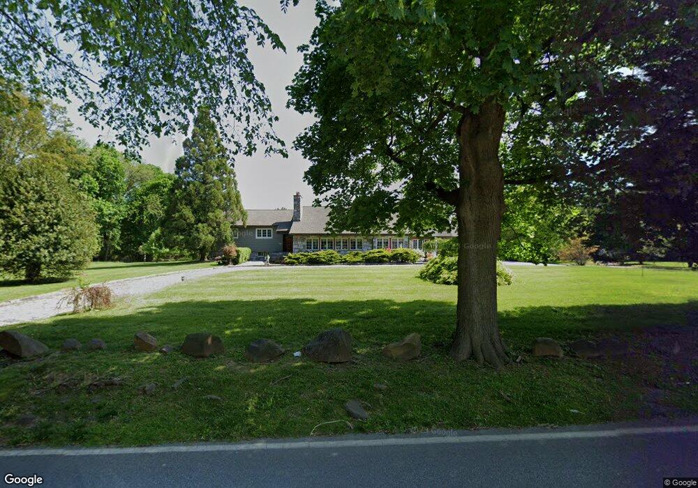
1220 Sugartown Rd Berwyn, PA 19312
Estimated Value: $1,205,000 - $1,604,000
3
Beds
3
Baths
3,637
Sq Ft
$388/Sq Ft
Est. Value
About This Home
This home is located at 1220 Sugartown Rd, Berwyn, PA 19312 and is currently estimated at $1,411,921, approximately $388 per square foot. 1220 Sugartown Rd is a home located in Chester County with nearby schools including Beaumont Elementary School, Tredyffrin-Easttown Middle School, and Conestoga Senior High School.
Ownership History
Date
Name
Owned For
Owner Type
Purchase Details
Closed on
Nov 19, 2009
Sold by
Hazboun Kamal Anthony and Hazboun Alma
Bought by
The Kamal Anthony Hazboun And Alma Anast
Current Estimated Value
Purchase Details
Closed on
Jul 1, 1994
Sold by
Faggioli Mary J
Bought by
Hazboun Kamal Anthony and Hazboun Alma
Home Financials for this Owner
Home Financials are based on the most recent Mortgage that was taken out on this home.
Original Mortgage
$237,700
Interest Rate
5.5%
Create a Home Valuation Report for This Property
The Home Valuation Report is an in-depth analysis detailing your home's value as well as a comparison with similar homes in the area
Home Values in the Area
Average Home Value in this Area
Purchase History
| Date | Buyer | Sale Price | Title Company |
|---|---|---|---|
| The Kamal Anthony Hazboun And Alma Anast | -- | None Available | |
| Hazboun Kamal Anthony | $297,140 | Chicago Title Insurance Co |
Source: Public Records
Mortgage History
| Date | Status | Borrower | Loan Amount |
|---|---|---|---|
| Closed | Hazboun Kamal Anthony | $237,700 |
Source: Public Records
Tax History Compared to Growth
Tax History
| Year | Tax Paid | Tax Assessment Tax Assessment Total Assessment is a certain percentage of the fair market value that is determined by local assessors to be the total taxable value of land and additions on the property. | Land | Improvement |
|---|---|---|---|---|
| 2025 | $14,779 | $396,230 | $91,710 | $304,520 |
| 2024 | $14,779 | $396,230 | $91,710 | $304,520 |
| 2023 | $13,819 | $396,230 | $91,710 | $304,520 |
| 2022 | $13,441 | $396,230 | $91,710 | $304,520 |
| 2021 | $13,149 | $396,230 | $91,710 | $304,520 |
| 2020 | $12,783 | $396,230 | $91,710 | $304,520 |
| 2019 | $4,364 | $396,230 | $91,710 | $304,520 |
| 2018 | $12,212 | $396,230 | $91,710 | $304,520 |
| 2017 | $11,937 | $396,230 | $91,710 | $304,520 |
| 2016 | -- | $396,230 | $91,710 | $304,520 |
| 2015 | -- | $396,230 | $91,710 | $304,520 |
| 2014 | -- | $396,230 | $91,710 | $304,520 |
Source: Public Records
Map
Nearby Homes
- 32 Manchester Ct
- 91 Central Ave
- 1441 Berwyn Paoli Rd
- 1242 Old Lancaster Rd
- 119 Waterloo Ave
- 5 Kent Ln
- 2000 Saint Andrews Dr
- 650 Augusta Ct
- 896 Conestoga Rd
- 327 Stoney Knoll Lane - Lot 5
- 191 Stony Point Dr
- 541 Woodside Ave
- 553 Woodside Ave
- 837 Nathan Hale Rd
- 206 Yorktown Place Unit 106
- 6 Wingstone Ln
- 521 Foxwood Ln
- 709 Newtown Rd
- 211 Wooded Way
- 2102 Quail Ridge Dr
- 411 Leopard Rd
- 1226 Sugartown Rd
- 400 Leopard Rd
- 1200 Sugartown Rd
- 1223 Sugartown Rd
- 410 Leopard Rd
- 330 Leopard Rd
- 406 Leopard Rd
- Sugartown Rd
- 1225 Sugartown Rd
- 423 Leopard Rd
- 417 Leopard Rd
- 320 Leopard Rd
- 318 Leopard Rd
- 1224 Pilgrim Ln
- 429 Leopard Rd
- 316 Leopard Rd
- 330 Blackburn Dr
- 330 Blackburn Dr
- 1242 Sugartown Rd