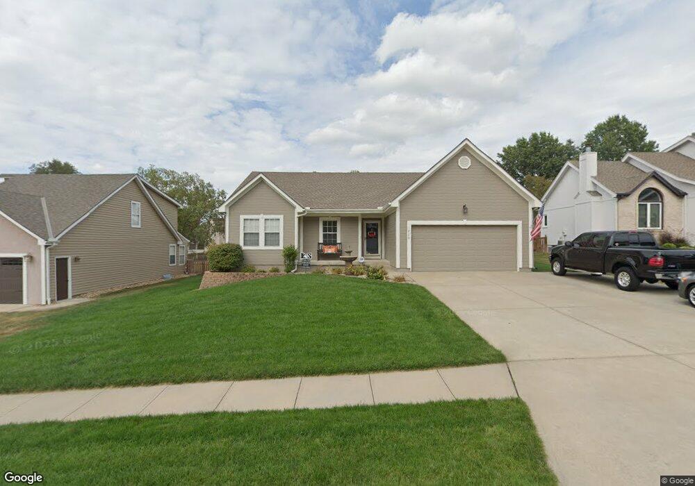
1220 SW Persels Rd Lees Summit, MO 64081
Estimated Value: $371,000 - $380,000
4
Beds
3
Baths
1,524
Sq Ft
$246/Sq Ft
Est. Value
About This Home
This home is located at 1220 SW Persels Rd, Lees Summit, MO 64081 and is currently estimated at $374,150, approximately $245 per square foot. 1220 SW Persels Rd is a home located in Jackson County with nearby schools including Pleasant Lea Middle School, Lee's Summit Senior High School, and Summit Christian Academy.
Ownership History
Date
Name
Owned For
Owner Type
Purchase Details
Closed on
Jul 16, 1998
Sold by
Spellerberg Construction Inc
Bought by
Mckee Scott Wade and Mckee Janet Linn
Current Estimated Value
Home Financials for this Owner
Home Financials are based on the most recent Mortgage that was taken out on this home.
Original Mortgage
$82,800
Outstanding Balance
$17,077
Interest Rate
7.09%
Mortgage Type
Purchase Money Mortgage
Estimated Equity
$357,073
Purchase Details
Closed on
Oct 14, 1997
Sold by
Bordner Spellerberg Dev
Bought by
Spellerberg Construction Inc
Home Financials for this Owner
Home Financials are based on the most recent Mortgage that was taken out on this home.
Original Mortgage
$93,500
Interest Rate
7.54%
Mortgage Type
Purchase Money Mortgage
Create a Home Valuation Report for This Property
The Home Valuation Report is an in-depth analysis detailing your home's value as well as a comparison with similar homes in the area
Home Values in the Area
Average Home Value in this Area
Purchase History
We collect this data history from publicly available records. To have your information removed, we recommend requesting removal directly through your county’s website.
| Date | Buyer | Sale Price | Title Company |
|---|---|---|---|
| Mckee Scott Wade | -- | Security Land Title Company | |
| Spellerberg Construction Inc | -- | Coffelt Land Title Inc |
Source: Public Records
Mortgage History
We collect this data history from publicly available records. To have your information removed, we recommend requesting removal directly through your county’s website.
| Date | Status | Borrower | Loan Amount |
|---|---|---|---|
| Open | Mckee Scott Wade | $82,800 | |
| Previous Owner | Spellerberg Construction Inc | $93,500 |
Source: Public Records
Tax History
| Year | Tax Paid | Tax Assessment Tax Assessment Total Assessment is a certain percentage of the fair market value that is determined by local assessors to be the total taxable value of land and additions on the property. | Land | Improvement |
|---|---|---|---|---|
| 2025 | $4,873 | $54,527 | $9,677 | $44,850 |
| 2024 | $4,873 | $67,488 | $8,554 | $58,934 |
| 2023 | $4,838 | $67,488 | $10,150 | $57,338 |
| 2022 | $3,328 | $41,230 | $7,505 | $33,725 |
| 2021 | $3,397 | $41,230 | $7,505 | $33,725 |
| 2020 | $3,262 | $39,201 | $7,505 | $31,696 |
| 2019 | $3,173 | $39,201 | $7,505 | $31,696 |
| 2018 | $3,126 | $35,839 | $4,193 | $31,646 |
| 2017 | $3,079 | $35,839 | $4,193 | $31,646 |
| 2016 | $3,079 | $34,941 | $4,560 | $30,381 |
| 2014 | $3,011 | $33,503 | $4,260 | $29,243 |
Source: Public Records
Map
Nearby Homes
- 1213 SW Persels Rd
- 1116 SW Crossing Dr
- 1021 SW Redbuck Cir
- 1636 SW Summit Valley Ln
- 1528 SW Hedgewood Ln
- 808 SW Daney Dr
- 1637 SW Hedgewood Ln
- 902 SW Lea Dr
- 1629 SW Hedgewood Ln
- 608 SW Montgomery Ave
- 825 SW Pleasant Dr
- 1604 SW Jeffrey Ct
- 2063 NW O'Brien Rd
- 1308 SW Highland Dr
- 413 SW Sunset Dr
- 1311 SW Highland Dr
- 900 SW 6th St
- 1611 SW Highland Dr
- 1440 SW Mission Rd
- 1633 SW Highland Dr
- 1216 SW Persels Rd
- 1224 SW Persels Rd
- 1221 SW Persels Rd
- 1225 SW Persels Rd
- 1228 SW Persels Rd
- 1217 SW Persels Rd
- 1212 SW Persels Rd
- 1229 SW Persels Rd
- 1216 SW Pacific Dr
- 1164 SW Pacific Cir
- 1212 SW Pacific Dr
- 1220 SW Pacific Dr
- 1160 SW Pacific Cir
- 1224 SW Pacific Dr
- 1209 SW Persels Rd
- 1208 SW Pacific Dr
- 1156 SW Pacific Cir
- 1174 SW Santa fe Dr
- 1167 SW Santa fe Dr
- 1204 SW Pacific Dr
Your Personal Tour Guide
Ask me questions while you tour the home.